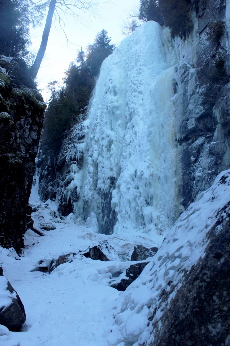
The deafening crack happened as soon as I turned my back on Rainbow Falls. It was sharp, like a rifle blast, and followed by a slushy sliding sound that could only mean one thing. Something big was falling.
Without hesitation I scurried down the trail and ducked behind a pair of boulders, where I felt safe from whatever was headed my way. As I peeked out from my impromptu stronghold, I was surprised that I couldn't find any evidence of ice dislodging from the mostly frozen waterfall. Everything looked intact and the gorge was quiet again, save for the interminable sound of flowing water. It was as if nothing happened, and all I could think of was a dog growling as someone tries to pet it: "I don't mind you being here, just don't get too close."
Go with the flow
That was a valuable lesson for spring waterfall viewing. As snow and ice melts and begins its journey down the mountains, waterfalls throughout the region swell to impressive proportions. The wet conditions make trails — especially those in higher elevations — susceptible to the impact of hikers' boots. When you combine those two factors, you're left with a wonderful option. Instead of checking another High Peak off of your 46er list, make some of the region's countless waterfalls your destination. Just don't get too close to them.
I like big hikes with big features, so I picked the long and rewarding waterfall loop hike, which starts at the hiker's parking area that's just off of state Route 73 in Saint Huberts. Look for the large Giant Mountain Roaring Brook trail parking area and turn onto Ausable Road across the street. Take note that the trails accessed from here are on private property, so respect the owners' wishes. That means no camping and no dogs.
From the parking area, follow the road through the golf course and bear left before the main Ausable Club building. There's a large, ornate wooden gate that only opens for Ausable Club staff. Sign the trail register, pass the gate, and continue along the dirt road.
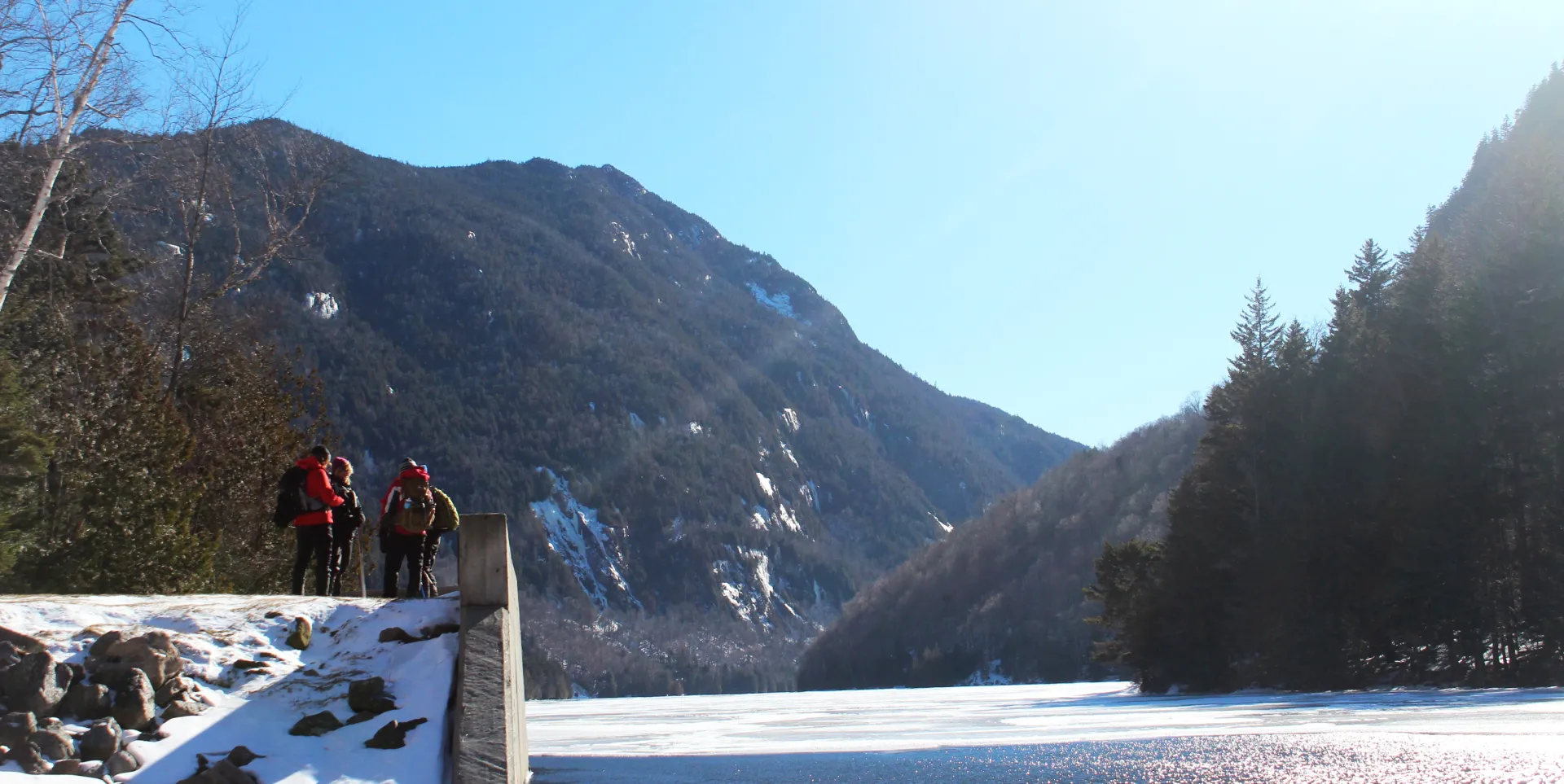
The best thing about this hike is there are multiple ways to do it. If time allows, I suggest traversing the full eight-and-a-half-mile loop, which makes a steady climb to Lower Ausable Lake on the dirt road before returning along a path that skirts the east branch of the Ausable River.
The day I did this hike was sunny and cold — perfect winter hiking conditions — and I made quick time following the smooth, moderate incline of the road as it climbed toward the lake.
A flume with a view
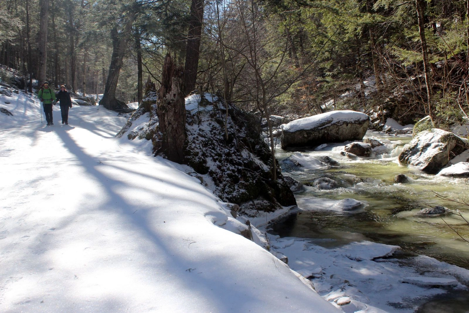
There aren't any waterfalls for the first couple of miles, but there are plenty of mountain streams to admire. They enter this narrow valley from every direction, spilling from the east side of the Great Range, tumbling down the western flanks of Noonmark, Dial, Bear Den, and Nippletop mountains, and gushing out of Lower Ausable Lake.
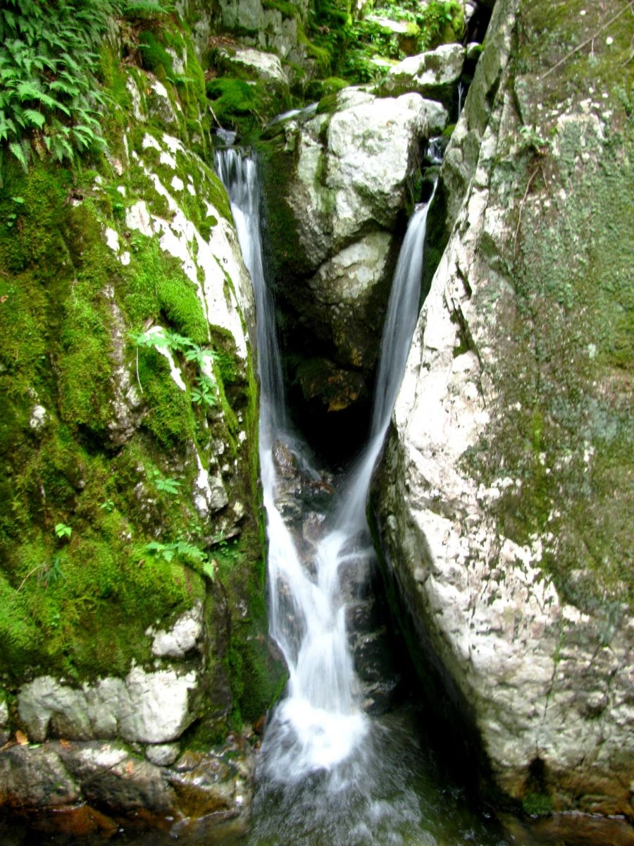
About two miles into the hike there is a small wooden sign on the left with the word "flume" written on it. Follow the little path and you'll soon come to the first waterfall. It looks lovely in winter, but in the summer this spot has a tropical feel with its mossy rock walls, its deep, jade-green pool, and its slender, Y-shaped waterfall. I continued past the flume on the side path to rejoin the dirt road.
Shortly after the flume the road levels off next to a beaver pond. Looking through the canopy I spotted the lower mass of Gothics mountain and the serrated edge of Sawteeth up ahead. I was soon face-to-face with both as I rounded the final bend in the road, which happens right before the short descent to Lower Ausable Lake.
Take in the lake
The lake alone is worth the hike in. It stretches between cliffs on Sawteeth and Colvin and is one of the most dramatic non-summit views in the Adirondacks. I met four women from the Finger Lakes region of New York who had just come off of a summit attempt on Colvin. One member of the group explained that the ice was simply too much for them to handle, so they retreated shortly before reaching the top. That's a tough decision that I've had to make before, but the group didn't seem phased. They were all smiles and laughs as they basked in the afternoon sun and talked about their mountain adventure.
I bid them farewell and crossed the long wooden bridge that spans the lake's outlet. From there it's a short hike to Rainbow Falls, an impressive destination any time of year. In the winter it reminds me of a geyser that somehow froze in mid eruption. And then there's the summer. Visiting the falls at the right time on a sunny day yields the namesake rainbows. They're everywhere, appearing as little crayon-box halos wherever sunbeams and mist meet. Regardless of the time of year, always be careful when exploring the base of a waterfall. During the warmer months the rocks can be slippery, and ice can fall from them in the winter.
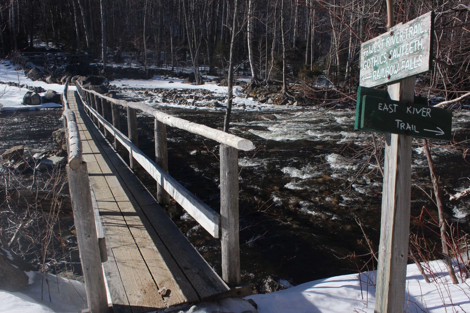
If you're short on time, or you prefer to linger near Lower Ausable Lake instead of lengthening your journey, the fastest way back to the car is by returning via the dirt road. If more waterfalls sound more appealing, follow the rugged West River trail as it winds along the riverbank at the foot of the Great Range. Some of the falls here are gushers, like the one that powers through a particularly wild section of the river, while others are calmer but no less idyllic. Beaver Meadow Falls streams off of Gothics in gigantic steps, and another unnamed waterfall pours from the cleft between Upper and Lower Wolfjaw mountains.
It's a fantastic route, but its rocky nature and distracting beauty can make it take longer than the distance would suggest, so plan accordingly. There are several trails that connect back to the road if you need to speed things up.
With its mountains and waterways, my favorite part of the Lower Ausable Lake area is I never feel like my time would have been better spent on a summit ridge. Those can wait for dryer times, when the waterfalls aren't at the height of their gorgeous fury.
Ready to hit the trail? Check out these suggestions for more hiking opportunities in the region or visit our page featuring many of the waterfall hikes near Lake Placid. If a hike's left you hungry, check out these dining options.
Break out of the norm this spring:
Explore More
This summer, find a trip perfect for all your girls in Lake Placid
March in Lake Placid is packed with energy as winter wraps up and spring approaches. From championship ECAC hockey to the FIS Cross-Country World Cup, the village comes alive with world-class competition, lively crowds, and unforgettable experiences.
Trade beach towels for powder turns this spring break. Lake Placid has epic spring skiing, craft breweries, and a mountain town vibe that crushes any boardwalk scene. With lighter crowds, solid snow, and plenty to do on and off the slopes, it’s the spring escape you didn’t know you needed.

Lake Placid is one of the best places for a guys trip in the country. Lakeside golf courses, world-class breweries, and outdoor adventure combine here for the perfect trip.