Round Trip
6.4 miles
10.3 kilometers

Elevation
The height of the summit or destination, from sea level.
1930 feet
588.3 meters

Elevation Gain
The total amount of vertical ascent (uphill climbing) on a hike. This is cumulative gain, totalling the elevation change of the uphill segments from a round-trip hike.
900 feet
274.3 meters

Route Type
A hiking trail may be classified as a Loop, Out and Back, Point to Point, Bushwhack, or Multi-day Thru Hike, with some destinations having more than one of these ways as a hiking option.
  • Out and Back
Round Trip
6.4 miles
10.3 kilometers

Route Type
A hiking trail may be classified as a Loop, Out and Back, Point to Point, Bushwhack, or Multi-day Thru Hike, with some destinations having more than one of these ways as a hiking option
  • Out and Back
Elevation
The height of the summit or destination, from sea level.
1930 feet
588.3 meters

Elevation Gain
The total amount of vertical ascent (uphill climbing) on a hike. This is cumulative gain, totalling the elevation change of the uphill segments from a round-trip hike.
900 feet
274.3 meters

Round Trip
6.4 miles
10.3 kilometers

Route Type
A hiking trail may be classified as a Loop, Out and Back, Point to Point, Bushwhack, or Multi-day Thru Hike, with some destinations having more than one of these ways as a hiking option
  • Out and Back
Elevation
Lorem ipsum dolor sit amet consectetur. Phasellus cursus malesuada tincidunt placerat non maecenas. Viverra morbi aliquam neque id nibh lorem massa quam non.
1930 feet
588.3 meters

Elevation Gain
The total amount of vertical ascent (uphill climbing) on a hike. This is cumulative gain, totalling the elevation change of the uphill segments from a round-trip hike.
1930 feet
274.3 meters

The falls emerge from the trees, but they can be heard much earlier.
View all photos
trail highlights
trail features
trail category
Waterfall
Trail Junctions
Dogs Not Allowed
Bridge
Road Walk
Half Day

About

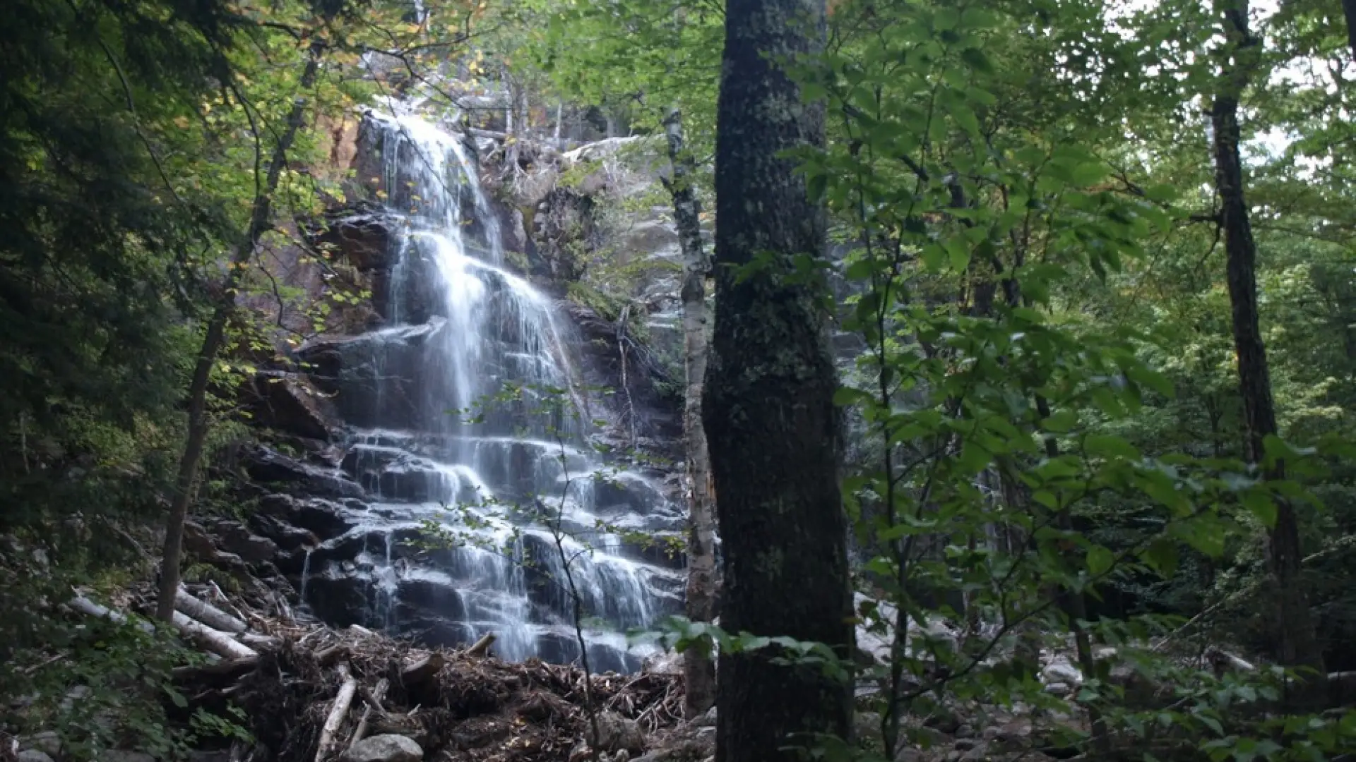
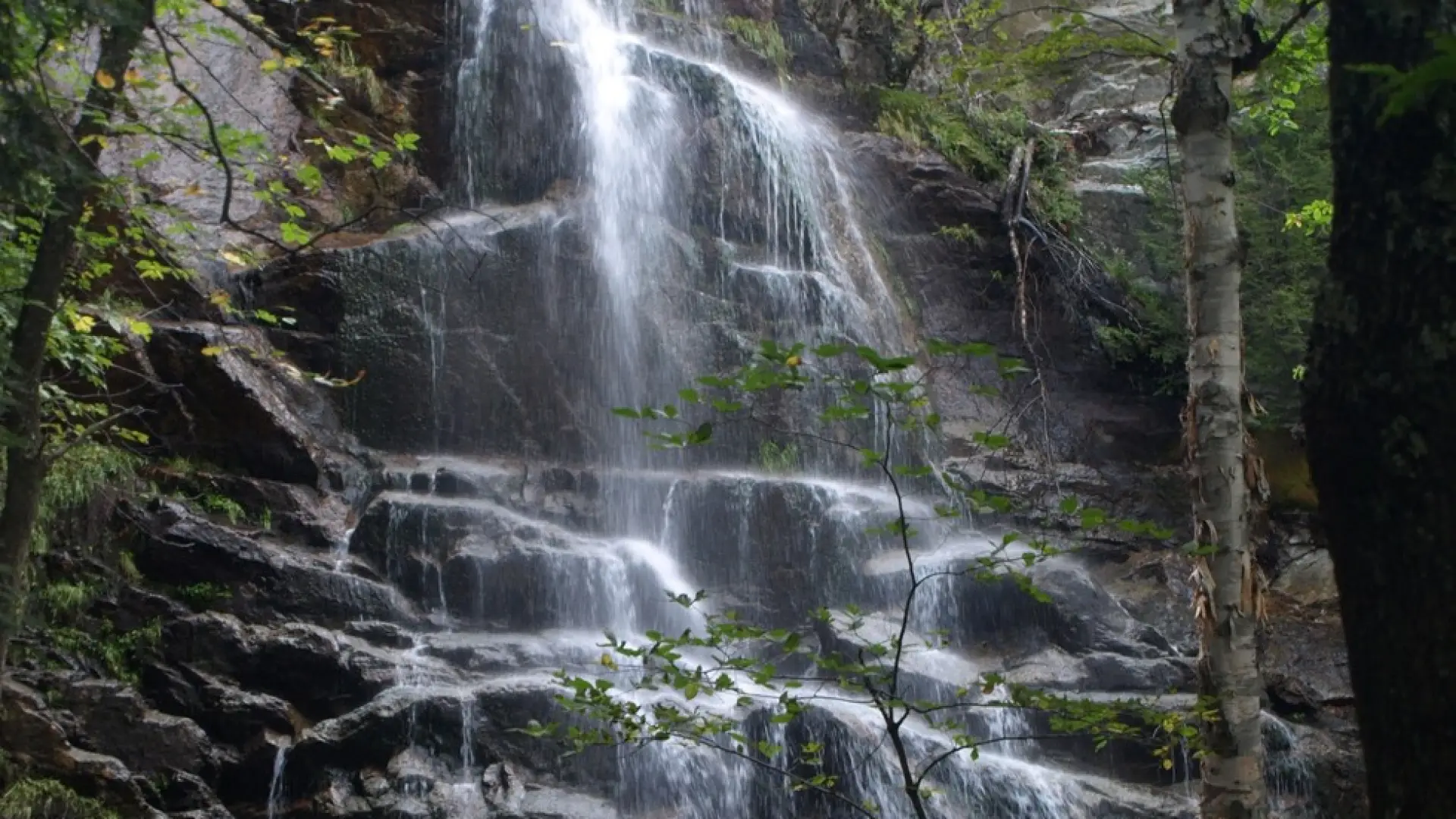
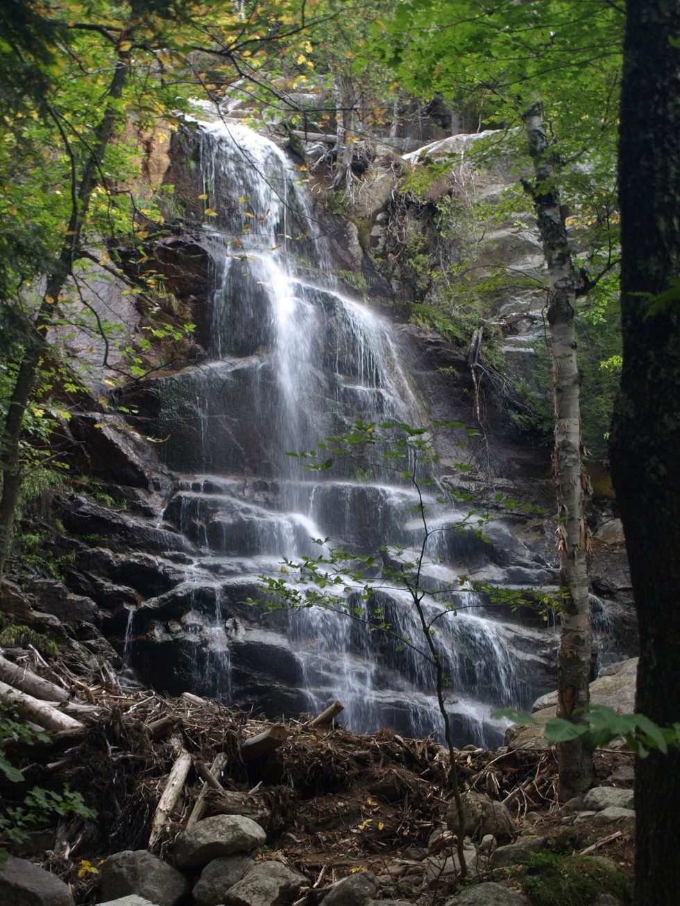
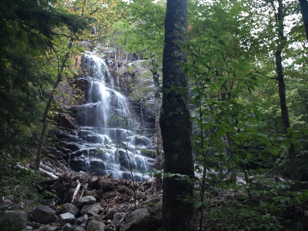
Beaver Meadow Falls is a popular, picturesque waterfall in the Adirondacks, commonly passed by when hikers are going up Gothics and the Upper Great Range. The entire hike in on Ausable Mountain Reserve (AMR) property, and dogs are strictly forbidden from the land and hiking trails. 

SPECIAL INFORMATION

This hike is accessed through a conservation easement with the Adirondack Mountain Reserve (AMR). A parking reservation is needed from May 1 - October 31. Although it is called a “parking reservation,” everyone will need a reservation to access hikes leaving from AMR, whether you drove yourself, rode a bike, got dropped-off, or walked. These reservations can be made online via the AMR website. For more information, please read these FAQs or contact the New York State Department of Environmental Conservation.

Key takeaways

  • Distance: 6.4 miles round trip
  • Elevation gain: 900 feet
  • Hike includes trail junctions, bridges, and a road walk

Hiking to Beaver Meadow Falls

From the parking lot you will initially have to follow a dirt road to a paved road. Just before reaching the main club house, turn left and down between two tennis courts on Lake Road Way to get to the gate into the AMR. The AMR is private property with recreational easements, special rules apply to use and those are posted at the gate. From the gate hike the dirt road for nearly 2 miles to a sign for a trail on the right for Gothics and Beaver Meadow Falls. This trail will lead you through an attractive forest to a bridge over the Ausable River. Just over the bridge is Beaver Meadow Falls, you will hear it before you see it.

How to get there

This is part of the St Huberts parking area/trailhead. Leave Lake Placid on Rte 73, follow Rte 73 toward Keene. Continue through Keene and Keene Valley and into Saint Huberts. Continue to the trailhead for the AMR on the right, directly across the road for the Roaring Brook Falls Trail to Giant Mountain. This is approximately 3 miles from the outskirts of Keene Valley.

Emergency Information
If you get lost or injured, remain calm and stay put. If you have cell service, call 911 or the DEC Forest Ranger Dispatch, 833-NYS-RANGERS (833-697-7264).
 
Plan ahead and hike smart. Bring a map, extra food, water, and warm clothing, and check the weather before you go. Stay aware of your surroundings and landmarks. If you get turned around, don’t panic—stop, think, and stay where you are. Let someone know your route and expected return time.
Additional Info
Beaver Meadow Falls map