

- Out and Back
- Out and Back
- Out and Back


About
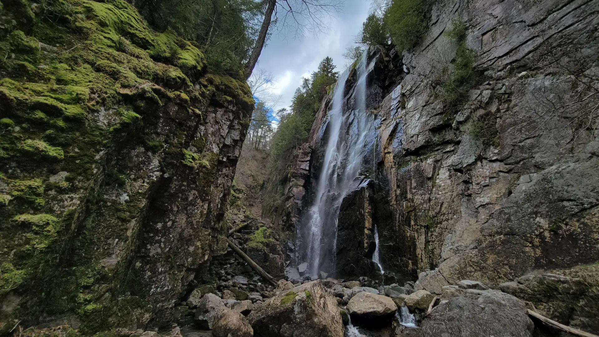
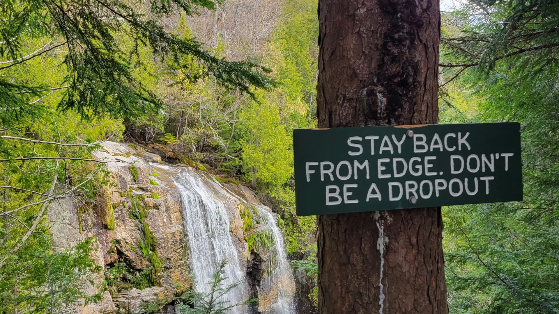
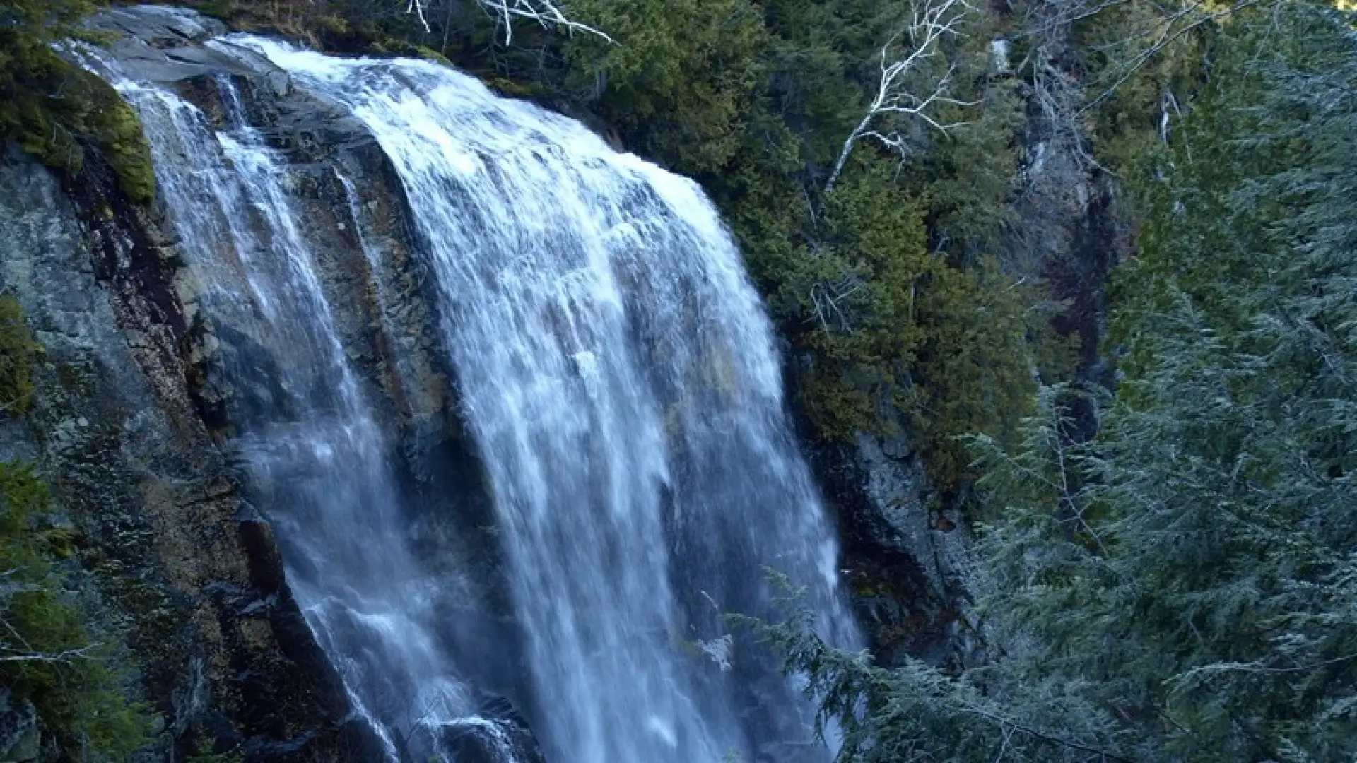
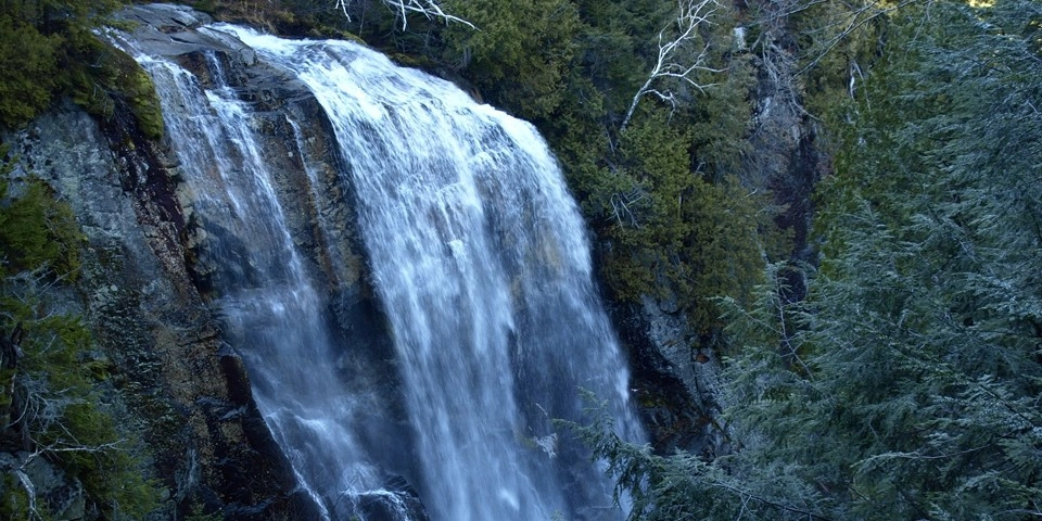
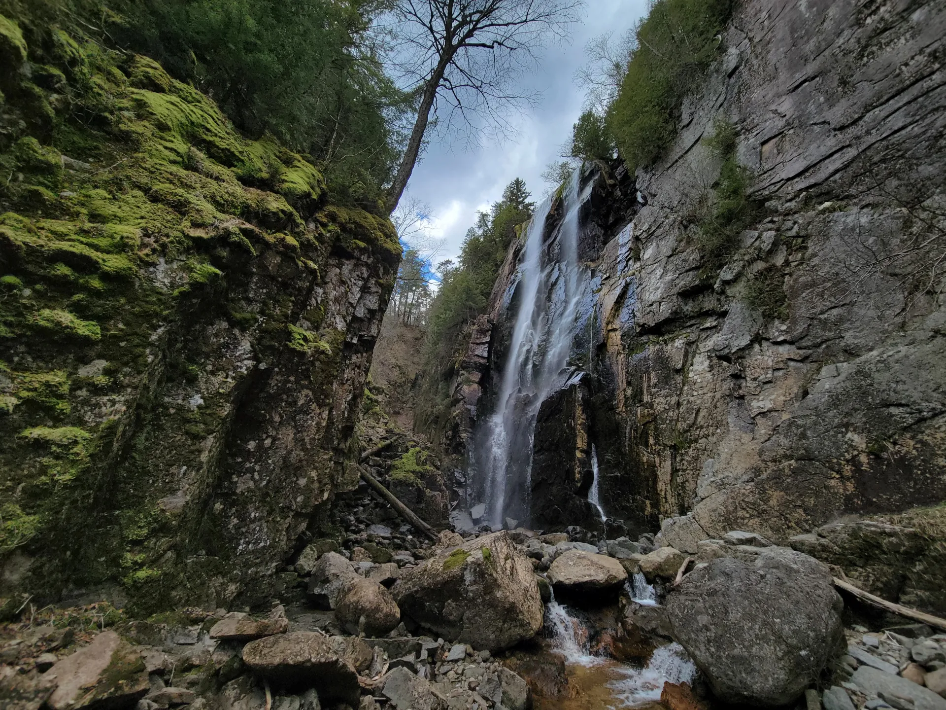
Rainbow Falls, a popular hiking destination, gets its name from the rainbow that often forms against the glistening waters as the sun hits the rock wall. Hikers and photographers alike will find this spot a worthy spot as a destination or mid-point. Please note that this waterfall is reached from the Adirondack Mountain Reserve property, which is accessible to the public through a conservation easement. Be respectful of private property, stay on marked hiking trails, and follow Leave No Trace principles. Dogs are prohibited on AMR lands.
SPECIAL INFORMATION
This hike is accessed through a conservation easement with the Adirondack Mountain Reserve (AMR). A parking reservation is needed from May 1 - October 31. Although it is called a “parking reservation,” everyone will need a reservation to access hikes leaving from AMR, whether you drove yourself, rode a bike, got dropped-off, or walked. These reservations can be made online via the AMR website. For more information, please read these FAQs or contact the New York State Department of Environmental Conservation.
Key takeaways
- Distance: 8.5 miles round trip
- Elevation gain: 1,100 feet
- Waterfall height: 150 feet
- Hike includes a road walk, trail junctions, and bridges
Hiking Rainbow Falls
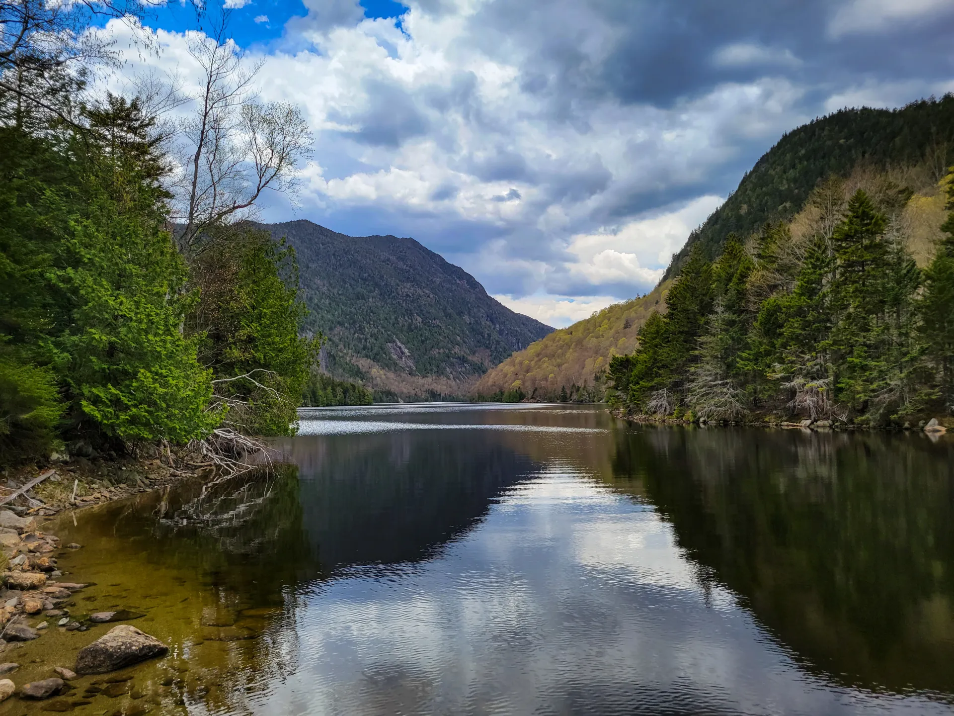
From the parking lot, you will initially have to follow a dirt road to a paved road next to the golf course. At 0.5 miles from the parking area, turn left and down between two tennis courts on Lake Road to get to the gate into the AMR. The AMR is a private property area with recreational easements - special rules apply to use and those are posted at the gate. After signing in and passing around the gate you will need to hike the dirt access road for a bit over 3 miles to Lower Ausable Lake. The hike climbs steadily to the dam at the end. There are other trails to get you to Rainbow Falls, but using the road is the most efficient. At the dam, cross the bridge below the dam and follow signs to Rainbow Falls.
At this point the trail becomes a bit difficult and very slippery in spots. The footing is a bit difficult, take your time and be cautious. You will be following along the stream that leads through a deep canyon with steep sides that leads to the base of the falls.
Rainbow Falls in the winter
Lake Road can be a good crosscountry ski in optimal conditions, and there is the high possibility that the trail to Rainbow Falls will be broken out. The rocks by Rainbow Falls can be quite icy.
Find your perfect trail near Keene Valley
Does Rainbow Falls sound amazing, but a little more than you want to tackle right now? No need to stress, with over 2000 miles of hiking trails in the Adirondacks we are sure we can find the perfect hike for you.
How to get there
This is part of the St. Huberts parking area/trailhead on AMR property. Leave Lake Placid on Route 73 and follow Route 73 toward Keene. Continue through Keene and Keene Valley and into Saint Huberts. Continue to the trailhead for the AMR on the right, directly across the road from the Roaring Brook Falls trailhead to Giant Mountain. This is approximately 3 miles from the outskirts of Keene Valley.