- Out and Back
- Out and Back
- Out and Back


About
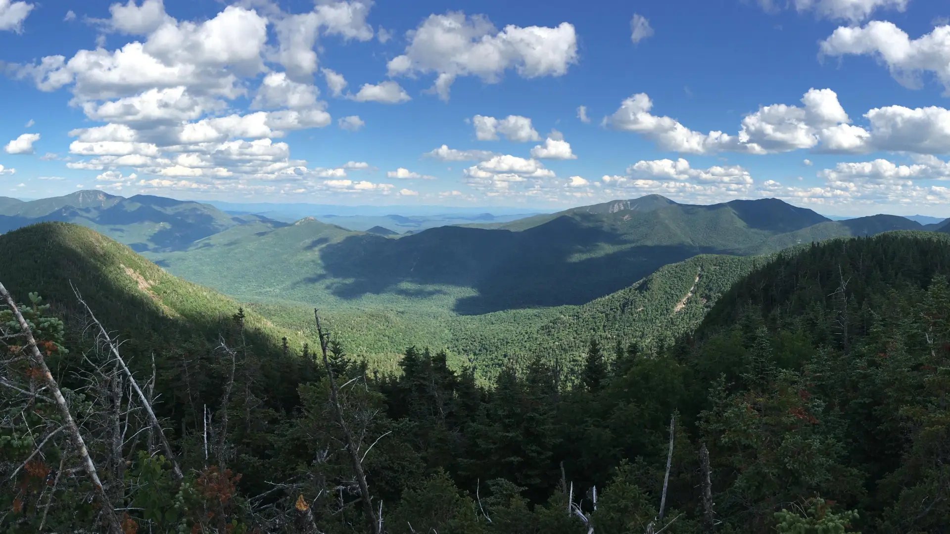
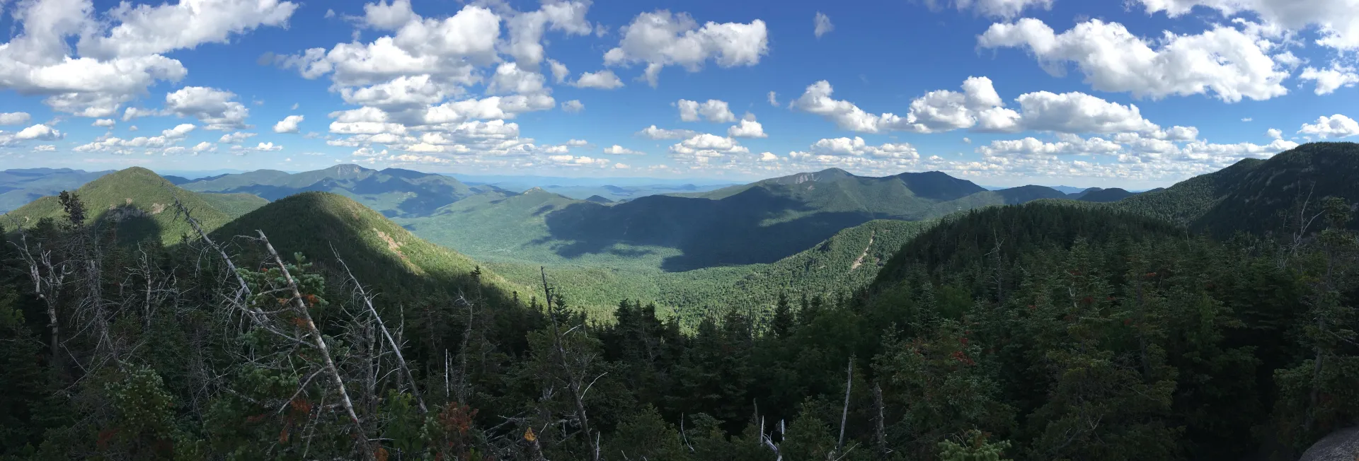
Hiking New York's 29th tallest peak
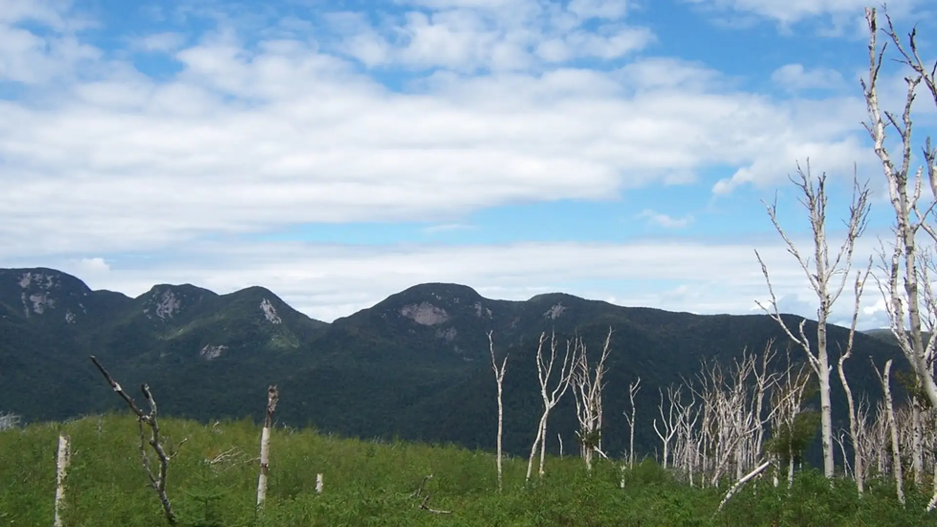
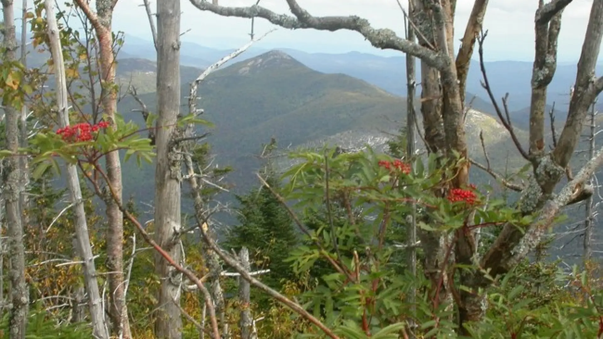
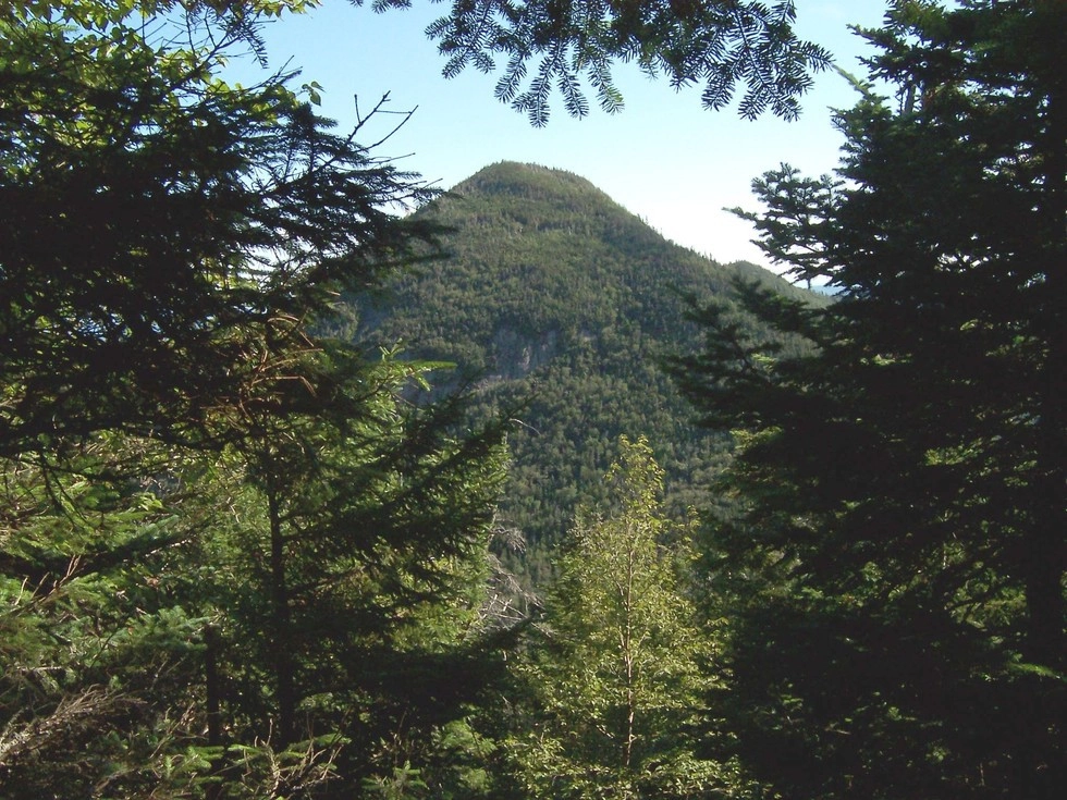
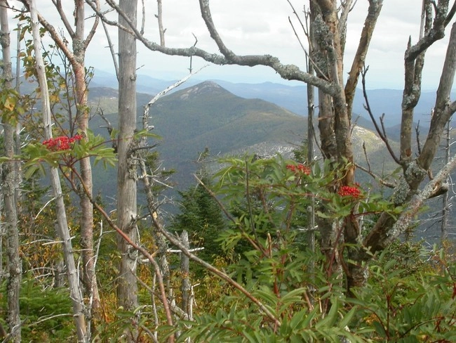
Upper Wolfjaw is the 29th highest of the Adirondack 46 High Peaks. It is a steep, serious hike that requires significant preparation. A successful hike of Upper Wolfjaw involves research, physical fitness, the right gear, and knowledge of Leave No Trace principles. The Wolf Jaws got their names because a painter, Alexander Wyant, said the deep col between them resembled a wolf's jaw.
SPECIAL INFORMATION
This hike is accessed through a conservation easement with the Adirondack Mountain Reserve (AMR). A parking reservation is needed from May 1 - October 31. Although it is called a “parking reservation,” everyone will need a reservation to access hikes leaving from AMR, whether you drove yourself, rode a bike, got dropped-off, or walked. These reservations can be made online via the AMR website. For more information, please read these FAQs or contact the New York State Department of Environmental Conservation.
Key takeaways
- Distance: 9 miles round trip
- Elevation: 4,185 feet
- Elevation gain: 3,075 feet
- Hike includes trail junctions, bridges, and a road walk
- Based on a hike from the AMR via the Wedge Brook Trail
Hiking Upper Wolfjaw
There are two routes to the summit of Upper Wolfjaw described below. Hiking from the AMR is
From AMR
This is part of the St Huberts parking area/trailhead. Leave Lake Placid on Route 73, follow Route 73 through Keene and Keene Valley and into Saint Huberts. Parking is across the road from the Roaring Brook Falls Trailhead for Giant Mountain. This approach is on private land of the Adirondack Mountain Reserve (AMR). Dogs are absolutely prohibited in this preserve. (If you do want to take your dog, use the secondary trailhead from the Garden.)
From the parking lot you will initially have to follow a dirt road to a paved road. At 0.5 miles from the parking area and just before reaching the main club house, turn left and down between two tennis courts on Lake Road Way to get to the gate into the AMR. The AMR is a private property area with recreational easements, special rules apply to use and those are posted at the gate.
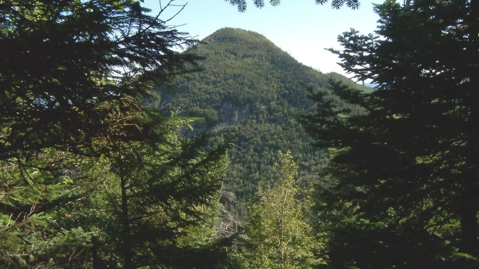
Following the West River Trail, the footpath starts right behind the gatehouse. It follows the bank of the Ausable River, featuring views of distant mountains and river pools. 2 miles from the parking lot, you reach the Wedge Brook Trail. From here, the trail climbs steeply to a primitive campsite 3.2 miles from the parking lot. Once again, the trail starts climbing steeply to a cut off with the State Range Trail which leads to Upper Wolfjaw. This is at 3.6 miles and the cut off is 0.3 miles long. From here it's less than a mile to Upper Wolfjaw. The trail is very steep to a false summit; the actual summit is 0.4 miles further. There is a short spur trail leading 20 yards to a view.
From the Garden
This route leaves from the Garden in Keene Valley; there is a parking fee at the trailhead. Parking is limited and fills up early most weekend mornings. Leave Lake Placid on Route 73, continue through Keene and into Keene Valley and turn right at the sign for the High Peaks at the Ausable Inn and follow Adirondack St. to Johns Brook Lane. It is 1.6 miles from Rt. 73 to the Garden with the last 0.2 miles on a narrow dirt road.
From the Garden parking area, the trail is mostly flat with gentle climbs past an intersection with the Southside Trial (not maintained) at 0.5 miles. Continuing straight you will be hiking along a portion of rolling hills till you drop steeply into Johns Brook Valley with a trail register at the junction. Johns Brook Lodge is to the right, but the most direct route to Upper Wolfjaw goes left past the DEC Interior Outpost to a bridge over Johns Brook. Stay straight immediately after the bridge and begin the climb up to the ADK Range Trail.
From the Outpost, you'll climb steady and pass by two campsites within 0.4 and 0.6 miles. Around one mile from the Outpost, cross over a debris field from a slide. The trail climbs moderately from here until it reaches the intersection of the trail coming from AMR 2 miles from the Outpost. From here it's less than a mile to Upper Wolf Jaw. The trail is very steep to a false summit; the actual summit is 0.4 miles more. There is a short spur trail leading 20 yards to a view.
- Distance: 11.25 miles round trip
- Elevation gain: 3,250 feet
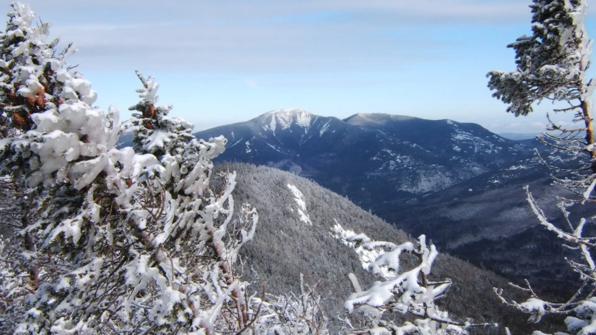
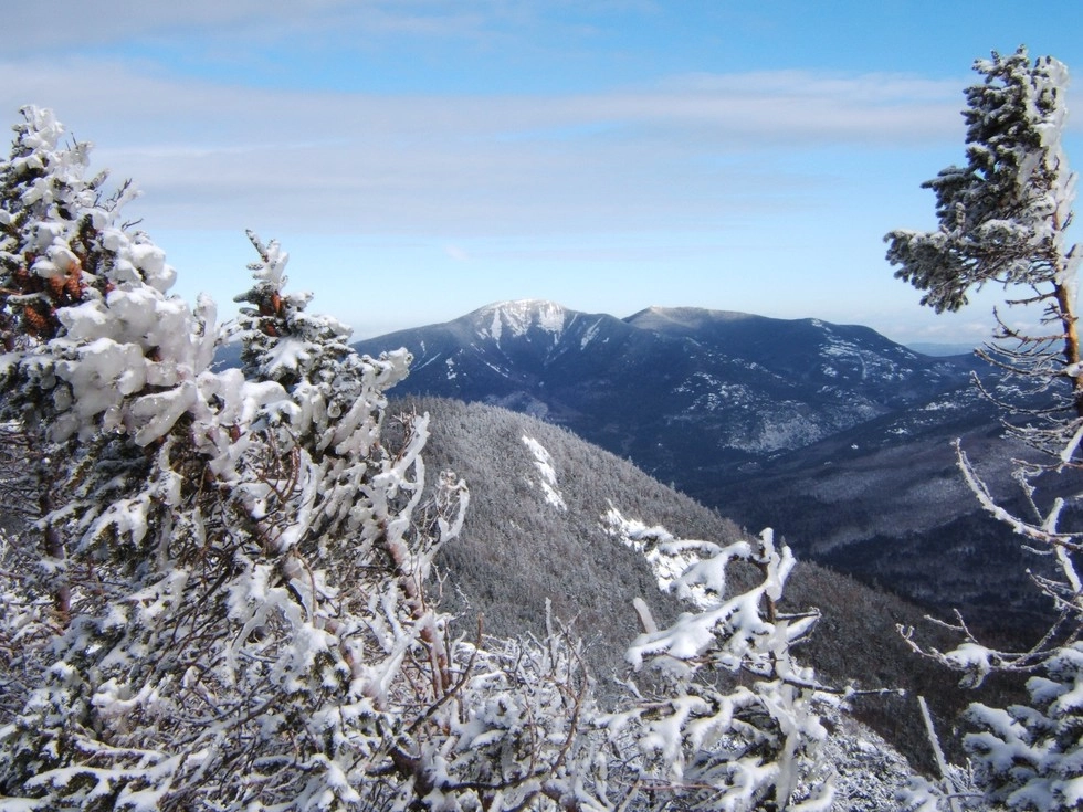
Upper Wolfjaw in the winter
Upper Wolfjaw is a challenging mountain that should only be attempted by experienced hikers, especially in winter, so make sure you are prepared. Snowshoes are necessary, and microspikes or crampons are needed to climb the steep upper sections of the peak, which is often icy. Plan on temperatures in the higher elevations being at least 20 degrees colder than at the trailhead, not including the windchill. Bring several extra non-cotton layers, a headlamp with spare batteries, extra food, a windbreaker, goggles, a face mask, and supplies for spending the night in case of an emergency.
Find your perfect trail near Keene Valley
Does Upper Wolfjaw sound amazing, but a little more than you want to tackle right now? No need to stress, with over 2000 miles of hiking trails in the Adirondacks we are sure we can find the perfect hike for you.
Emergency Information
Related Content

Ready to hike in the High Peaks? There is no set way for how to become a 46er, but there is a R.I.G.H.T. way.