- Loop
- Loop
- Loop


Lost Lookout is an amazing loop hike that incorporates Beaver Meadow Falls on one end and Rainbow Falls on the other. But, along with that, there are outstanding views along the short ridge trail as well. This hike is entirely on the private property of the Adirondack Mountain Reserve (AMR) which has granted an easement for public foot travel. Note that dogs are absolutely prohibited in this game preserve.
SPECIAL INFORMATION
This hike is accessed through a conservation easement with the Adirondack Mountain Reserve (AMR). A parking reservation is needed from May 1 - October 31. Although it is called a “parking reservation,” everyone will need a reservation to access hikes leaving from AMR, whether you drove yourself, rode a bike, got dropped-off, or walked. These reservations can be made online via the AMR website. For more information, please read these FAQs or contact the New York State Department of Environmental Conservation.
Key takeaways
- Distance: 9 miles round trip
- Elevation gain: 1,575 feet
- Hike includes trail junctions, bridges, a road walk, and ladders
Hiking Lost Lookout
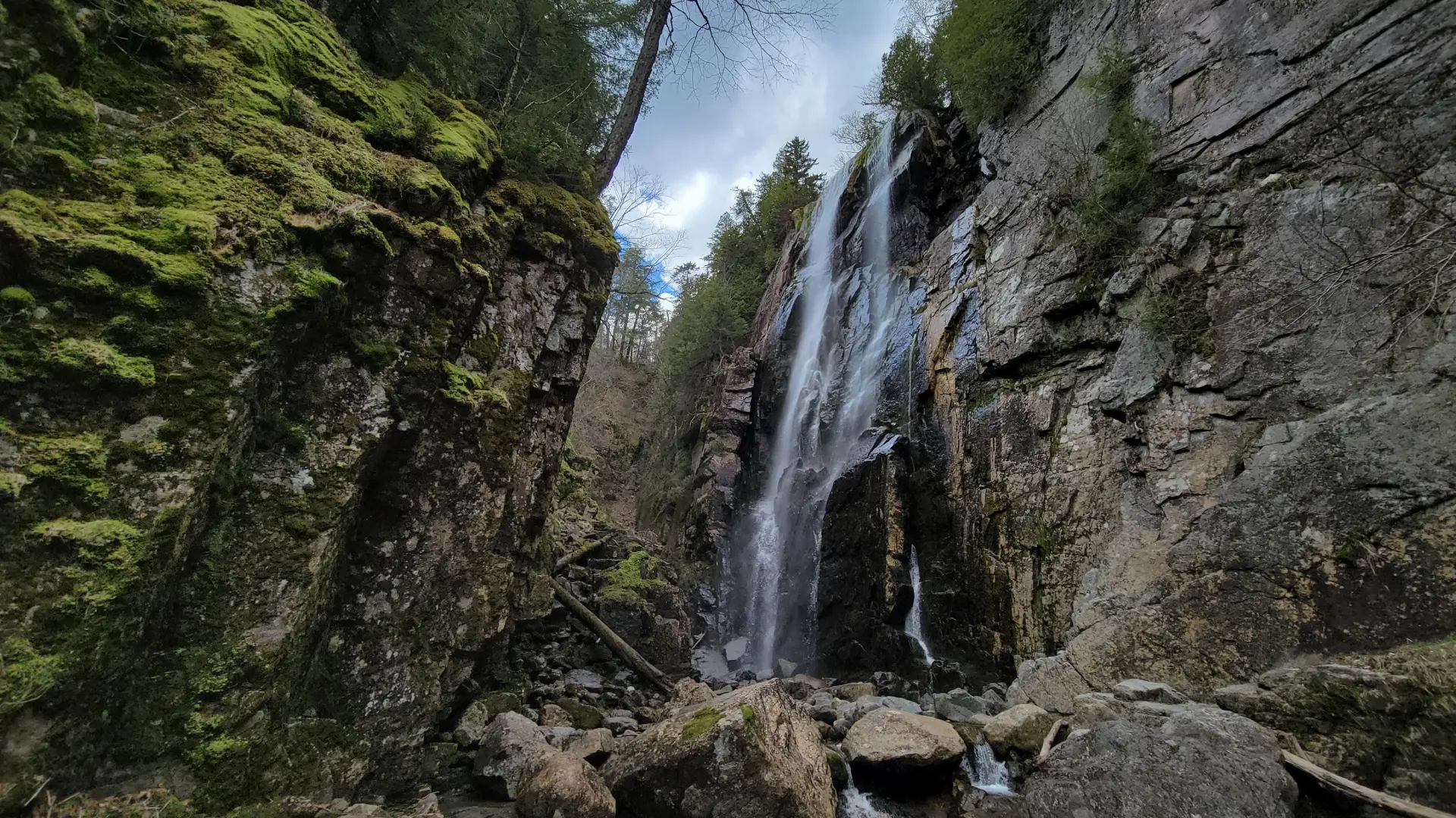
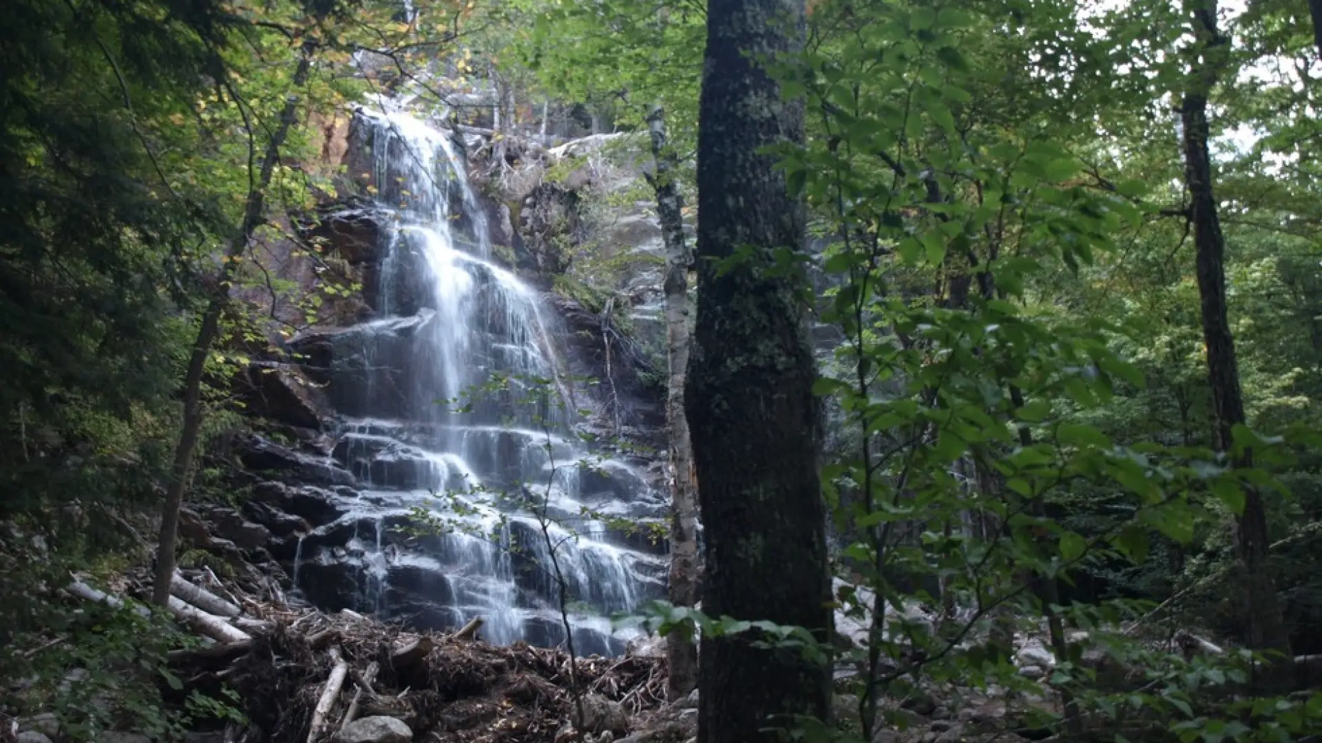
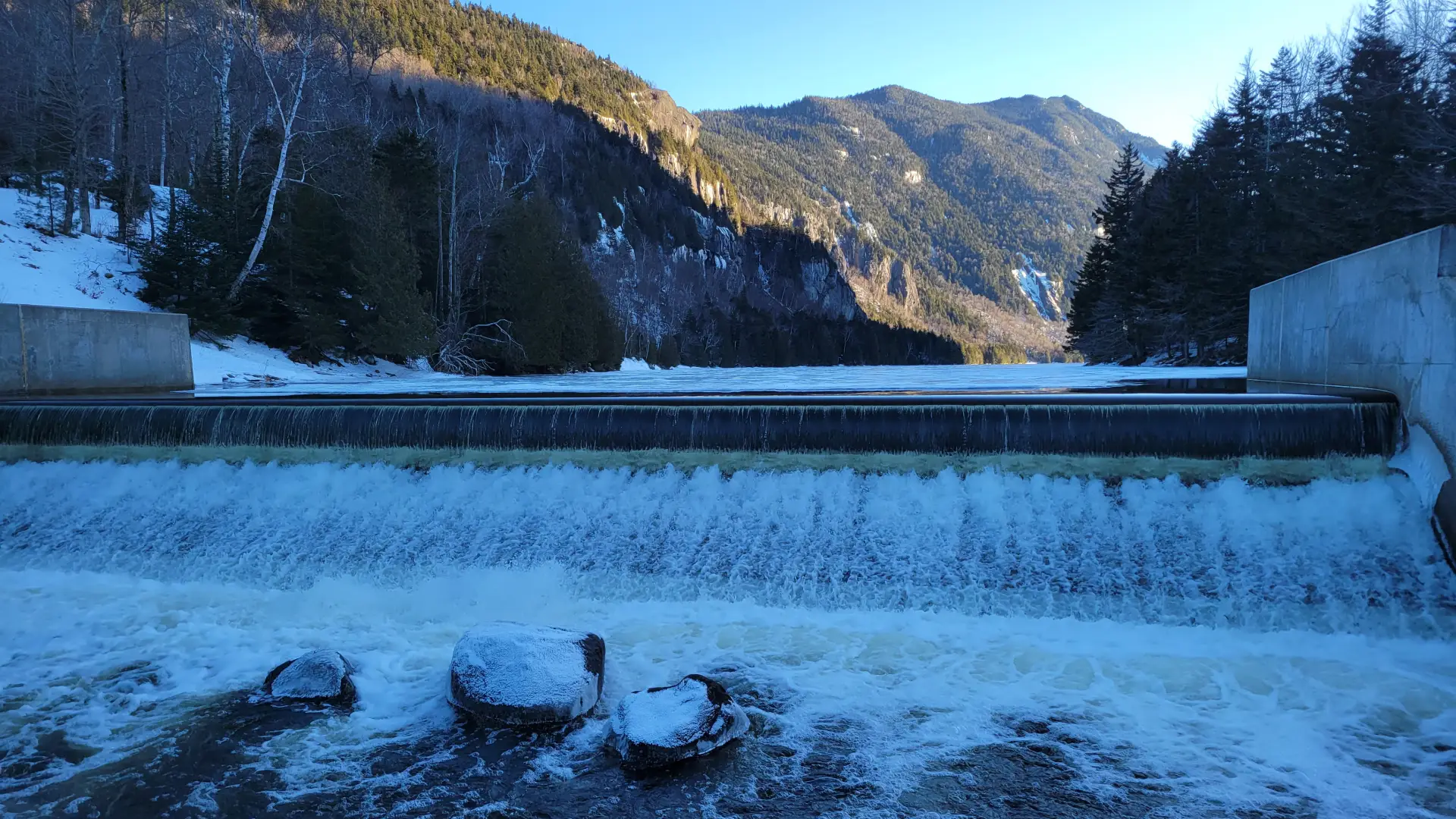
From the parking lot you will initially have to follow a dirt road to a paved road along a golf course. At 0.5 miles from the parking area, go left and down between two tennis courts on Lake Road Way to get to the gate into the AMR. The AMR is a private property area with easements, special rules apply to use and those are posted at the gate. At the gate you will need to hike the dirt access road (Lake Road) for a bit over 2 miles. The road climbs steadily to the trail for Gothics and Beaver Meadow Falls on the right. This trail will lead you through an attractive forest to a bridge over the Ausable River. Just over the bridge is Beaver Meadow Falls, you will hear it before you see it.
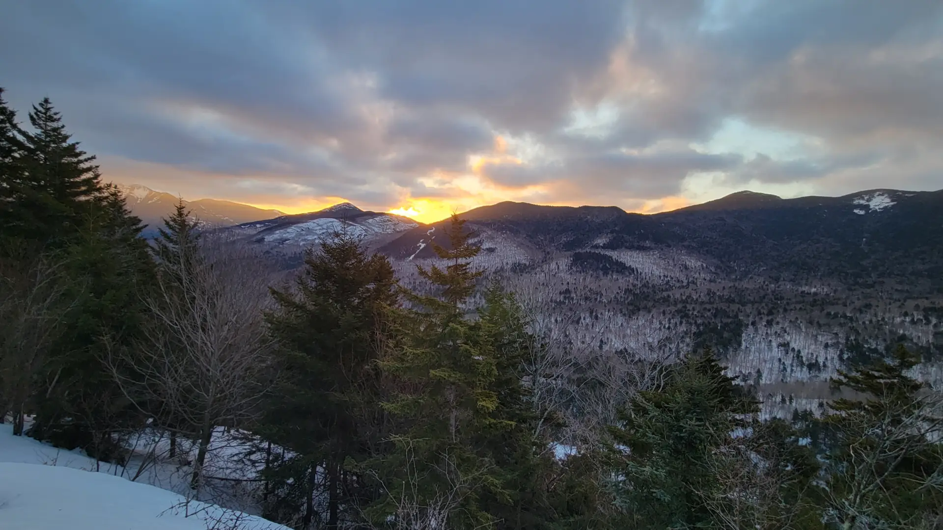
Starting with a ladder, the trail continues steeply up the left side of the falls for a bit over 0.25 miles to the Lost Lookout Trail on the left. Follow here as you pass through the woods on a ridge trail with moderate terrain and only a couple short steep sections. There are several small viewing areas along the ridge out over the Ausable Lakes toward Colvin and Blake Mountains. The trail descends rapidly to the valley near Lower Ausable Lake where you can take a short trail to the base of Rainbow Falls. Cross the bridge and regain Lake Road to return to the trailhead.
Lost Lookout in the winter
The Lake Road can be a good crosscountry ski in optimal conditions, but expect Lost Lookout itself to not be broken out by other snowshoers (as opposed to the more popular trails surrounding it). Being prepared is necessary for any winter hike.
Find your perfect trail near Keene Valley
Does Lost Lookout sound amazing, but a little more than you want to tackle right now? No need to stress, with over 2000 miles of hiking trails in the Adirondacks we are sure we can find the perfect hike for you.
How to get there
This is part of the St Huberts parking area/trailhead. Leave Lake Placid on Rte 73, follow Rte 73 toward Keene. Continue through Keene and Keene Valley and into Saint Huberts. Continue to the trailhead for the AMR on the right, directly across the road for the Roaring Brook Falls Trail to Giant Mountain. This is approximately 3.0 miles from the outskirts of Keene Valley.