Round Trip
9.7 miles
15.6 kilometers

Elevation
The height of the summit or destination, from sea level.
3750 feet
1,143.0 meters

Elevation Gain
The total amount of vertical ascent (uphill climbing) on a hike. This is cumulative gain, totalling the elevation change of the uphill segments from a round-trip hike.
1880 feet
573.0 meters

Route Type
A hiking trail may be classified as a Loop, Out and Back, Point to Point, Bushwhack, or Multi-day Thru Hike, with some destinations having more than one of these ways as a hiking option.
  • Out and Back
Round Trip
9.7 miles
15.6 kilometers

Route Type
A hiking trail may be classified as a Loop, Out and Back, Point to Point, Bushwhack, or Multi-day Thru Hike, with some destinations having more than one of these ways as a hiking option
  • Out and Back
Elevation
The height of the summit or destination, from sea level.
3750 feet
1,143.0 meters

Elevation Gain
The total amount of vertical ascent (uphill climbing) on a hike. This is cumulative gain, totalling the elevation change of the uphill segments from a round-trip hike.
1880 feet
573.0 meters

Round Trip
9.7 miles
15.6 kilometers

Route Type
A hiking trail may be classified as a Loop, Out and Back, Point to Point, Bushwhack, or Multi-day Thru Hike, with some destinations having more than one of these ways as a hiking option
  • Out and Back
Elevation
Lorem ipsum dolor sit amet consectetur. Phasellus cursus malesuada tincidunt placerat non maecenas. Viverra morbi aliquam neque id nibh lorem massa quam non.
3750 feet
1,143.0 meters

Elevation Gain
The total amount of vertical ascent (uphill climbing) on a hike. This is cumulative gain, totalling the elevation change of the uphill segments from a round-trip hike.
3750 feet
573.0 meters

A boulder in a high mountain pond
View all photos
trail highlights
trail features
trail category
Lakes/Ponds
Trail Junctions
Bridge
Full Day

About

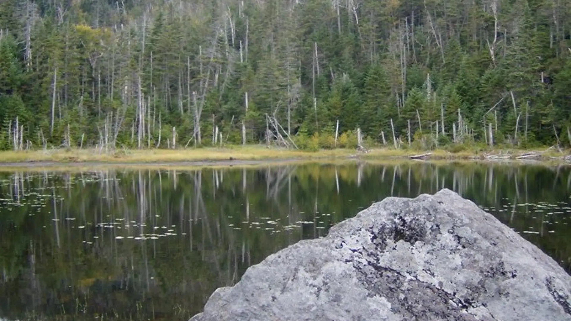
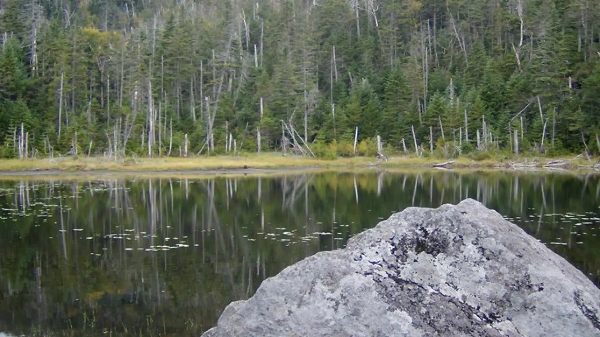
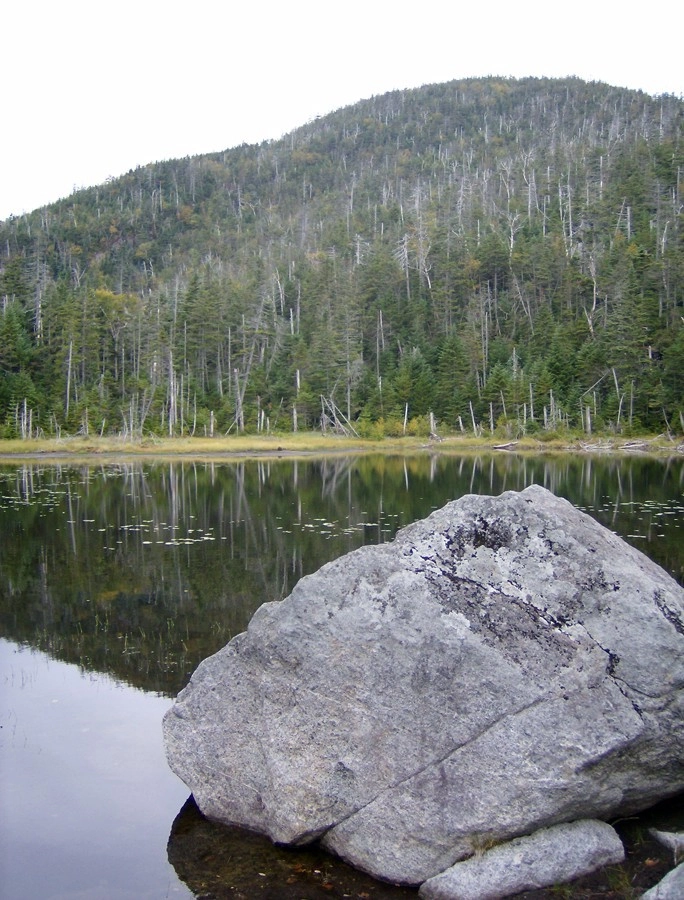
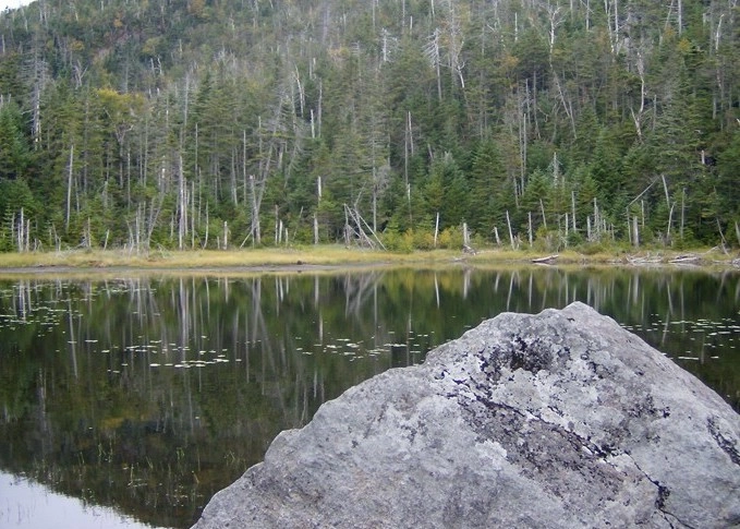
Lake Arnold is a small body of water located at almost 3800’ in elevation, making it one of the highest bodies of water in the Adirondack Park. It is rarely a destination hike, and hikers often see it when ascending Mount Colden. A successful hike of Lake Arnold involves research, physical fitness, the right gear, and knowledge of Leave No Trace principles

Key takeaways

  • Distance: 9.7 miles round trip
  • Elevation: 3,750 feet
  • Elevation gain: 1,880 feet
  • Hike includes trail junctions and a bridge

Hiking to Lake Arnold

The hike follows along the busy Marcy Dam Trail before forking off toward Avalanche Camps. Once at Avalanche Camps you should be prepared for a steady and rather steep ascent over rocky terrain. The trail follows a very picturesque brook to a very tight-knit balsam/spruce forest.

There you will find Lake Arnold nestled at the base of Mount Colden, near the top of a high mountain pass. There is a designated primitive tent site here. This area can get very muddy.

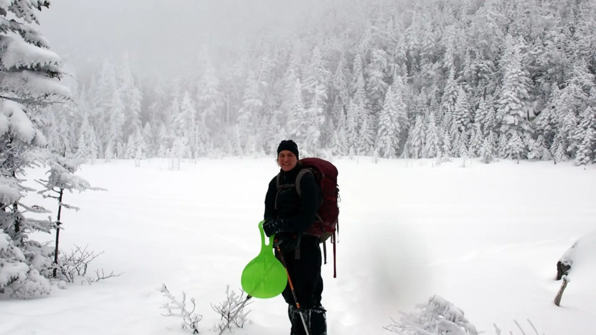
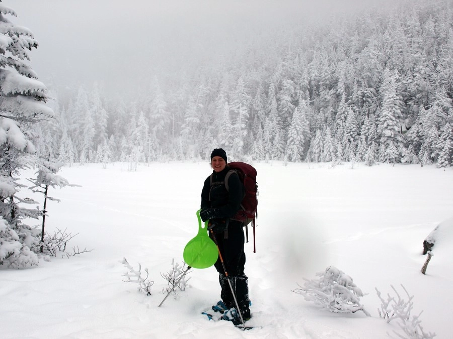
Lake Arnold in the winter

Lake Arnold is a challenging hike in the winer that should only be attempted by experienced hikers, so make sure you are prepared. Snowshoes are necessary, and microspikes may be needed in spots. Plan on temperatures in the higher elevations being much colder than at the trailhead, not including the windchill. Bring several extra non-cotton layers, a headlamp with spare batteries, extra food, a windbreaker, goggles, a face mask, and supplies for spending the night in case of an emergency.

Find your perfect trail near Lake Placid

Does Lake Arnold sound amazing, but a little more than you want to tackle right now? No need to stress, with over 2000 miles of hiking trails in the Adirondacks we are sure we can find the perfect hike for you

How to get there

From the intersection of Route 73 and Route 86 in Lake Placid follow Route 73 toward Keene. Continue for 3.25 miles to Adirondack Loj Road on the right – this is the first right after the Olympic ski jumps. Follow Adirondack Loj Road to its end at Heart Lake. There is a parking fee.

Emergency Information
If you get lost or injured, remain calm and stay put. If you have cell service, call 911 or the DEC Forest Ranger Dispatch, 833-NYS-RANGERS (833-697-7264).
 
Plan ahead and hike smart. Bring a map, extra food, water, and warm clothing, and check the weather before you go. Stay aware of your surroundings and landmarks. If you get turned around, don’t panic—stop, think, and stay where you are. Let someone know your route and expected return time.