Another killer fall day in the Adirondacks and I had the esteemed pleasure of hiking with an outstanding group of outdoor enthusiasts, and boy were they enthused. About a month ago I brought a group up to Summit Rock for a great day on the trails and during that trip I was asked about a full through hike of the pass in the future. I gave it some thought and sure enough, it was planned.
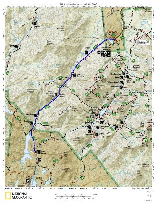
After our bumpy ride over to Upper Works we got our packs all tied to our backs, said farewell to the bus driver and off we went. The bus was to pick us up in roughly 7-hours in Lake Placid. Yes that’s right; Indian Pass is a through hike that essentially passes through the High Peaks from Newcomb to Lake Placid. To drive from point A to point B is well over 1.5 hours and roughly 90-miles, but to hike, it’s just over 10-miles.
We made excellent time along the initial section of trail to where the official start is for Indian Pass. From here our pace was only slightly diminished as we attacked the muddy sections of the old road. With all the leaves now on the trail, they covered the mud and water that periodically hindered us, but that was a good thing. The leaves acted like Mother Nature’s housecoat, laid out for us to use. At the first intersection, with Duck Hole, we had our first real break for the day. The sign on the tree said 10.2 miles to the Adirondack Loj, which was where we were going – that couldn’t be right, because we had already gone 2-miles. We quickly came to the next intersection 0.4 miles away, the sign here read 6-miles to the Adirondack Log – according to the sign we had just covered 4.2 miles over the last 0.4 miles of trail, confused, us too? 6-miles was incorrect as well, so we decided not to worry about the signs and just hike the trail, and the mileage is what it is.
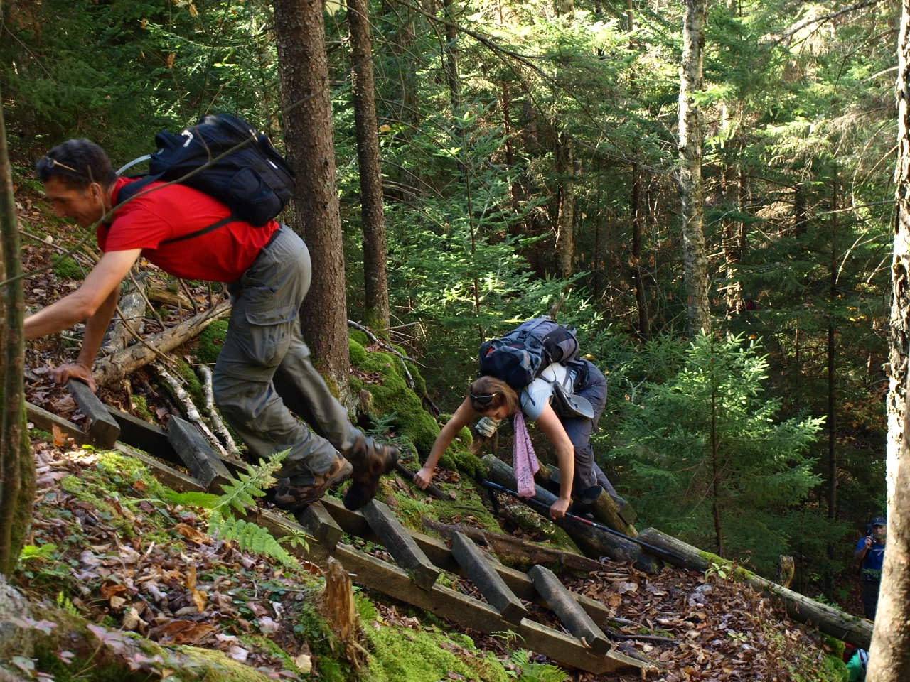
From here we crossed the new bridge over Indian Pass Brook and moved along briskly over the muddy terrain past Wallface Lean-to. We were quite surprised on how muddy the trail still was, but with no fear of mud we cruised right along. Before too long we were at the climbers path for the wall where we saw a group planning the days climbing route. From here the true climbing began with a scramble through the boulders, some the size of three story buildings. Along with the scrambling there were 4-ladders that delivered us up over the excessively steep cliffs to Summit Rock.
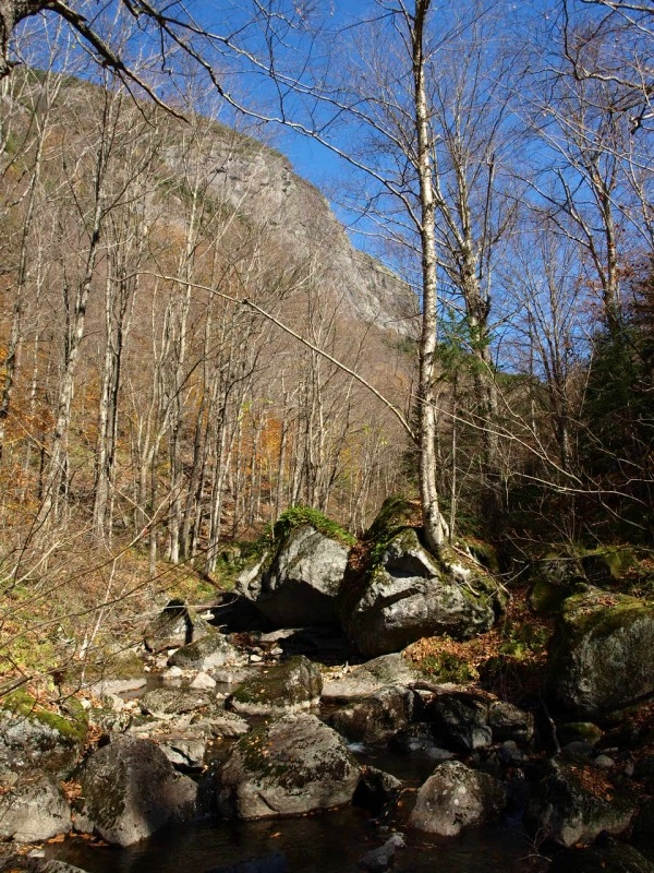
We enjoyed our lunch on Summit Rock while watching 10-12 rock climbers scale there way over dime holds and shallow lips of rock. Now just so you know, summit rock is not the height-of-land along the trail in the pass. There is a slight amount of climbing to be had yet, but none too strenuous. The descent would prove to be harder portion of the day. This side was littered with small boulders along a rock strewn trail. The rocks, coated in a thin layer of green and red slime, made for a very slippery walk. The descent was slow, as it should have been; this was the type of conditions where accidents happen.
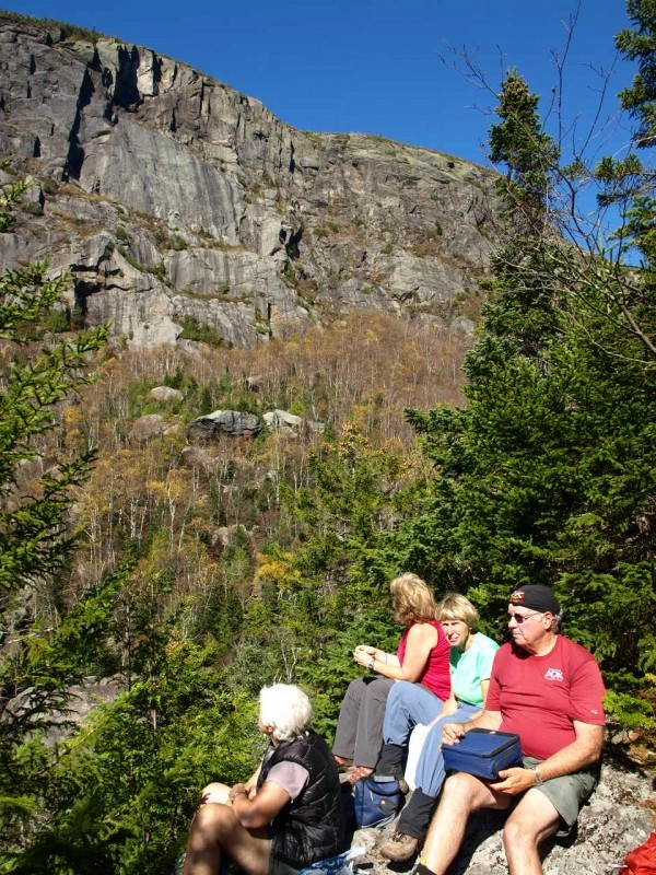
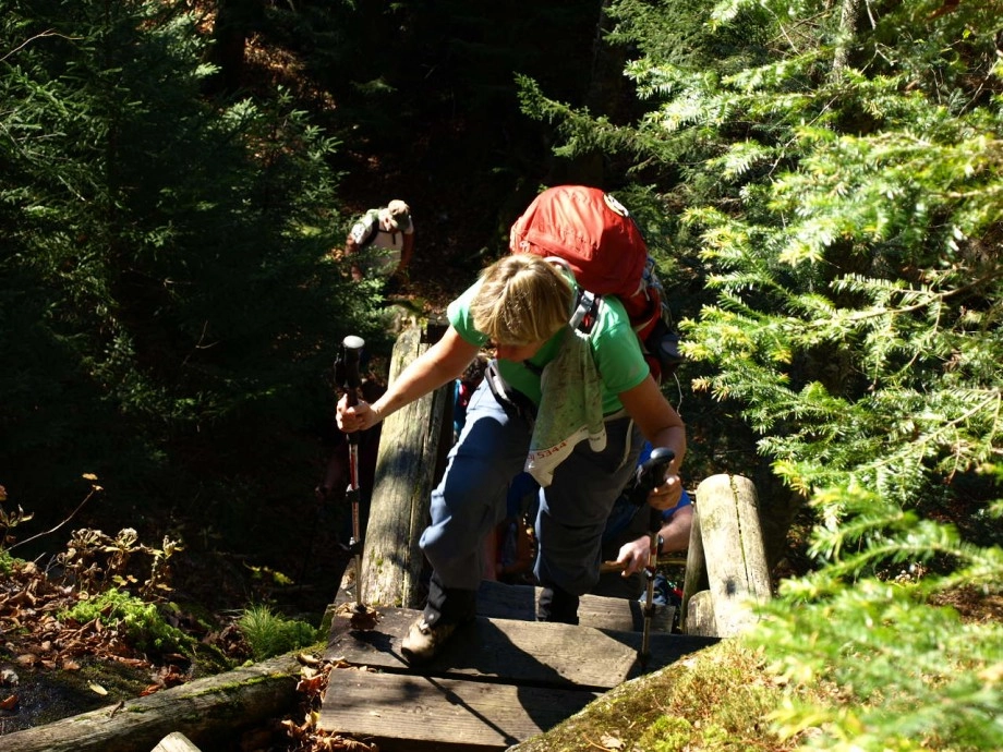
We were now at another crossing of Indian Pass Brook, but this time on the Lake Placid side of the pass. We enjoyed the must softer and graded trail under our feet. The next stop was Scott Clearing, where we opted to take the old “Low Water Route,” that has pretty much been abandoned. The path has become quite narrow and overgrown in spots but still not too hard to follow. Once in the heart of Scott Clearing we all enjoyed a long break and relaxing in the views.
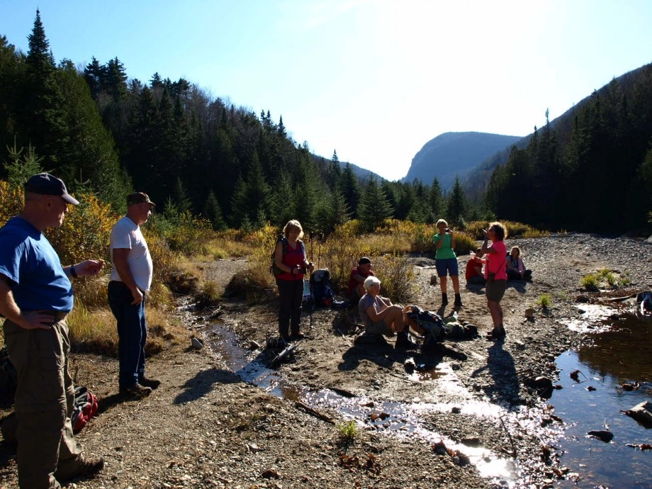
We had hardly seen anyone at all, until we got to this point. From here out we would see over 20-people either heading out or coming in for a couple days of camping. The remaining trail, loaded with small rolling hills, was like heaven to our feet. We moved along at a decent clip is anticipation of a soft seat on the bus and the probability of a cold beer and some wholesome food in our bellies. We had made the bus, and only 15-minutes behind schedule. 7.25 hours to hike through from Tahawus to Lake Placid, not too shabby for a group of ten highly driven hikers.
If you are interested in a hike through of Indian Pass or other hikes in the High Peaks Region, check in with a local guide service for details or stop into a local bookshop or gear shop and pick up a trail guide.
Explore More

Lake Placid is one of the best places for a guys trip in the country. Lakeside golf courses, world-class breweries, and outdoor adventure combine here for the perfect trip.
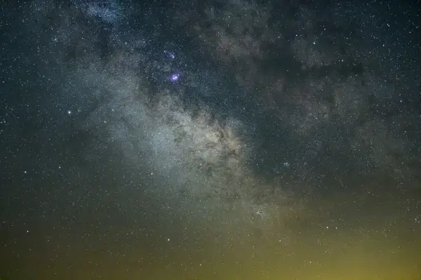
Discover why Lake Placid is a rising astrotourism destination, with pristine dark skies, innovative lighting efforts, and unforgettable stargazing experiences. Explore the best spots to watch meteor showers, learn how locals are protecting the night sky, and get tips for your visit.
Johns Brook Lodge, New York state's only backcountry lodge open to the public, turns 100 this year! Celebrate by reading a bit about it, and booking a stay at this backcountry getaway.

Hikes to High Peak mountains that aren't above 4,000 feet! It's winter in the Adirondack High Peaks! While thoughts of crystallized spruce trees high up the mountains, bluebird views from above 4,000 feet, and big mileage days might be tempting, it's...