Round Trip
1.3 miles
2.1 kilometers

Elevation
The height of the summit or destination, from sea level.
1270 feet
387.1 meters

Elevation Gain
The total amount of vertical ascent (uphill climbing) on a hike. This is cumulative gain, totalling the elevation change of the uphill segments from a round-trip hike.
280 feet
85.3 meters

Route Type
A hiking trail may be classified as a Loop, Out and Back, Point to Point, Bushwhack, or Multi-day Thru Hike, with some destinations having more than one of these ways as a hiking option.
  • Loop
Round Trip
1.3 miles
2.1 kilometers

Route Type
A hiking trail may be classified as a Loop, Out and Back, Point to Point, Bushwhack, or Multi-day Thru Hike, with some destinations having more than one of these ways as a hiking option
  • Loop
Elevation
The height of the summit or destination, from sea level.
1270 feet
387.1 meters

Elevation Gain
The total amount of vertical ascent (uphill climbing) on a hike. This is cumulative gain, totalling the elevation change of the uphill segments from a round-trip hike.
280 feet
85.3 meters

Round Trip
1.3 miles
2.1 kilometers

Route Type
A hiking trail may be classified as a Loop, Out and Back, Point to Point, Bushwhack, or Multi-day Thru Hike, with some destinations having more than one of these ways as a hiking option
  • Loop
Elevation
Lorem ipsum dolor sit amet consectetur. Phasellus cursus malesuada tincidunt placerat non maecenas. Viverra morbi aliquam neque id nibh lorem massa quam non.
1270 feet
387.1 meters

Elevation Gain
The total amount of vertical ascent (uphill climbing) on a hike. This is cumulative gain, totalling the elevation change of the uphill segments from a round-trip hike.
280 feet
85.3 meters

Keene is the Home of the High Peaks.
View all photos
trail highlights
trail features
trail category
Trail Junctions
Short

About

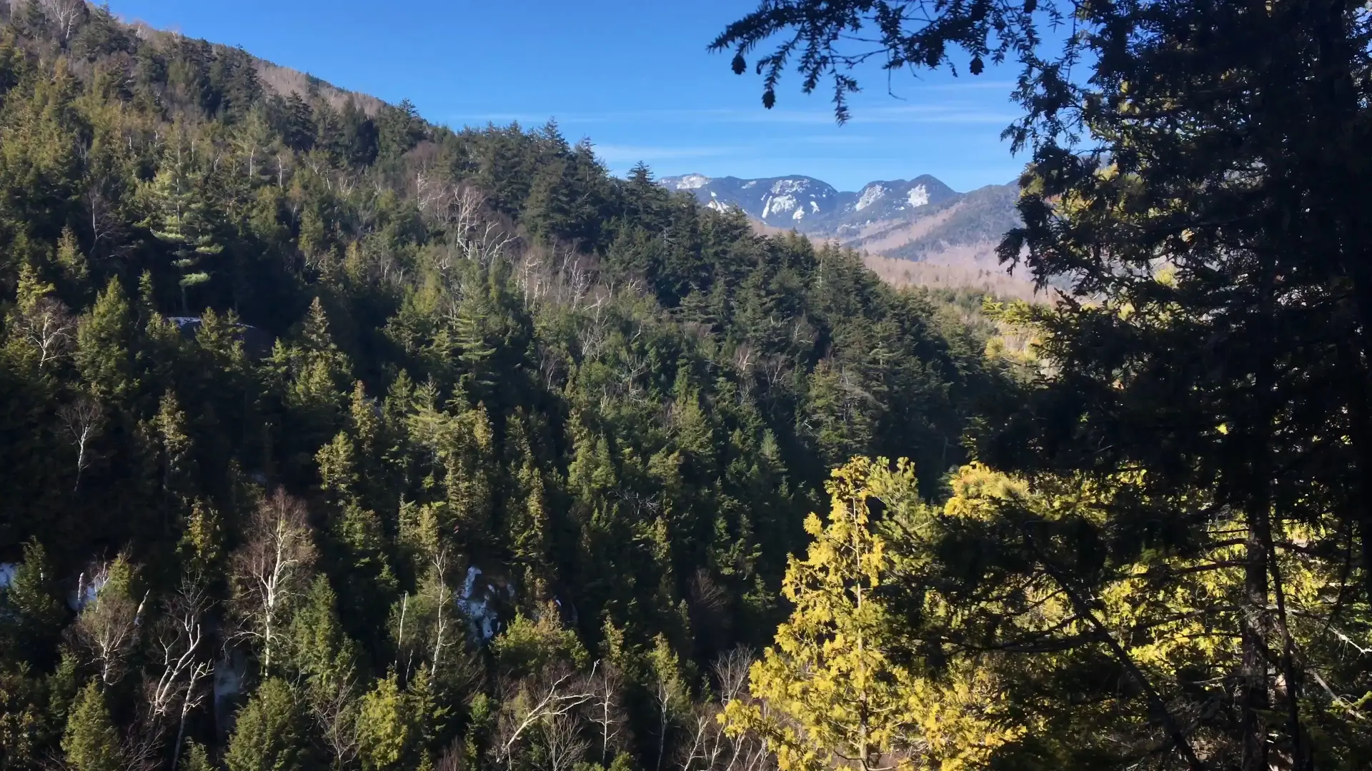
This is a nice walk through the woods on an easy trail with a couple of modest climbs to reach the height-of-land. It features interesting views and a quiet forest add up to a nice, short, family hike.

Key takeaways

  • Distance: 1.3 miles round trip
  • Elevation gain: 280 feet
  • Hike includes trail junctions

Hiking the Keene Ridge Loop

This is a 1.3 mile hike, and is a lollipop loop, along a woods road and well maintained foot trail.

From the parking lot you will initially have to follow a dirt road that leads through a wet forest. The foot trail for Blueberry Mountain will leave on the right and this trail continues straight along a woods road and begins a steady climb. The road will continue to go straight and the foot trail breaks right and enters an attractive forest of cedars and tall pines. In a short distance the trail splits and left heads steeply up the ridge, this is the loop.

Continue straight for a counter-clockwise loop. The trail stays a bit mellow as it soon swings left and starts a steeper climb that will bring you to a couple viewing areas. Once past the height-of-land you will start a descent that is very steep in spots, but the footing is in good shape. You will quickly be back on the trail you were on earlier where you will need to take a right to head back to the car.

Keene Ridge Loop in the winter

This is a nice walk in the winter as well, and great for beginner snowshoers. The parking area is open in the winter.

Find your perfect trail near Keene Valley

Want to find another perfect hike? The surrounding region has so many more trails waiting for you!

How to get there

Leave Lake Placid on Route 73, follow Route 73 toward Keene. Continue through Keene and locate the Marcy Air Field on the right. Take the right just after the air strip onto Airport Road and park at the hiker lot on the right.

Emergency Information
If you get lost or injured, remain calm and stay put. If you have cell service, call 911 or the DEC Forest Ranger Dispatch, 833-NYS-RANGERS (833-697-7264).
 
Plan ahead and hike smart. Bring a map, extra food, water, and warm clothing, and check the weather before you go. Stay aware of your surroundings and landmarks. If you get turned around, don’t panic—stop, think, and stay where you are. Let someone know your route and expected return time.