

- Loop
- Loop
- Loop


About
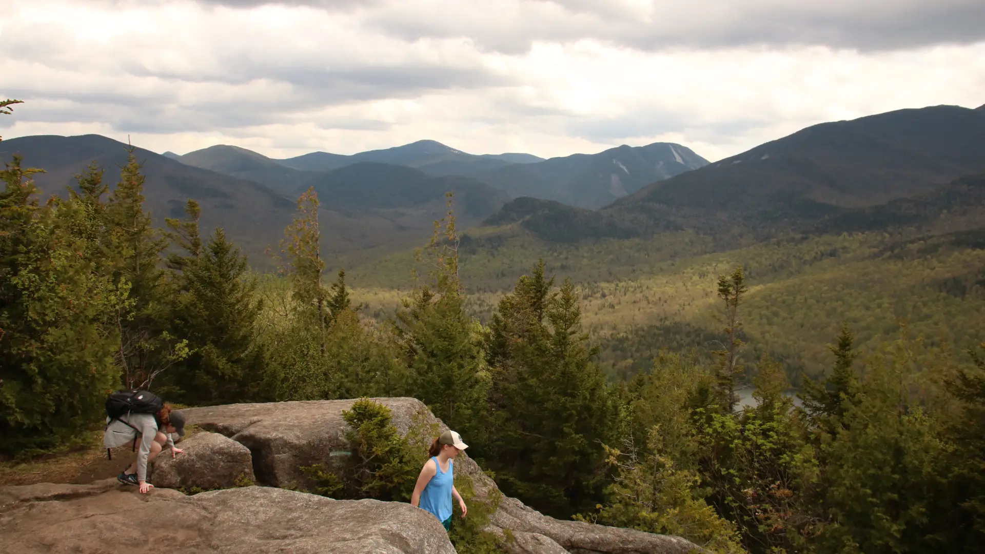
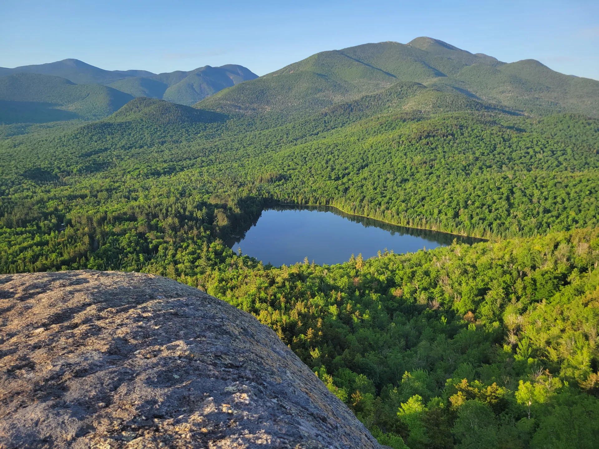
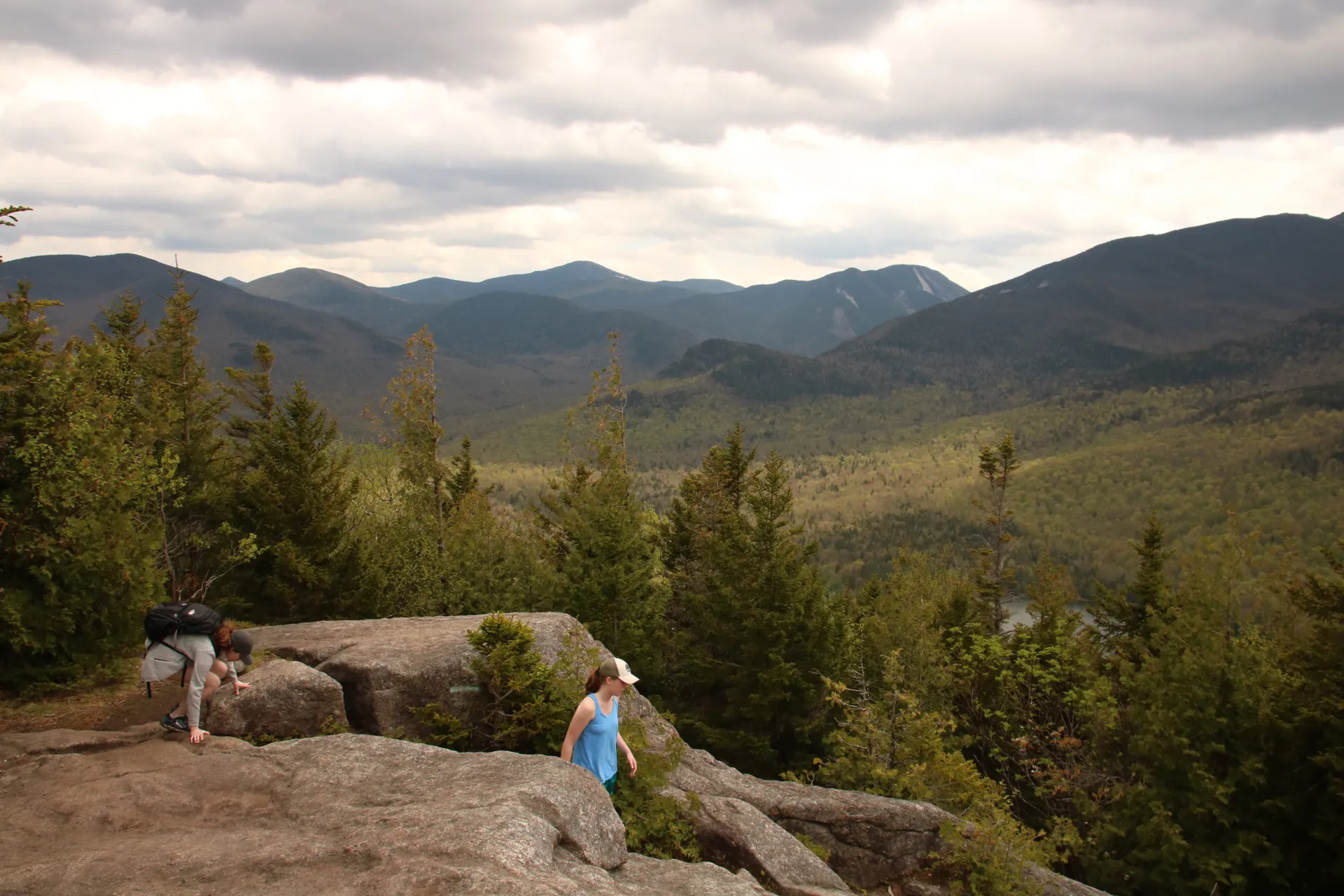
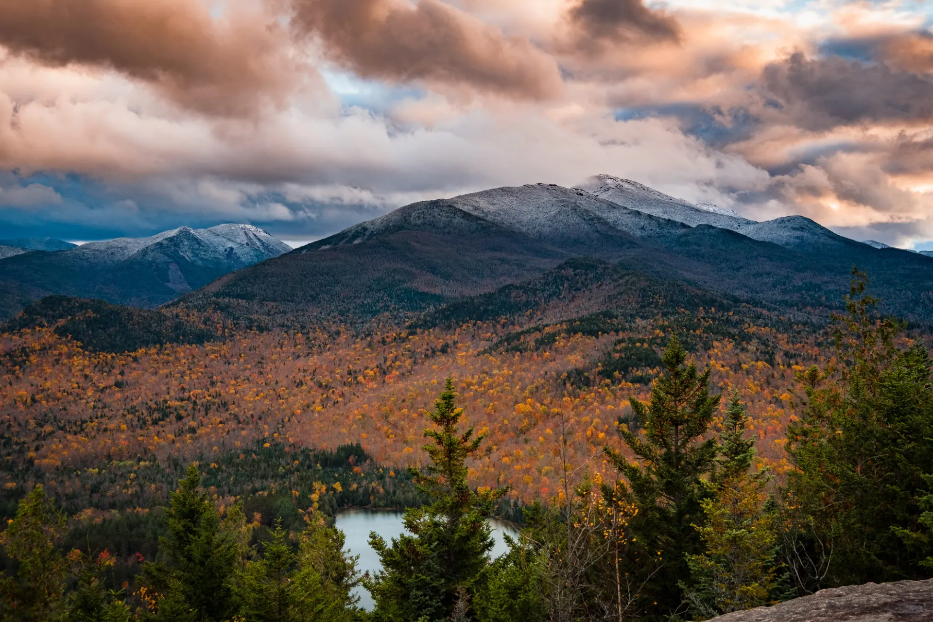
A good option for families and beginners with some hiking experience, Mt. Jo's open summit ledges provide one of the best views of the High Peaks. There are two trails to the top so it's easy to make a loop hike out of this adventure, although inexperienced hikers might find the Short Trail too steep for their liking. Read the romantically tragic story behind how Mt. Jo got its name. Hikers should learn about Leave No Trace principles before hiking any trail in the Adirondacks.
Key takeaways
- Distance: Short Trail, 1.1 miles one way; Long Trail, 1.3 miles one way
- Elevation: 2,876 feet
- Elevation gain: Approximately 700 feet
- Hike includes trail junctions and ladders
Hiking Mt Jo
The well established trail remains mostly level for about 300 yards to a wide trail on the shore of Heart Lake. Turn right and walk for about 60 yards to the true start of the Mt. Jo trail, where you'll find a trail register. After about a quarter mile of hiking uphill, there is a junction. The Short Trail goes right while the Long trail goes straight. The Short Trail is only 0.2 miles shorter, but it is considerably steeper and rougher, so the Long Trail is better for most family groups. The two trails rejoin just before the summit, and then it's an easy walk to the summit rocks, which are easily ascended via a series of wooden stairs.
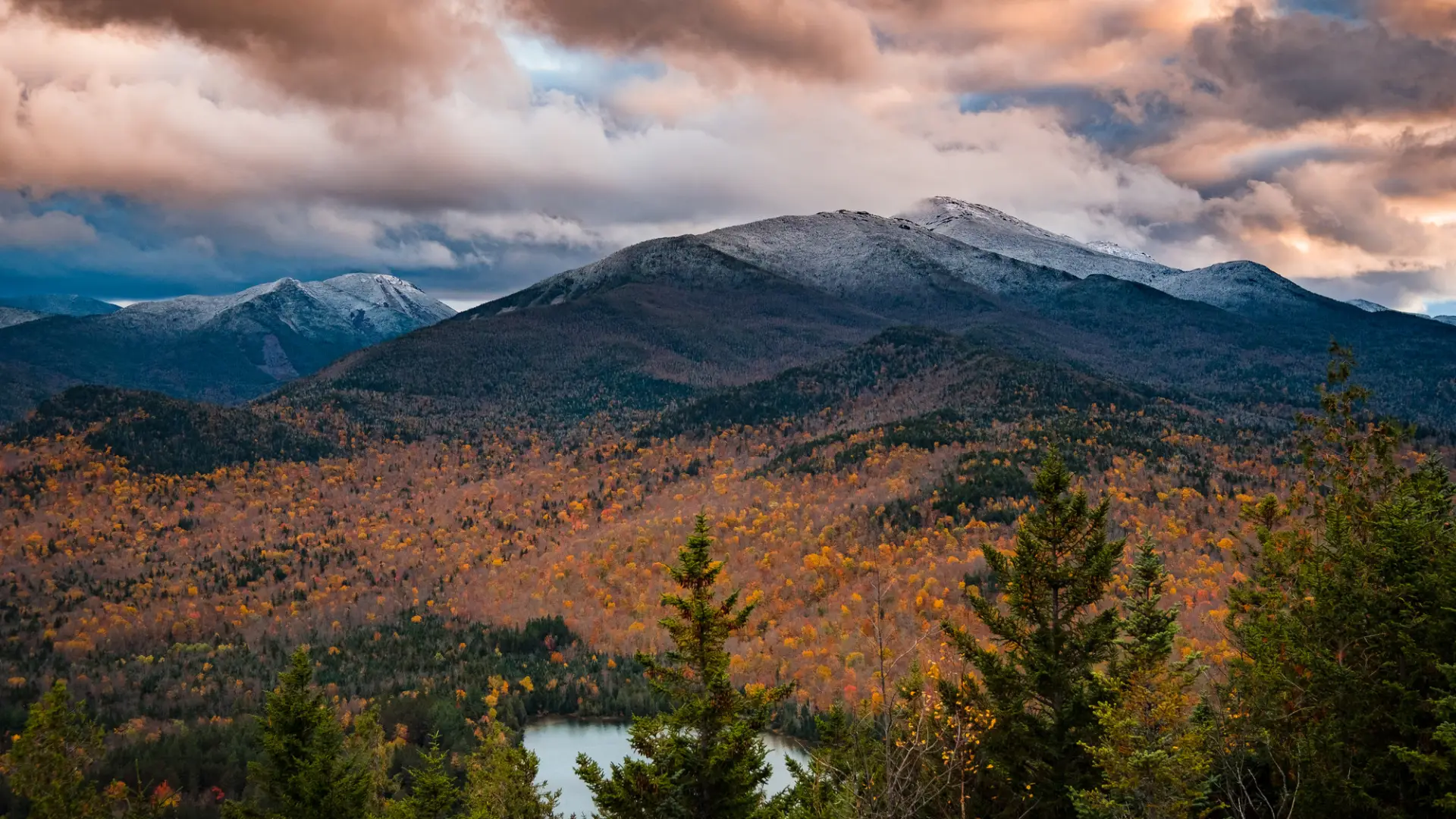
Mount Jo in winter
Mt. Jo is a great choice for anyone who is new to snowshoeing. As with any winter trail, snowshoes are a must for traction and to avoid postholing. Snowshoes will get you to the top on the Long Trail, but snow spikes may be necessary to traverse the Short Trail's steeper sections. Either way, it's a good idea to have them in your pack just in case. Expect a drop in temperature as elevation is gained, and be prepared for cold winds on the open cobble. Always bring extra layers, especially for higher elevations, and don't hesitate to turn around if the weather starts to turn. This trail is not recommended for cross-country skiing. Being prepared is necessary for any winter hike.
Snowshoe and spike rentals are available at the High Peaks Information Center, located near the parking lot.
Find your perfect trail near Lake Placid
Does Mount Jo sound amazing, but a little more than you want to tackle right now? No need to stress, with over 2000 miles of hiking trails in the Adirondacks we are sure we can find the perfect hike for you.
How to get there
From Lake Placid, go east on Route 73 and turn right on Adirondack Loj Road, the first right after the ski jumps. The parking lots are about 5 miles from Route 73. Be sure to pay the parking fee at the booth, even if no one is there. Your parking fee helps the Adirondack Mountain Club in the following ways: keeps public service facilities and trailhead information updated, supports backcountry stewardship programs, helps improve and maintain trails, provide educational programs on backcountry use, and helps conserve natural resources. Take note that these parking lots often fill up early in the summer and on weekends. Consider a different hike if that's the case.
From the parking lot at the High Peaks Information Center at the end of Adirondack Loj Road, return to the entrance station and find the trail at the far corner of the snowplow turnaround.
Emergency Information
Related Content

Lake Placid, NY is home to short hikes, moderate hikes, and longer hikes, making us the perfect hiking destination for any hiker! Read these hiking safety and etiquette tips that will keep you safe and happy on the trails this summer!

Mount Van Hoevenberg has a long history, and recent improvements to the site help ensure it remains a go-to destination for Olympic history and new hiking adventures.