Round Trip
0.5 miles
0.8 kilometers

Elevation
The height of the summit or destination, from sea level.
1026 feet
312.7 meters

Elevation Gain
The total amount of vertical ascent (uphill climbing) on a hike. This is cumulative gain, totalling the elevation change of the uphill segments from a round-trip hike.
20 feet
6.1 meters

Route Type
A hiking trail may be classified as a Loop, Out and Back, Point to Point, Bushwhack, or Multi-day Thru Hike, with some destinations having more than one of these ways as a hiking option.
  • Loop
Round Trip
0.5 miles
0.8 kilometers

Route Type
A hiking trail may be classified as a Loop, Out and Back, Point to Point, Bushwhack, or Multi-day Thru Hike, with some destinations having more than one of these ways as a hiking option
  • Loop
Elevation
The height of the summit or destination, from sea level.
1026 feet
312.7 meters

Elevation Gain
The total amount of vertical ascent (uphill climbing) on a hike. This is cumulative gain, totalling the elevation change of the uphill segments from a round-trip hike.
20 feet
6.1 meters

Round Trip
0.5 miles
0.8 kilometers

Route Type
A hiking trail may be classified as a Loop, Out and Back, Point to Point, Bushwhack, or Multi-day Thru Hike, with some destinations having more than one of these ways as a hiking option
  • Loop
Elevation
Lorem ipsum dolor sit amet consectetur. Phasellus cursus malesuada tincidunt placerat non maecenas. Viverra morbi aliquam neque id nibh lorem massa quam non.
1026 feet
312.7 meters

Elevation Gain
The total amount of vertical ascent (uphill climbing) on a hike. This is cumulative gain, totalling the elevation change of the uphill segments from a round-trip hike.
1026 feet
6.1 meters

View near the trailhead. Enjoy a short pond walk.
trail highlights
trail features
trail category
Lakes/Ponds
Trail Junctions
Bridge
Short

About

The pond walk is simply a small beaver pond located behind the Keene Central School, and close to one of the most popular trailheads in the area.

Key takeaways

  • Distance: 0.5 miles round trip
  • Elevation gain: Less than 25 feet
  • Hike includes trail junctions and a bridge

Hiking around Keene Pond

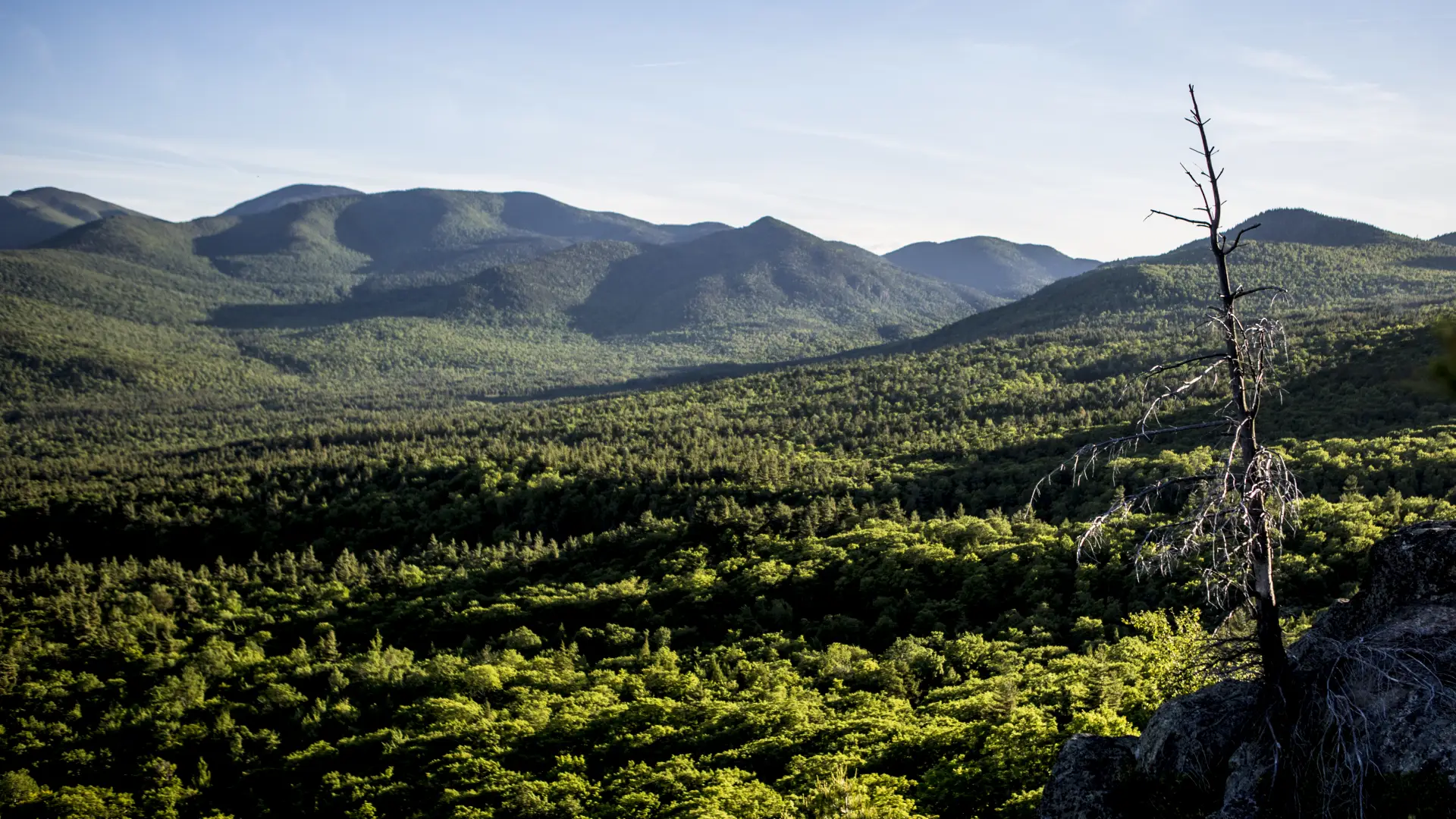
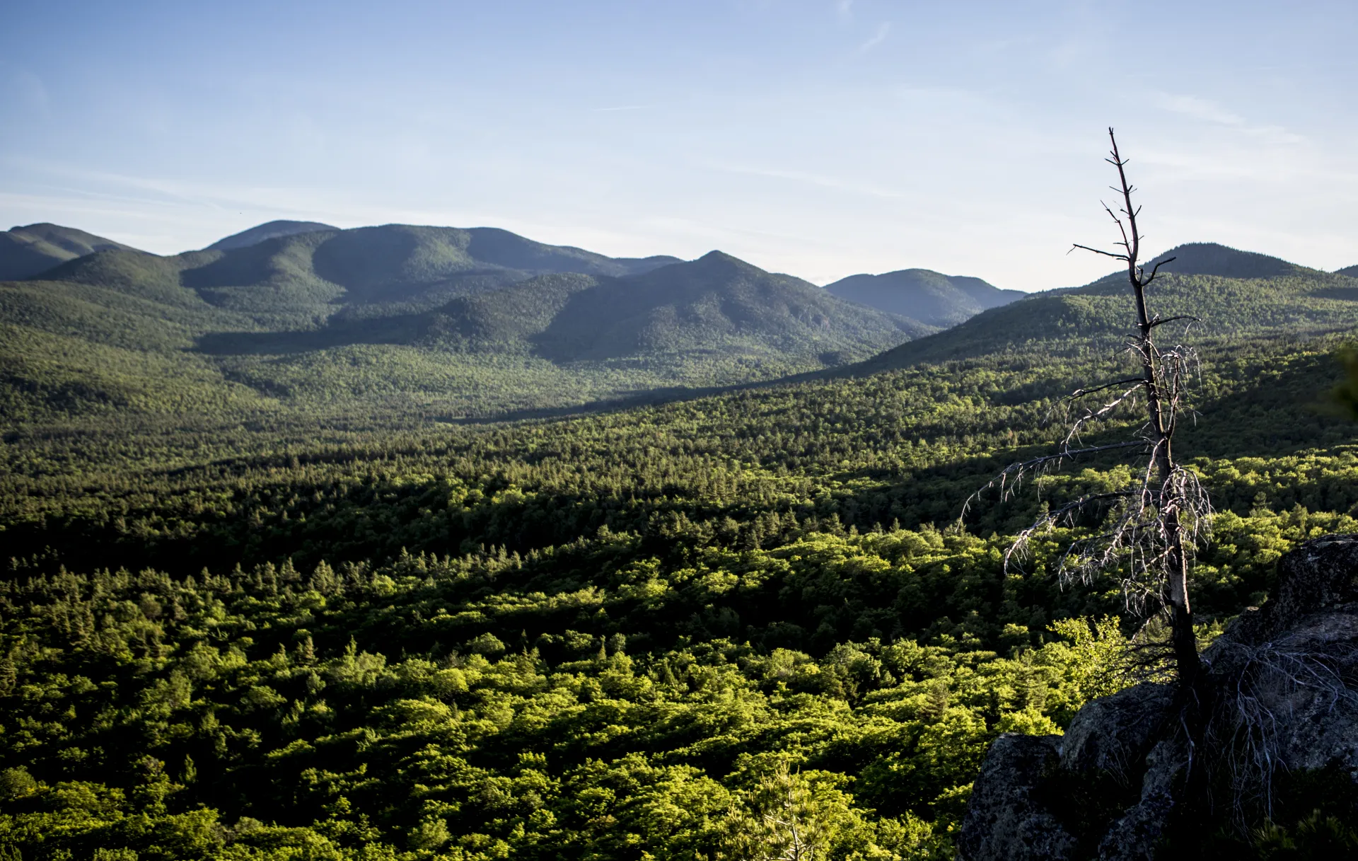
From the trailhead you will have to cross a long bridge over a beaver flow. The trail register is immediately after the bridge. About 0.1 miles further you will come to the pond. A trail leads all the way around the pond. This is an excellent scenic destination for birding, wildlife viewing, and a short peaceful stroll. Blueberry Mountain and Porter's Ridge loom off in the distance.

Keene Pond in the winter

While this would be a nice destination for an introduction to snowshoeing for little children, the actual loop gets only moderate attention from users.

Find your perfect trail

Want to find another perfect hike? Lake Placid and the surrounding areas have so many more trails waiting for you!

Birding

This is an excellent scenic destination for birding, wildlife viewing, and a short peaceful stroll. Blueberry Mountain and Porters Ridge loom off in the distance.

How to get there

Follow Route 73 out of Lake Placid and continue through Keene and into Keene Valley. As you pass through Keene Valley there will be a major trailhead on your right for Roostercomb Mountain, park here.

Emergency Information
If you get lost or injured, remain calm and stay put. If you have cell service, call 911 or the DEC Forest Ranger Dispatch, 833-NYS-RANGERS (833-697-7264).
 
Plan ahead and hike smart. Bring a map, extra food, water, and warm clothing, and check the weather before you go. Stay aware of your surroundings and landmarks. If you get turned around, don’t panic—stop, think, and stay where you are. Let someone know your route and expected return time.
Additional Info
Keene Pond Walk trail map