Round Trip
3 miles
4.8 kilometers

Elevation
The height of the summit or destination, from sea level.
2760 feet
841.2 meters

Elevation Gain
The total amount of vertical ascent (uphill climbing) on a hike. This is cumulative gain, totalling the elevation change of the uphill segments from a round-trip hike.
1200 feet
365.8 meters

Route Type
A hiking trail may be classified as a Loop, Out and Back, Point to Point, Bushwhack, or Multi-day Thru Hike, with some destinations having more than one of these ways as a hiking option.
  • Out and Back
Round Trip
3 miles
4.8 kilometers

Route Type
A hiking trail may be classified as a Loop, Out and Back, Point to Point, Bushwhack, or Multi-day Thru Hike, with some destinations having more than one of these ways as a hiking option
  • Out and Back
Elevation
The height of the summit or destination, from sea level.
2760 feet
841.2 meters

Elevation Gain
The total amount of vertical ascent (uphill climbing) on a hike. This is cumulative gain, totalling the elevation change of the uphill segments from a round-trip hike.
1200 feet
365.8 meters

Round Trip
3 miles
4.8 kilometers

Route Type
A hiking trail may be classified as a Loop, Out and Back, Point to Point, Bushwhack, or Multi-day Thru Hike, with some destinations having more than one of these ways as a hiking option
  • Out and Back
Elevation
Lorem ipsum dolor sit amet consectetur. Phasellus cursus malesuada tincidunt placerat non maecenas. Viverra morbi aliquam neque id nibh lorem massa quam non.
2760 feet
841.2 meters

Elevation Gain
The total amount of vertical ascent (uphill climbing) on a hike. This is cumulative gain, totalling the elevation change of the uphill segments from a round-trip hike.
2760 feet
365.8 meters

Spectactular views from Giant's Nubble.
View all photos
trail highlights
trail features
trail category
Lakes/Ponds
Trail Junctions
Exposed Summit
Ladder
Short

About

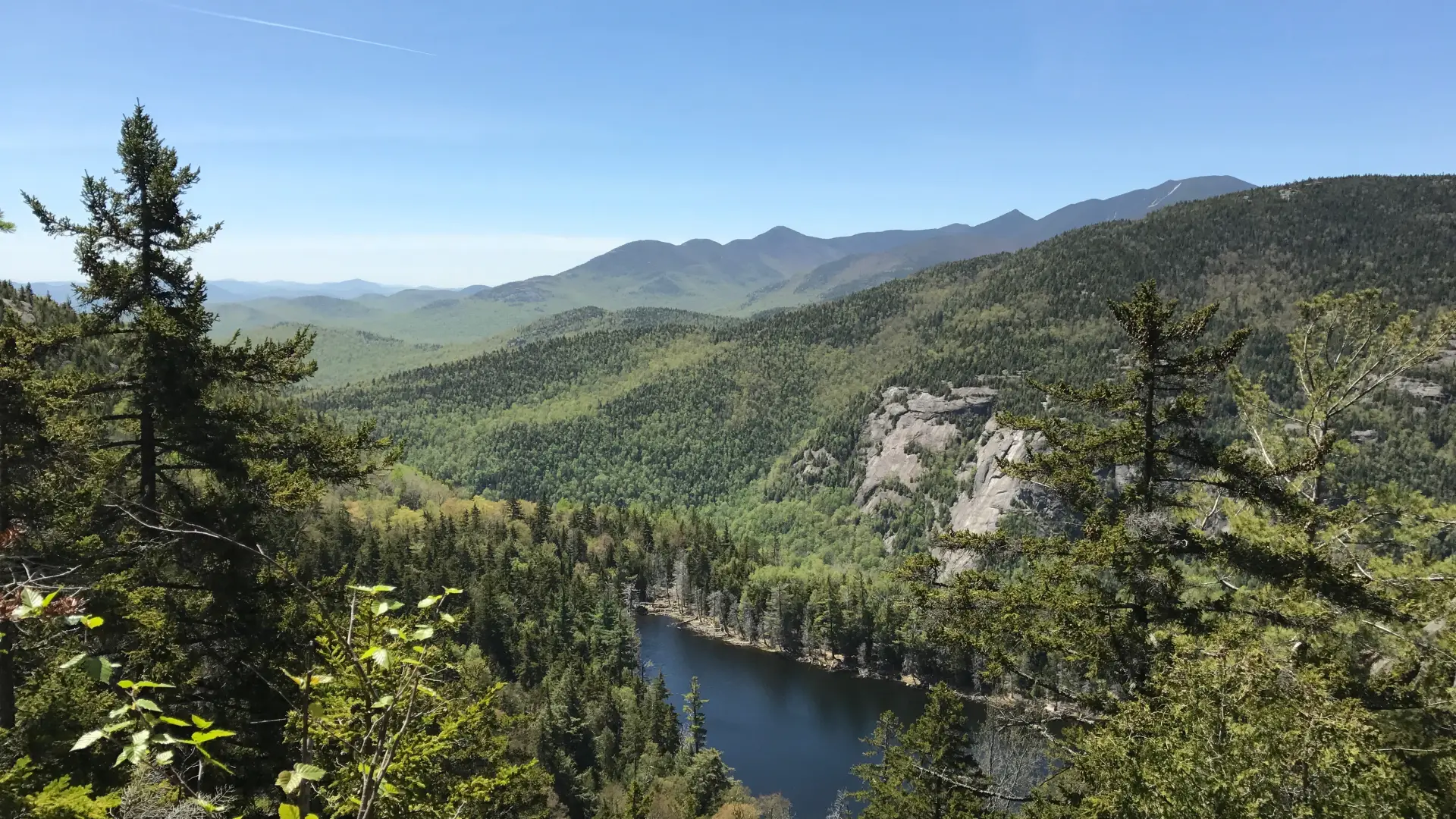
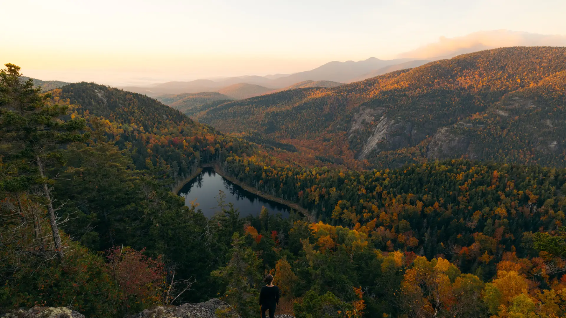
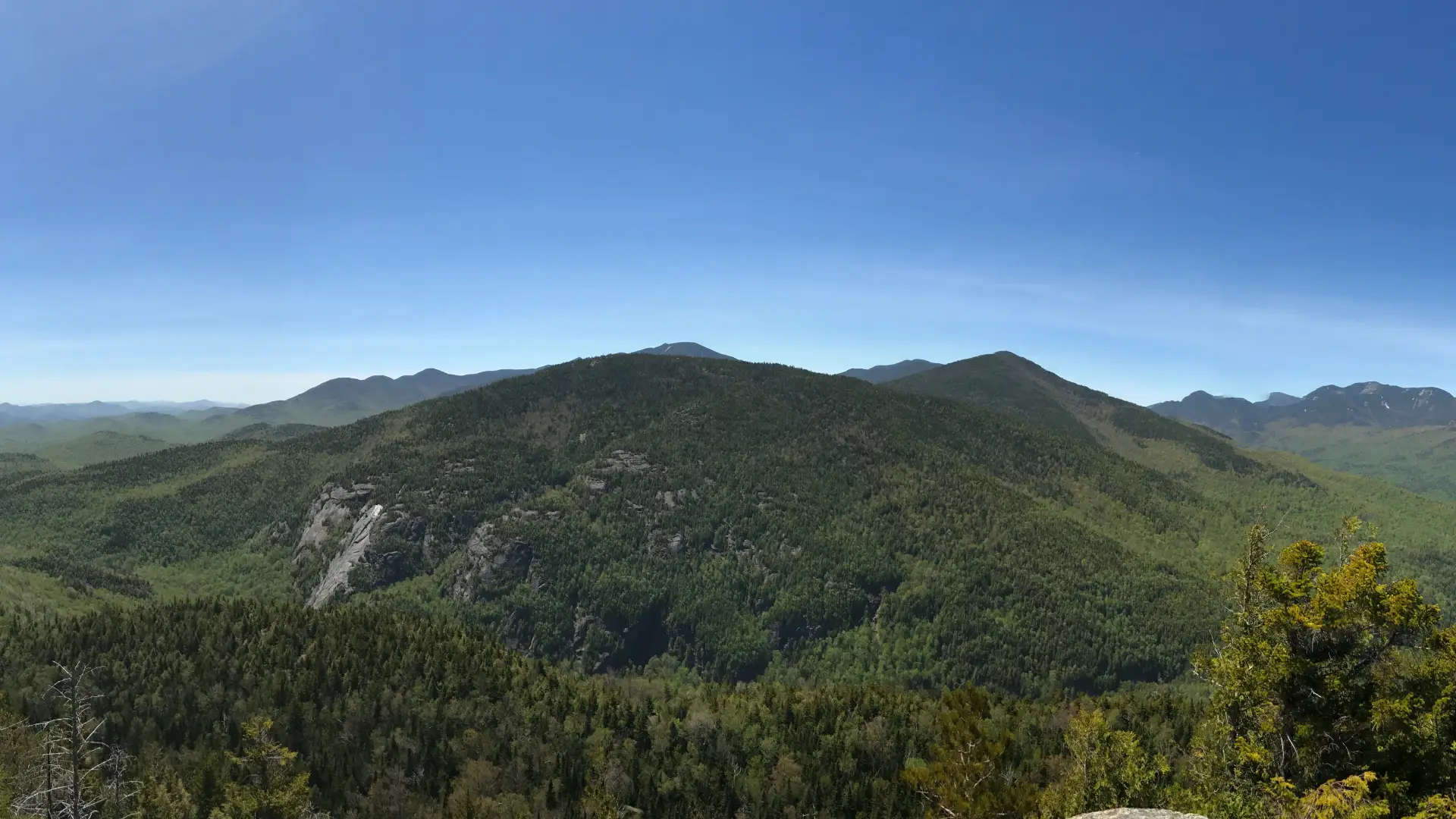
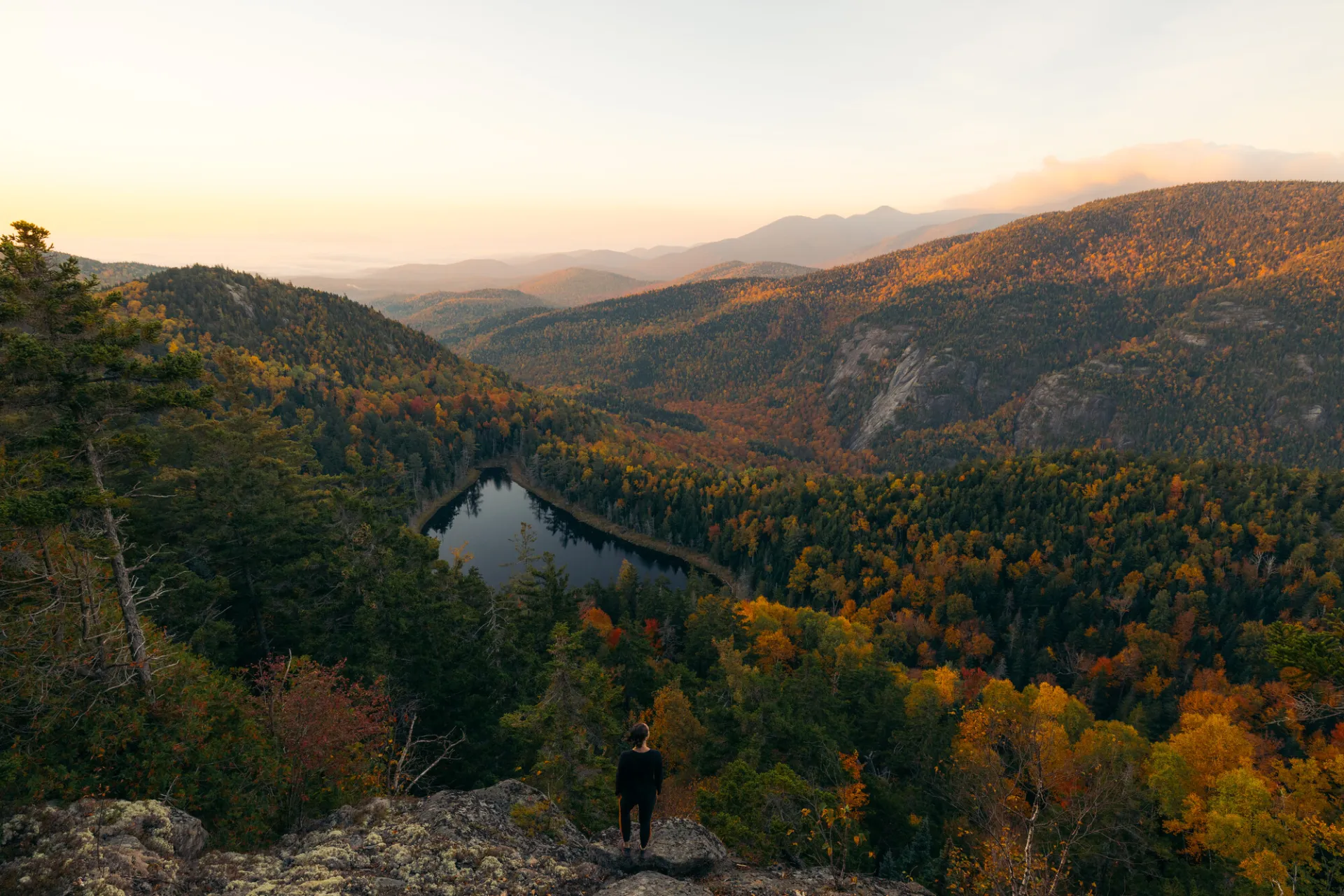
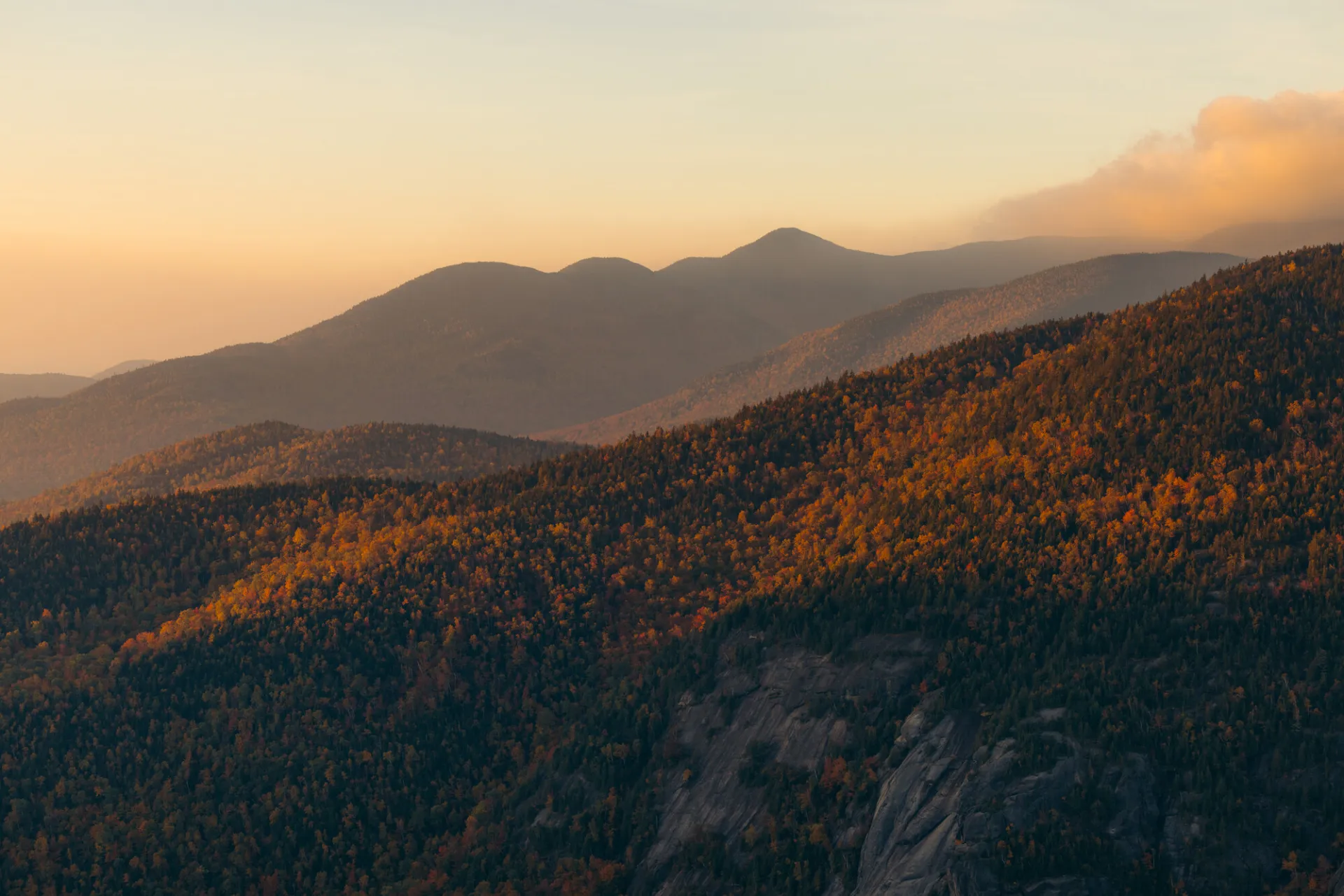
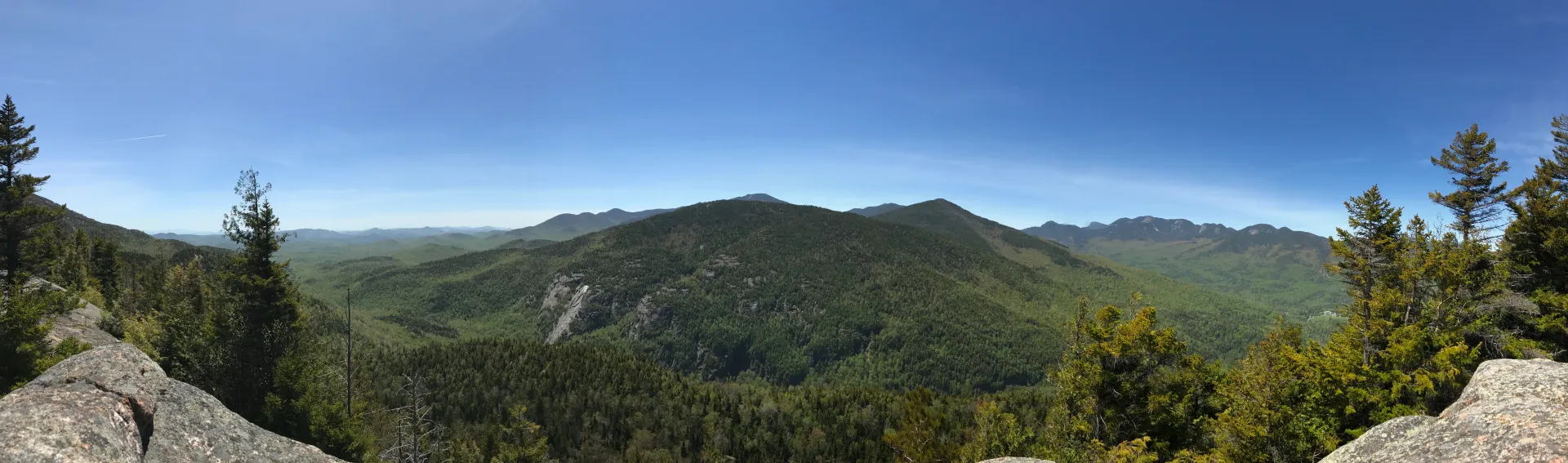
Enjoy a short, yet steep, hike to this rocky little knob, where there is an up-close view of Giant Mountain, plus many of the peaks in the Dix Range and Great Range.

Key takeaways

  • Distance: 3 miles round trip
  • Elevation gain: 1,200 feet
  • Elevation: 2,760 feet
  • Based on a hike up the Ridge Trail
  • Hike includes trail junctions, an exposed summit, and ladders

Hiking Giant's Nubble via the Ridge Trail

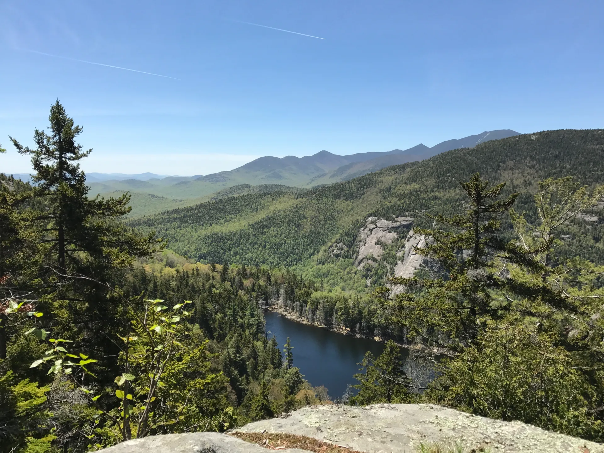
The first mile follows the Ridge Trail toward Giant Mountain's summit. After a steep climb, the path passes a view of the Chapel Pond slab across the road. After the view, a short straightaway ends at Giant's Washbowl, a small pond where the cliffs of the Nubble rise from the opposite shore. Follow the trail to the right and cross the outlet of the Washbowl on a wooden bridge. There are a few designated primitive tent sites here for camping.

After a brief climb, continue straight at the trail junction (right continues to the summit of Giant) and complete the final half mile climb to the lookout point.

Giant's Nubble in the winter

This is a great snowshoe if you have some experience hiking in the winter already. As with any winter trail, microspikes and snowshoes are a must for traction and to avoid postholing. Expect a drop in temperature as elevation is gained, and be prepared for cold winds on the open rock. Always bring extra layers, especially for higher elevations, and don't hesitate to turn around if the weather starts to turn. This trail is not recommended for cross-country skiing. Being prepared is necessary for any winter hike.

Find your perfect trail near Keene Valley

Does Giant's Nubble sound amazing, but a little more than you want to tackle right now? No need to stress, with over 2000 miles of hiking trails in the Adirondacks we are sure we can find the perfect hike for you

How to get there

From Keene Valley, follow Route 73 west for 4.8 miles. Park in the Chapel Pond parking area, on the right. The trailhead is across the road. 

Emergency Information
If you get lost or injured, remain calm and stay put. If you have cell service, call 911 or the DEC Forest Ranger Dispatch, 833-NYS-RANGERS (833-697-7264).
 
Plan ahead and hike smart. Bring a map, extra food, water, and warm clothing, and check the weather before you go. Stay aware of your surroundings and landmarks. If you get turned around, don’t panic—stop, think, and stay where you are. Let someone know your route and expected return time.