
- Out and Back
- Out and Back
- Out and Back


About
This hike is accessed through a conservation easement with the Adirondack Mountain Reserve (AMR). A parking reservation is needed from May 1 - October 31. Although it is called a “parking reservation,” everyone will need a reservation to access hikes leaving from AMR, whether you drove yourself, rode a bike, got dropped-off, or walked. These reservations can be made online via the AMR website. For more information, please read these FAQs or contact the New York State Department of Environmental Conservation.
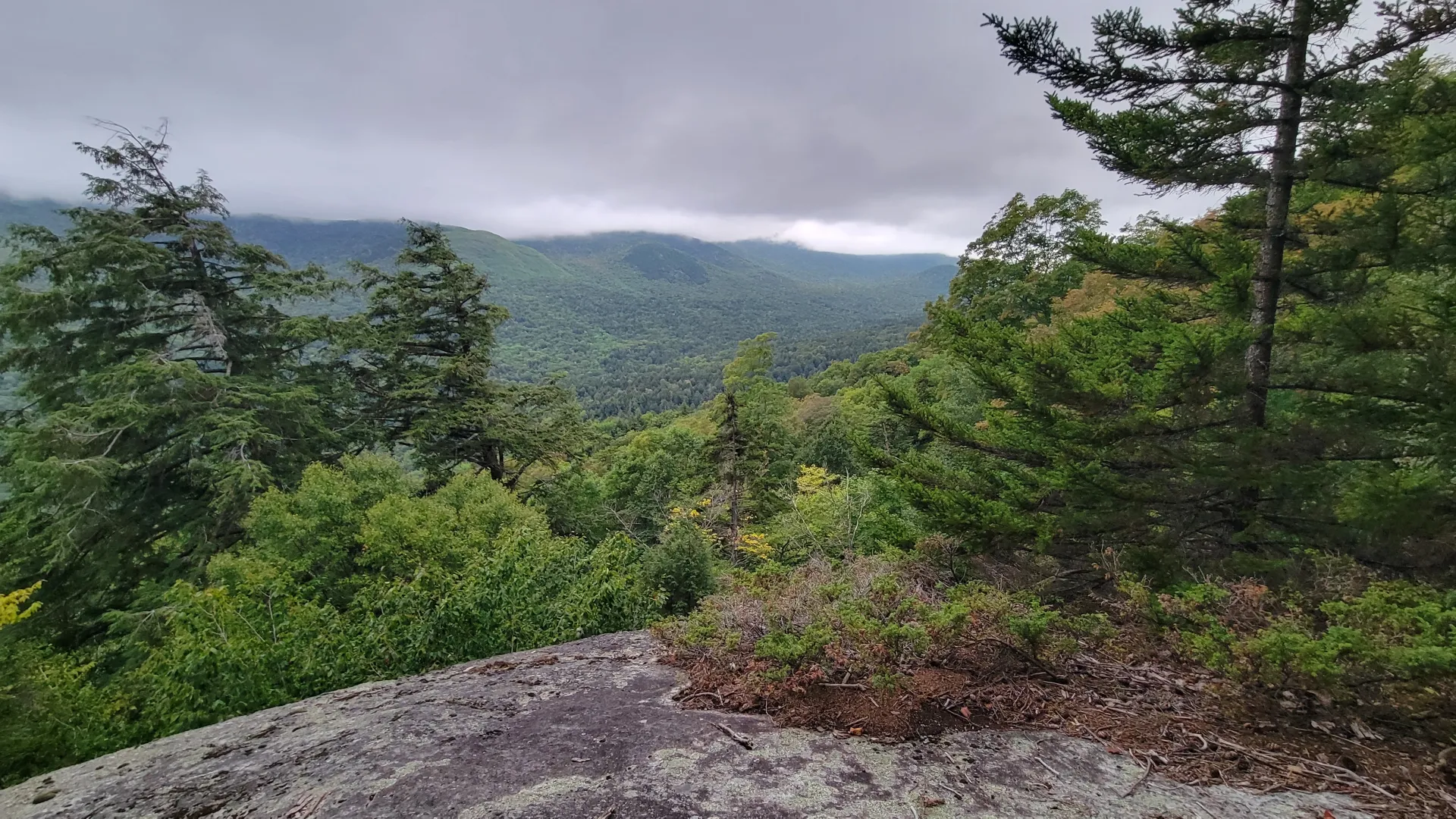
Bear Run is a narrow rock cut into the side of the Great Range. The trail passes through the rocky shoot and up to a nice overlook.
Key takeaways
Distance: 0.5 miles round trip, spur trail only (4.5 miles and 1,350 feet of elevatin gain round trip from the parking area)
Elevation gain: Roughly 300 feet, spur trail only
Hike includes trail junctions, bridges, and a road walk
Hiking to Bear Run
Bear Run is a short spur trail off the Cathedral Rock Loop Trail, please see Cathedral Rock and Pyramid Falls for more information on this trail. 1.6 miles from Lake Road along the Cathedral Rock Trail lies this fun and exciting short spur trail. A small pool rests at the intersection and you will follow a tall sheer cliff toward Bear Run. Be very careful as you climb and descend this rocky section, it can be slippery and is quite steep.
Bear Run in the winter
The parking area is open in the winter (no reservation required). You will want to bring microspikes for the upper parts of this hike, and be prepared to break trail as this is not commonly snowshoed. Be prepared for all winter conditions.
Find your perfect trail near Keene Valley
Does Bear Run sound amazing, but a little more than you want to tackle right now? No need to stress, with over 2000 miles of hiking trails in the Adirondacks we are sure we can find the perfect hike for you.
How to get there
From the intersection of Route 73 and Route 86 in Lake Placid follow Route 73 toward Keene. Drive through Keene and Keene Valley and Into St. Huberts. Locate the High Peaks Trailhead for the AMR on the right and park here.