Wright Peak is a definite top ten peak in the Adirondacks for me, which could be possibly be why I visit it every winter. Winter 2013 would end up being no different. There is one thing that can always be counted on with this mountain and that's the probability that we could get scooped up and blown right off the mountain into the next county. On a good note, if that were to happen, I would at least be able to find the hat I lost a couple years back.
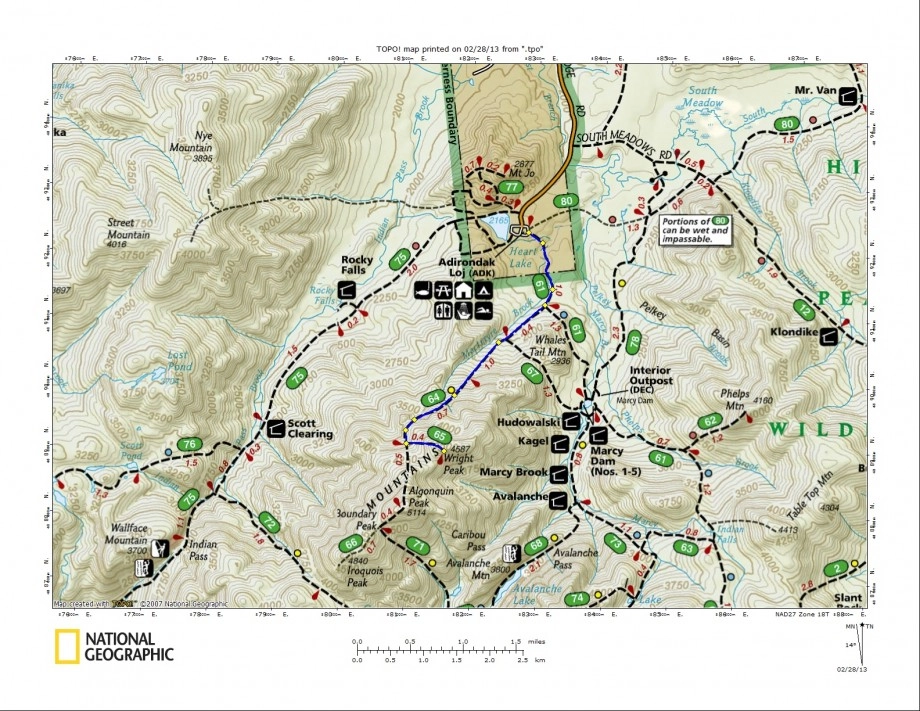
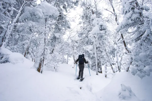
As typical, conditions for the Marcy Dam Trail were like that of a sidewalk, pounded hard and left with only about 2 inches of snow. With that being the case we opted to take our snowshoes for a ride on our pack for a while. The trail would not get any better until we reached the Whale's Tail Ski Trail about 1.5 miles in. As we climbed we continued to play tag with a group of five heading to do Iroquois Peak. After about five courses of leap frog we decided to go and check out the monument at the high camp. I couldn't find it, maybe it was buried or maybe I just forgot exactly where it was. The monument I seek sets further back off the campsite in a rather obscure area and is different than the one on the summit.
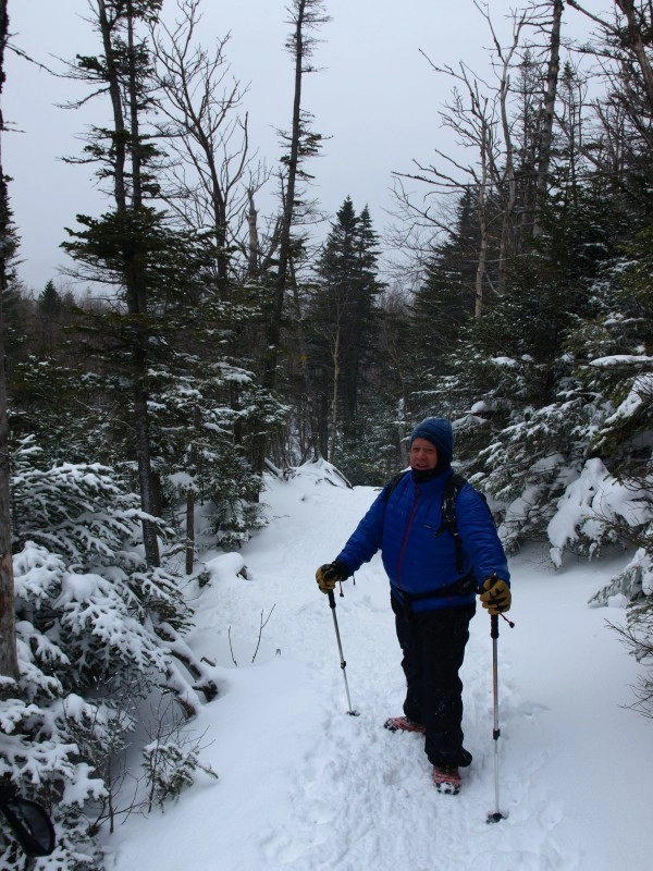
Once we regained the trail it gave the other group enough time to put distance between us and them, we never saw them again. As we passed by the waterfall I often think about climbing Wright along its course, maybe someday. But right now we would remain on the trail and enjoy the great conditions and accumulating snow. At this point we could really hear the wind picking up above the trees and knew we would be in for heavy winds above tree-line.
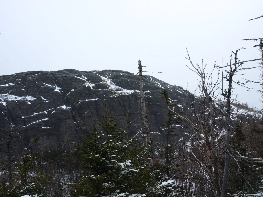
We eventually reached the base of Rong Peak. Rong Peak is the rock ledge, high point to the right of the trail at around 3900'. This rocky knob has been given this name by climbers and has somehow stuck over the years, it is however, not, named as such on any map. Rong Peak sets about 50' higher than the trail and is possibly only visited by a hand-full of people a year. A herd-path leads to the center-base of the cliff, which we followed and fought through, in deep unconsolidated snow. We climbed it to the left, which seems to be the best route, but that could easily be argued as not. The climb is very tricky with snowshoes and the snow gets wind loaded and is on an average 2-3 times as deep as along the trail. Once on the top we enjoyed nothing, there were no views to be had except that of the rock that surrounded us and the shoulder of the MacIntyre Range.
After we descended Rong Peak we regained our packs which we had dropped and started along the normal trail toward Wright. It wasn't long before we were at the Wright Peak junction and climbing steadily toward tree-line. At tree-line, with micro-spikes on we broke the barrier of the rock ledge and stunted trees to be walloped by steady low gale force winds. It wasn't too hard to stand but our packs kept catching the winds and pushing us around. Once we reached the rocky slope where traction was limited, due to thin ice and no snow, I found myself being knocked around like a rag doll and eventually lowered to my back-side and sliding back down about 10 feet. As we climbed and crested the first false summit I decided to head north around the higher rocks and use them as barriers to avoid the wind gusts that were overpowering.
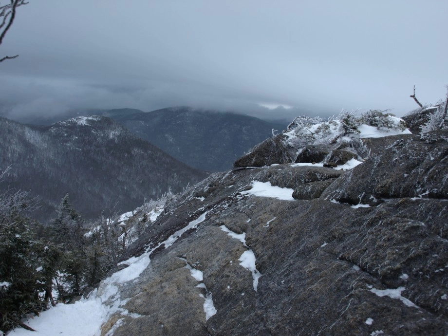
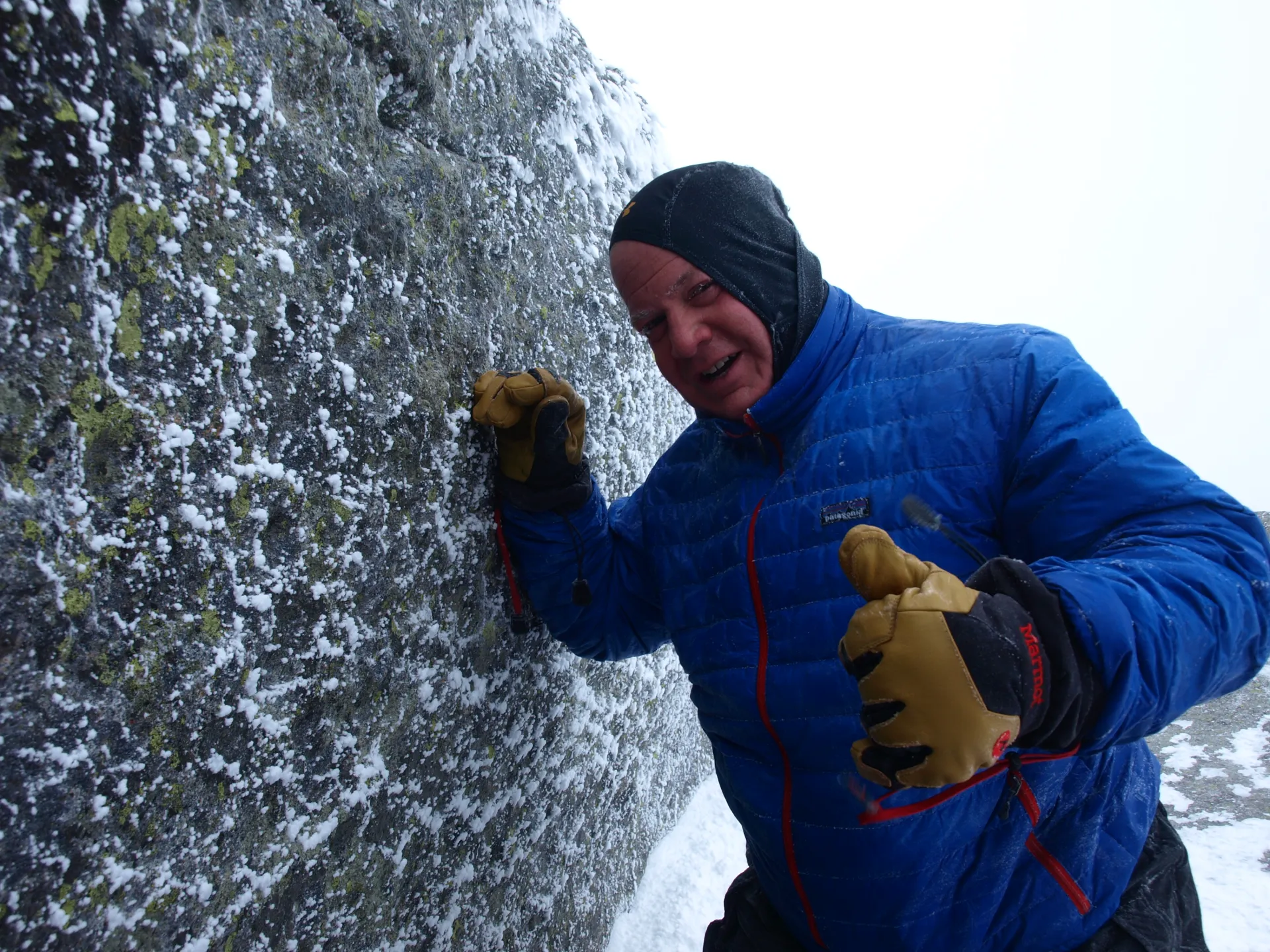
I looked at my climbing partner who had never been on Wright before in winter and said, "be prepared, as we stick our heads up over this rock barrier we will hit a wall", and we did. The wind force here was 50 mph, with gusts exceeding this. We had to push ourselves through the wind as it was steady. We listened and felt for minor lulling of the winds and as they came we darted as far as we could before the next wave of wind came along. We could see the true summit ahead but before we would reach it I would be relieved of my vertical position and introduced to one of less wind resistance if you catch my drift. Once we positioned ourselves below the summit rock we removed our packs, pulled ourselves up on the rock and crawled hands and knees to the summit. We sat there for about 30 seconds before the pelting of ice into our face became enough to remember and returned to our packs.
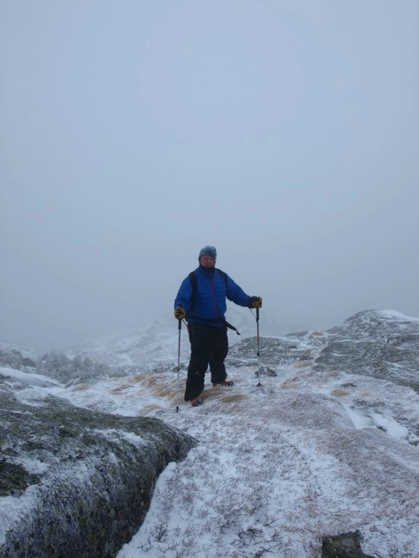
We decided NOT to have lunch at this point, but to descend as fast and as safe as we could. There were times when I had to push myself downhill against the wind and other times where the crab walk became necessary. Once back into the trees and behind the natural rock barrier we had lunch and warned the other 6 groups ascending to be prepared. Three of those groups turned back after only a short distance. Following lunch we removed ourselves and our wind burned faces back along the trail and closer to that hot cup of coffee I left in a thermos on my counter back at home.
Interested in a guided ascent of Wright Peak or any of the High Peaks? Check out a local guide service in the Lake Placid Region. Lake Placid is also a great place to spend a couple days, check out what we have for accommodations and local flavor.
Explore More
This summer, find a trip perfect for all your girls in Lake Placid

Get even more out of your winter getaway to Lake Placid when you stay midweek! With great deals on lodging, and ski and stay packages for those looking to hit the slopes, it's the perfect way to experience Lake Placid at your own pace.
The Empire State Winter Games are almost here! Find out how to get involved, compete, and enjoy!
Discover Lake Placid's winter beauty beyond the ski slopes with these five exceptional snowshoeing trails. From the challenging trek to Marcy Dam with stunning High Peaks views to the easy, dog-friendly loops at Heaven Hill, there's a trail for every ability level.