Round Trip
1.2 miles
1.9 kilometers

Elevation
The height of the summit or destination, from sea level.
1725 feet
525.8 meters

Elevation Gain
The total amount of vertical ascent (uphill climbing) on a hike. This is cumulative gain, totalling the elevation change of the uphill segments from a round-trip hike.
260 feet
79.2 meters

Route Type
A hiking trail may be classified as a Loop, Out and Back, Point to Point, Bushwhack, or Multi-day Thru Hike, with some destinations having more than one of these ways as a hiking option.
  • Out and Back
Round Trip
1.2 miles
1.9 kilometers

Route Type
A hiking trail may be classified as a Loop, Out and Back, Point to Point, Bushwhack, or Multi-day Thru Hike, with some destinations having more than one of these ways as a hiking option
  • Out and Back
Elevation
The height of the summit or destination, from sea level.
1725 feet
525.8 meters

Elevation Gain
The total amount of vertical ascent (uphill climbing) on a hike. This is cumulative gain, totalling the elevation change of the uphill segments from a round-trip hike.
260 feet
79.2 meters

Round Trip
1.2 miles
1.9 kilometers

Route Type
A hiking trail may be classified as a Loop, Out and Back, Point to Point, Bushwhack, or Multi-day Thru Hike, with some destinations having more than one of these ways as a hiking option
  • Out and Back
Elevation
Lorem ipsum dolor sit amet consectetur. Phasellus cursus malesuada tincidunt placerat non maecenas. Viverra morbi aliquam neque id nibh lorem massa quam non.
1725 feet
525.8 meters

Elevation Gain
The total amount of vertical ascent (uphill climbing) on a hike. This is cumulative gain, totalling the elevation change of the uphill segments from a round-trip hike.
1725 feet
79.2 meters

There is good fishing in Round Pond.
View all photos
trail highlights
trail features
trail category
Lakes/Ponds
Short

About

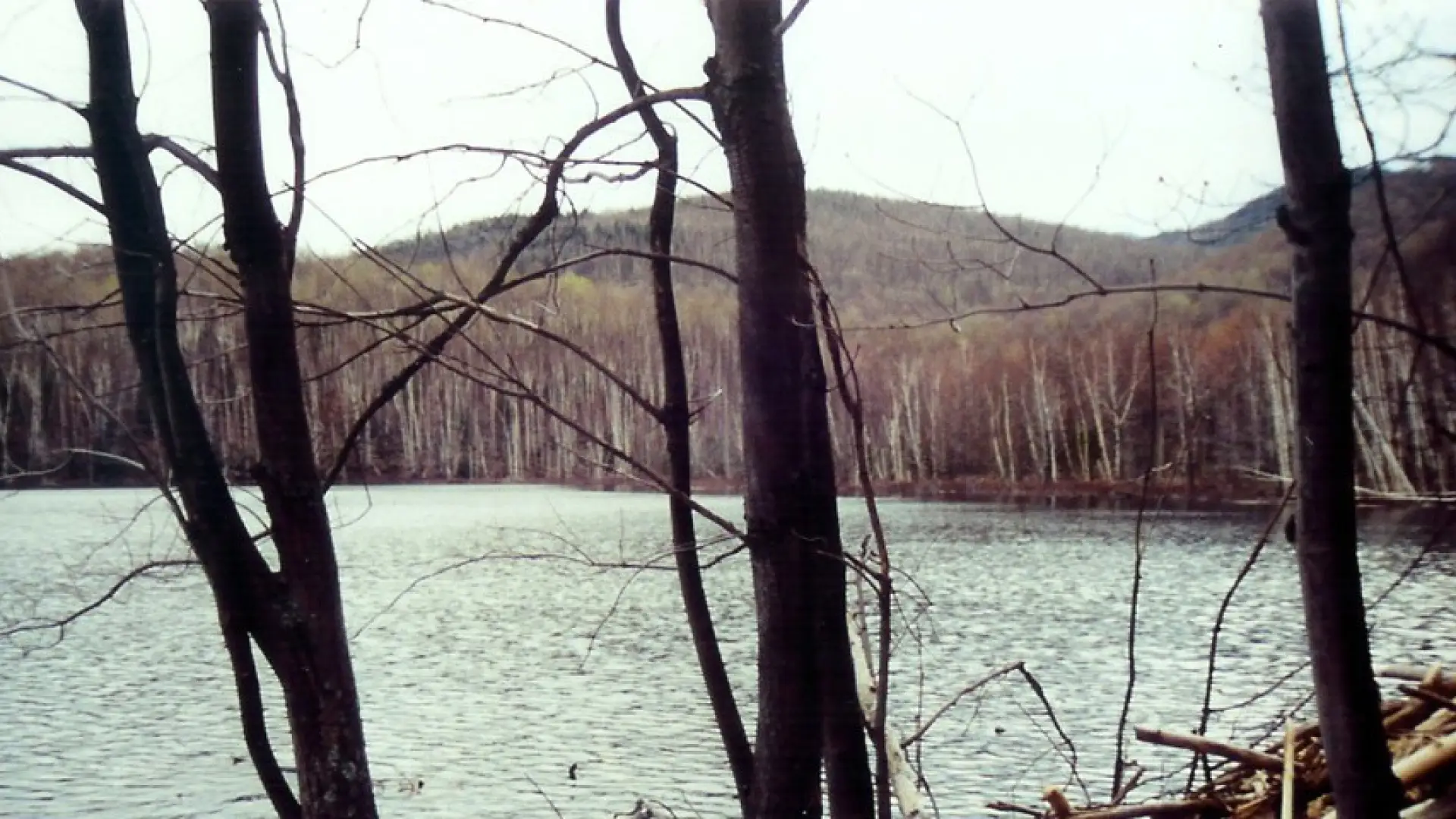
Round Pond is an excellent destination for the entire family. This can be done as a short hike destination, fishing destination, or a family camp outing. The pond is a very attractive objective with the mountains rising above on many sides.

Key takeaways

  • Distance: 1.2 miles round trip
  • Elevation: 1,725 feet
  • Elevation gain: 260 feet

Hiking Round Pond

From the parking area you will need to hike up the roadside for 100 feet or so to the actual trail on the right. The trail starts off very steep to above Route 73 before it levels off and moderately approaches a height-of-land above Round Pond. A slight descent to the shore of Round Pond is all that remains. The trail follows along the shore for a bit before turning away toward the trail to Dix Mountain.
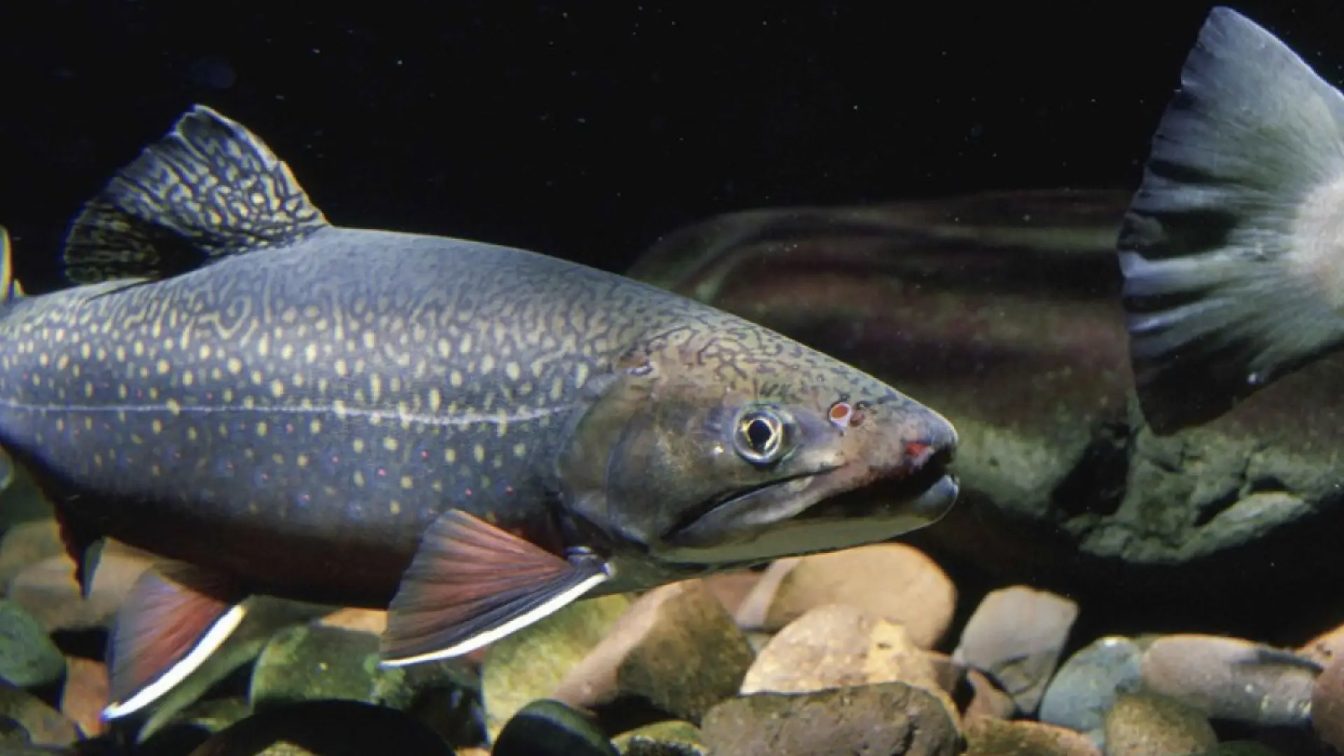
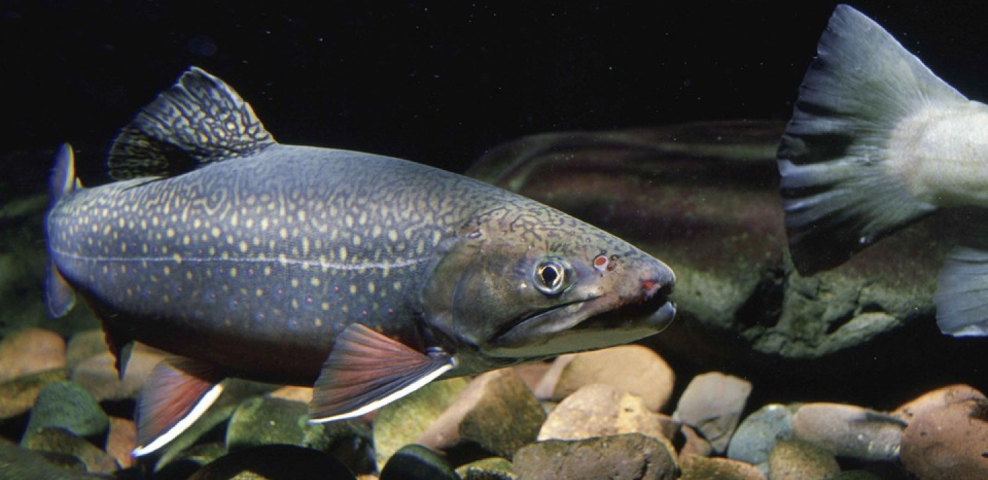
Fishing

Round Pond is listed by the New York State Department of Environmental Resources as one of the best brook trout waters in the county. It’s only 23 acres with less than a mile of shoreline, but it is very round. You can fish from the shore at ice-out, but in the summer you’ll want to tote your canoe or inflatable up the hill to hit the depths in the middle, where it bottoms out at just under 40 feet.

The pond was reclaimed in 2005, followed by several years of brook trout fingerling stockings. Subsequently, the use or possession of baitfish is prohibited.

Camping

A herd path goes around the pond to the left to some very nice primitive campsites.

Round Pond in the winter

A fine choice for kids learning to snowshoe, or adults wanting an easier trek.

Find your perfect trail

Want to find another perfect hike? Keene Valley and the surrounding areas have so many more trails waiting for you!

How to get there

Primary Trailhead: From the intersection of Route 86 and Route 73 in Lake Placid, follow Route 73 toward Keene. Continue through Keene, Keene Valley and Saint Huberts. Continue up over the long hill past Chapel Pond. on the right and locate the next The trailhead is on the right one mile past Chapel Pond. This is the trail for Round Pond and Dix Mountain.

Fish Species

  • Brook Trout
Emergency Information
If you get lost or injured, remain calm and stay put. If you have cell service, call 911 or the DEC Forest Ranger Dispatch, 833-NYS-RANGERS (833-697-7264).
 
Plan ahead and hike smart. Bring a map, extra food, water, and warm clothing, and check the weather before you go. Stay aware of your surroundings and landmarks. If you get turned around, don’t panic—stop, think, and stay where you are. Let someone know your route and expected return time.