Round Trip
2.8 miles
4.5 kilometers

Elevation
The height of the summit or destination, from sea level.
1316 feet
401.1 meters

Elevation Gain
The total amount of vertical ascent (uphill climbing) on a hike. This is cumulative gain, totalling the elevation change of the uphill segments from a round-trip hike.
700 feet
213.4 meters

Route Type
A hiking trail may be classified as a Loop, Out and Back, Point to Point, Bushwhack, or Multi-day Thru Hike, with some destinations having more than one of these ways as a hiking option.
  • Out and Back
Round Trip
2.8 miles
4.5 kilometers

Route Type
A hiking trail may be classified as a Loop, Out and Back, Point to Point, Bushwhack, or Multi-day Thru Hike, with some destinations having more than one of these ways as a hiking option
  • Out and Back
Elevation
The height of the summit or destination, from sea level.
1316 feet
401.1 meters

Elevation Gain
The total amount of vertical ascent (uphill climbing) on a hike. This is cumulative gain, totalling the elevation change of the uphill segments from a round-trip hike.
700 feet
213.4 meters

Round Trip
2.8 miles
4.5 kilometers

Route Type
A hiking trail may be classified as a Loop, Out and Back, Point to Point, Bushwhack, or Multi-day Thru Hike, with some destinations having more than one of these ways as a hiking option
  • Out and Back
Elevation
Lorem ipsum dolor sit amet consectetur. Phasellus cursus malesuada tincidunt placerat non maecenas. Viverra morbi aliquam neque id nibh lorem massa quam non.
1316 feet
401.1 meters

Elevation Gain
The total amount of vertical ascent (uphill climbing) on a hike. This is cumulative gain, totalling the elevation change of the uphill segments from a round-trip hike.
1316 feet
213.4 meters

View all photos
trail highlights
trail features
trail category
Lakes/Ponds
Short

About

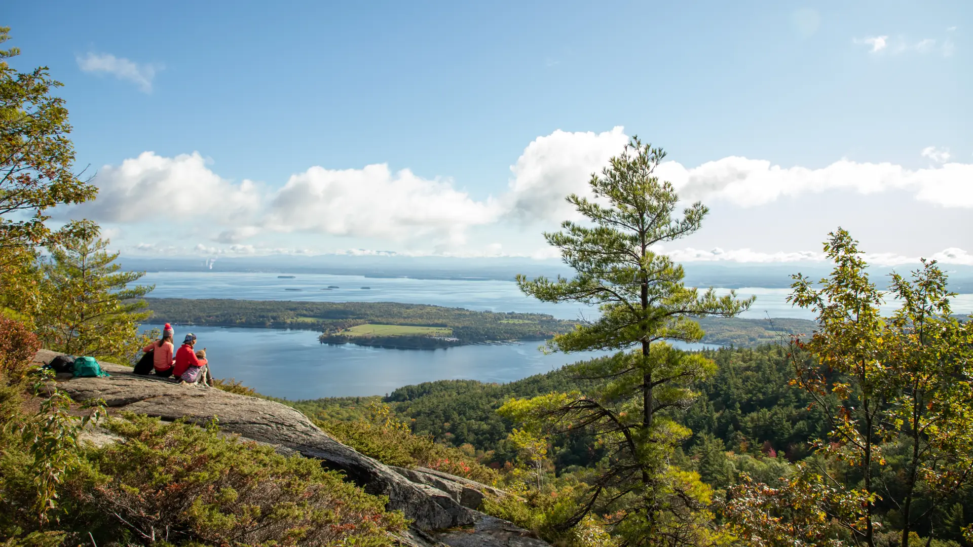
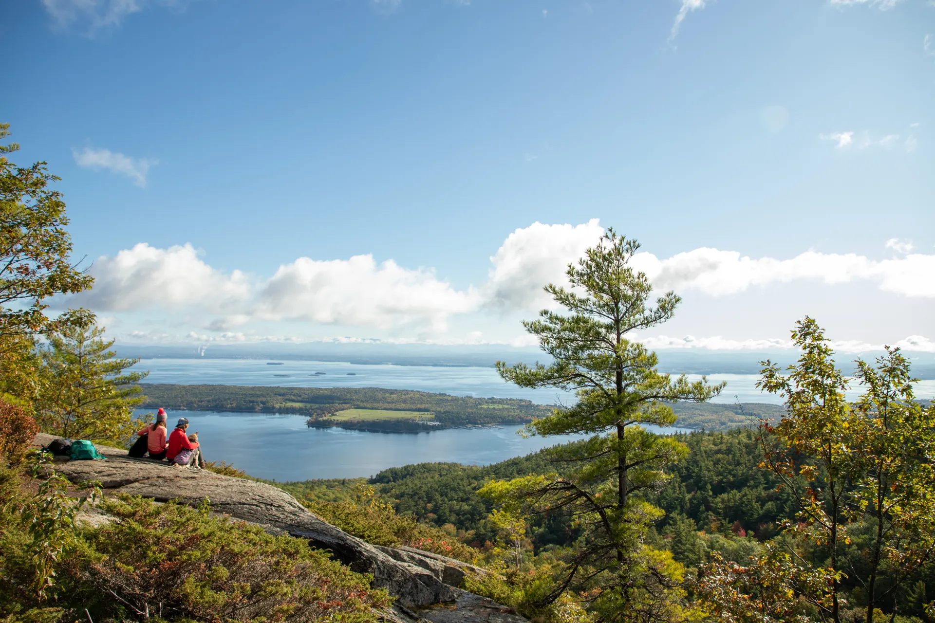
This mountain is well-known for offering great "value for effort." There are spectacular views of the entire area from the top, including Willsboro Bay and Willsboro Point, the Four Brothers Islands, Giant Mountain, and Rocky Peak Ridge.

Key takeaways

  • Distance: 2.6 miles round trip
  • Elevation gain: 720 feet
  • Mountain elevation: 1,316 feet

Hiking Rattlesnake Mountain

The trail is an old logging road that turns left onto a foot trail, which climbs steeply to the summit where there are spectacular views of Lake Champlain, Willsboro Point, and Vermont. Don't forget to look back on Long Pond. The views extend all the way to the Lake Champlain, and the Green Mountains across it in Vermont!

This trail is on private land; please be respectful to the owners. It's for hiking/snowshoeing only. There is no camping, littering, fires, bikes, or motorized vehicles.

Despite the name, this is the extreme northern end of the range for the timber rattlesnake. They are active from mid-May to mid-October, and like to sun themselves on the abundant rocky ledges, so they tend to be visible! 

Rattlesnake in the winter

The first part of the trail is a road suitable for any snowshoer, but the climb is rocky and must be taken with care. Snowshoes and traction devices are highly recommended. Be prepared for any Adirondack winter outdoor adventure.

Find more legendary trails in the Lake Champlain Region

Want to find more hikes in the Lake Champlain Region’s open spaces? With the Lake Champlain Region’s extensive trail network, there are endless options to choose from!

How to get there

Take Exit 33 from I-87 (the Northway) and continue on Route 22. Long Pond appears on the right, and the parking area is near a small cabin with the sign "Bear's Den." There is a small sign at the pull-off on the east side of road across from Long Pond Cabins.

Emergency Information
If you get lost or injured, remain calm and stay put. If you have cell service, call 911 or the DEC Forest Ranger Dispatch, 833-NYS-RANGERS (833-697-7264).
 
Plan ahead and hike smart. Bring a map, extra food, water, and warm clothing, and check the weather before you go. Stay aware of your surroundings and landmarks. If you get turned around, don’t panic—stop, think, and stay where you are. Let someone know your route and expected return time.