- Out and Back
- Out and Back
- Out and Back


About
Warning: The Avalanche Lake trail is closed due to a sizable slide. Do not hike Marshall from the Loj via the Avalanche Lake trail until further updates.
Hiking New York's 25th tallest peak
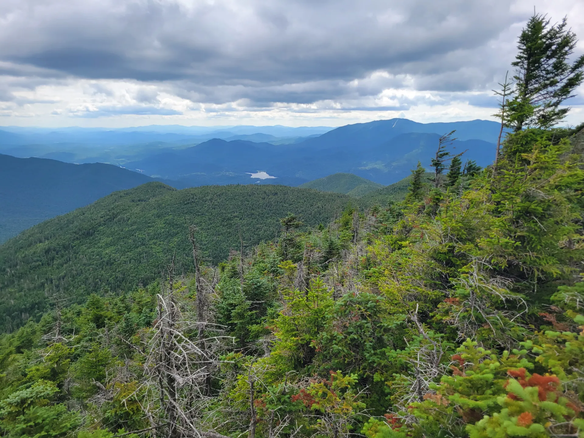
Mount Marshall is the 25th tallest of the Adirondack High Peaks. It is a steep, serious hike that requires significant preparation and navigational skill. A successful hike of Mount Marshall involves research, physical fitness, the right gear, and knowledge of Leave No Trace principles.
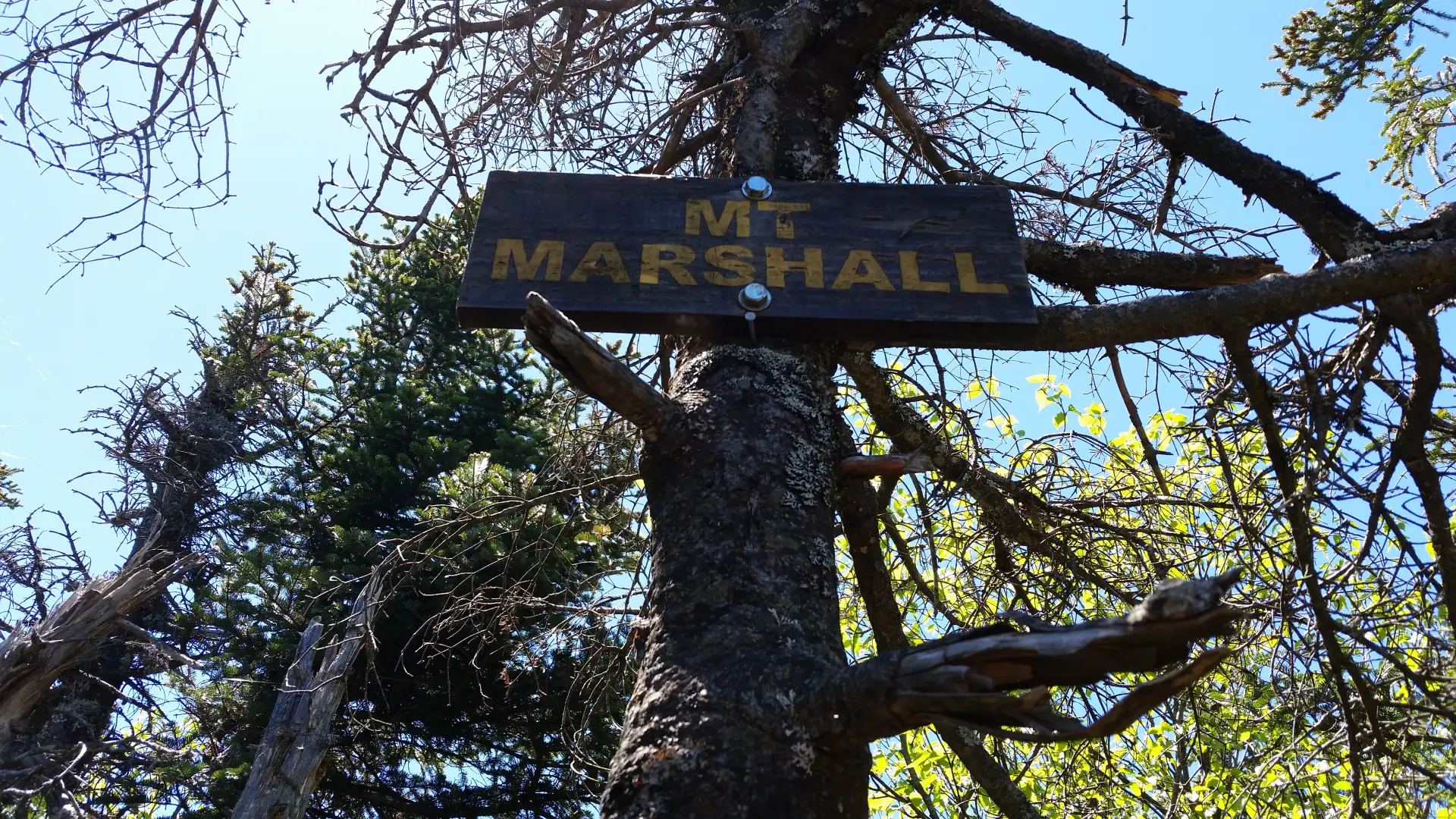
Marshall was named to honor Robert Marshall who, with his brother George, is one of the original ADK 46ers.
Key takeaways
- Distance: 16 miles round trip
- Elevation: 4,360 feet
- Elevation gain: 3,130 feet
- Hike includes unmarked trails, water crossings, ladders, bridges, and trail junctions
- Based on a hike from the Adirondack Loj
Hiking Marshall from the Adirondack Loj
There are two herd paths that lead to the summit of Mount Marshall, the route below describes a hike of Marshall via the Herbert Brook herd path from the Adirondack Loj. There is also the option of hiking Marshall via Upper Works, which is a shorter hike with less elevation gain. Please be aware that for most of this hike you will be on a marked trail, but the final ascent to the summit will be on an unmarked path. There are many worn paths around Marshall; it's critical you know which one to follow, and do your research before you go.
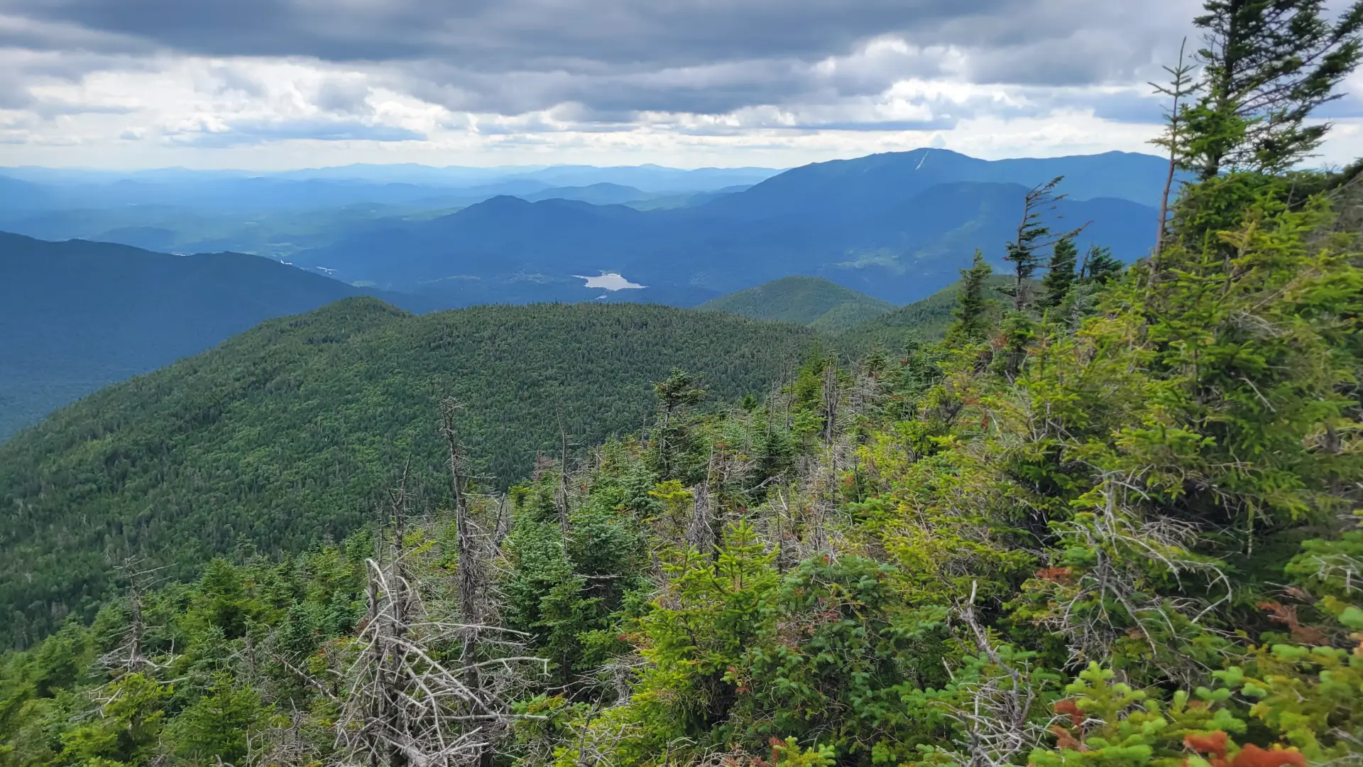
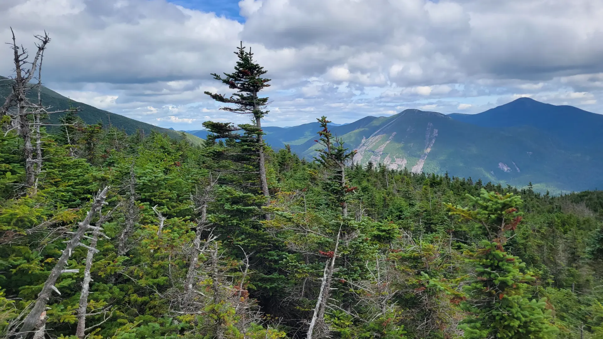
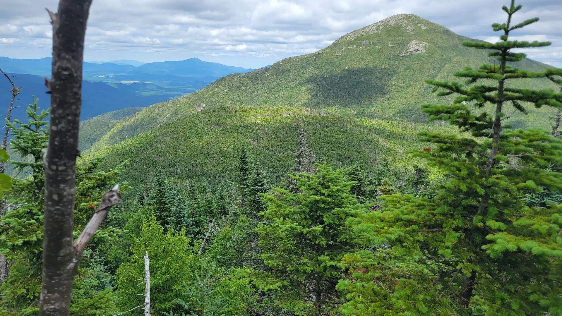
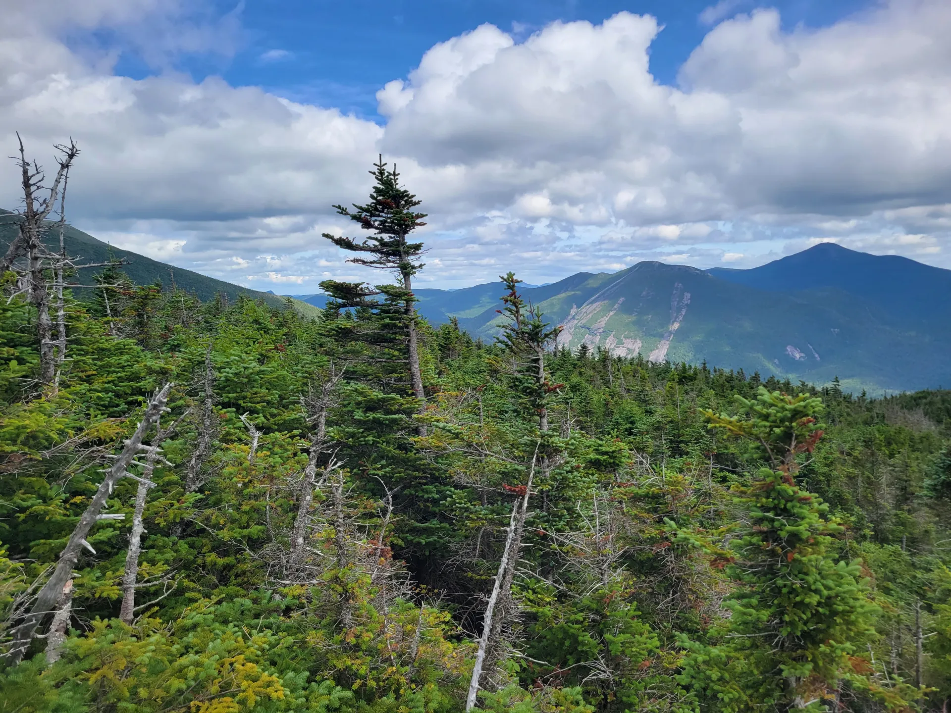
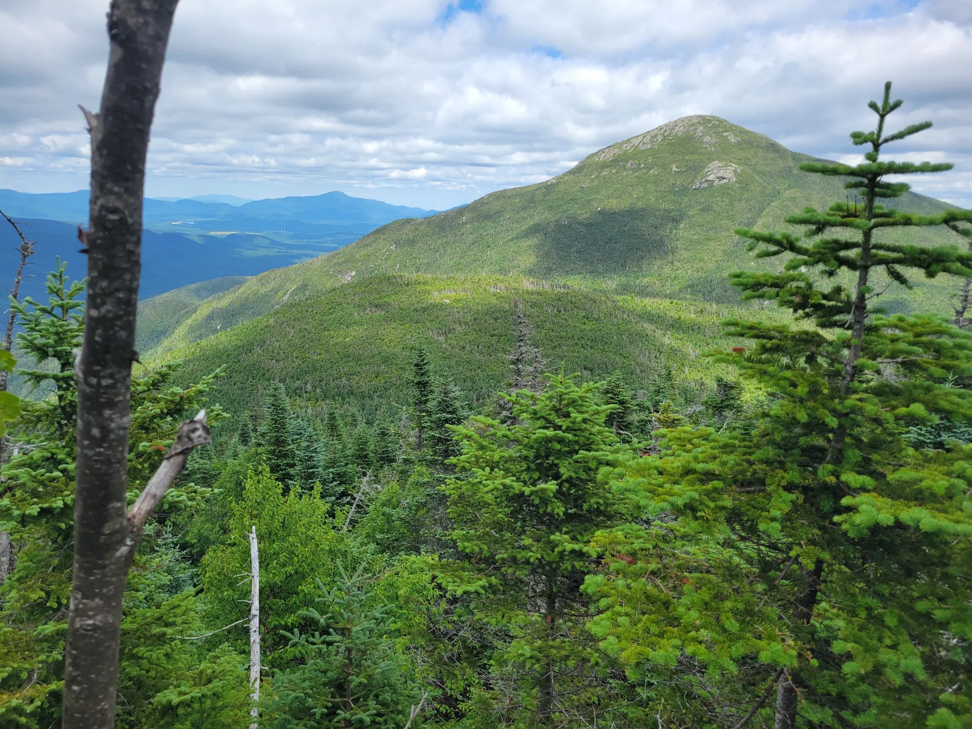
From the Loj follow the trail to Marcy Dam. From Marcy Dam you will need to follow the trail to Avalanche Pass. You will pass by Avalanche Camps, and the mile or so past Avalanche Camps is where you begin to climb. Passing by a couple newer slides on the side of Mount Colden you make your way through the pass and descend to Avalanche Lake. The hike past the lake is demanding, especially with full packs. You will contend with boulders, ladders and a very windy trail, but the views along this section of trail are stunning. Once on the opposite side of Avalanche Lake you will descend and then go right at the junction at the register and hike the west side of Lake Colden to the dam at its outlet. Don’t cross the dam, but rather stay above it and continue toward Flowed Lands. Roughly 0.25 miles past the dam is Herbert Brook and the herd-path on your right marked with a cairn. The route is now much narrower and follows along the brook to your left. The terrain starts out moderate with a couple steep ascent sections. Once the herd-path leaves the brook, the terrain steepens. There is one excellent viewing area along the summit ridge before you reach the treed summit to your left.
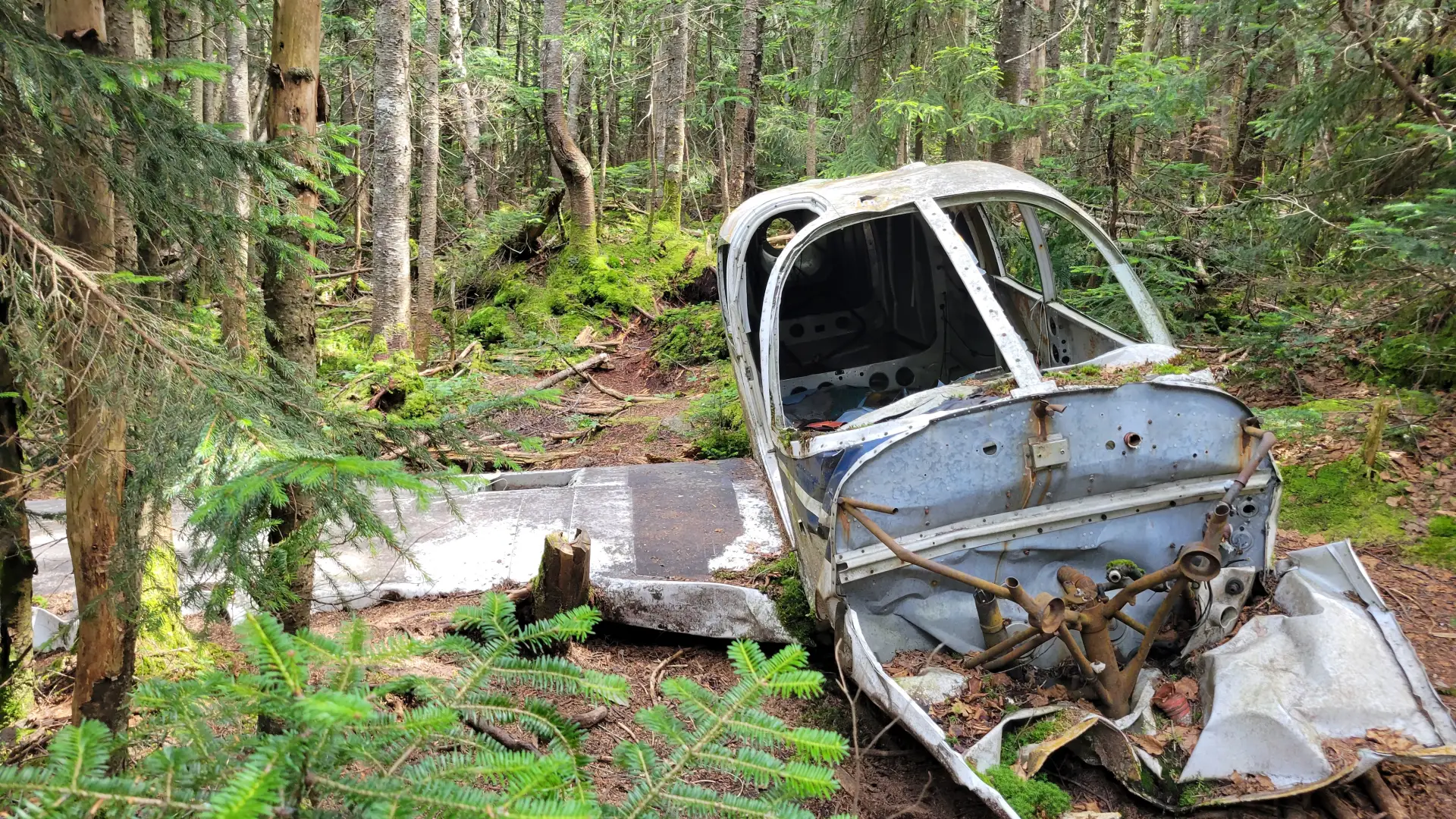
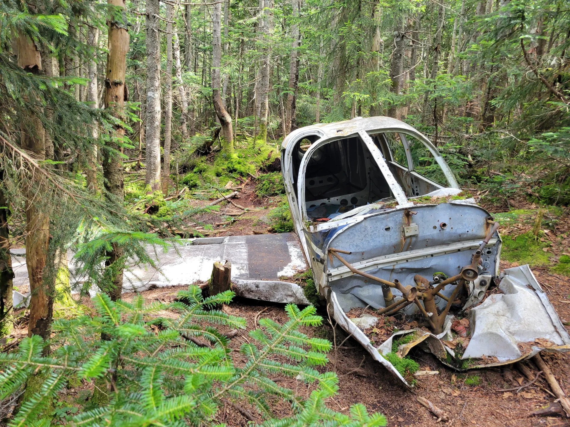
*Another way to reach Mount Marshall from the Adirondack Loj is via Cold Brook Pass.If you are interested in taking this route, particularly to view the historic plane wreckage, do your research and consult with the experienced staff at the High Peaks Information Center.
Marshall in the winter
Mount Marshall is a challenging mountain that should only be attempted by experienced hikers, especially in winter, so make sure you are prepared. Snowshoes are necessary, and snow spikes are needed to climb the upper reaches of the peak and around the icy sections by the brook. Plan on temperatures in the higher elevations being at least 20 degrees colder than at the trailhead, not including the windchill. Bring several extra non-cotton layers, a headlamp with spare batteries, extra food, a windbreaker, goggles, a face mask, and supplies for spending the night in case of an emergency. You will cross Herbert Brook several times. These crossings can be especially dangerous during the beginning and end of winter. Always use caution at water crossings. Turning around is always an option.
Find your perfect trail near Lake Placid
Does Mount Marshall sound amazing, but a little more than you want to tackle right now? No need to stress, with over 2000 miles of hiking trails in the Adirondacks we are sure we can find the perfect hike for you.
How to get there
Leave Lake Placid on Route 73 and follow toward Keene. Continue for about 3 miles to Adirondack Loj Road on the right. Follow Adirondack Loj Road to its end at Heart Lake. A parking fee is required.
Emergency Information
Related Content

Ready to hike in the High Peaks? There is no set way for how to become a 46er, but there is a R.I.G.H.T. way.