
- Out and Back
- Out and Back
- Out and Back


About
Warning: A slide on the southeast side of Mount Colden into Feldspar/Lake Arnold trail has blocked the trail. There is a necessary, short bushwhack around debris to continue on trail. Do not plan on taking this route as a loop hike for Marcy, Gray, and Skylight until further updates.
Hiking New York’s highest peak
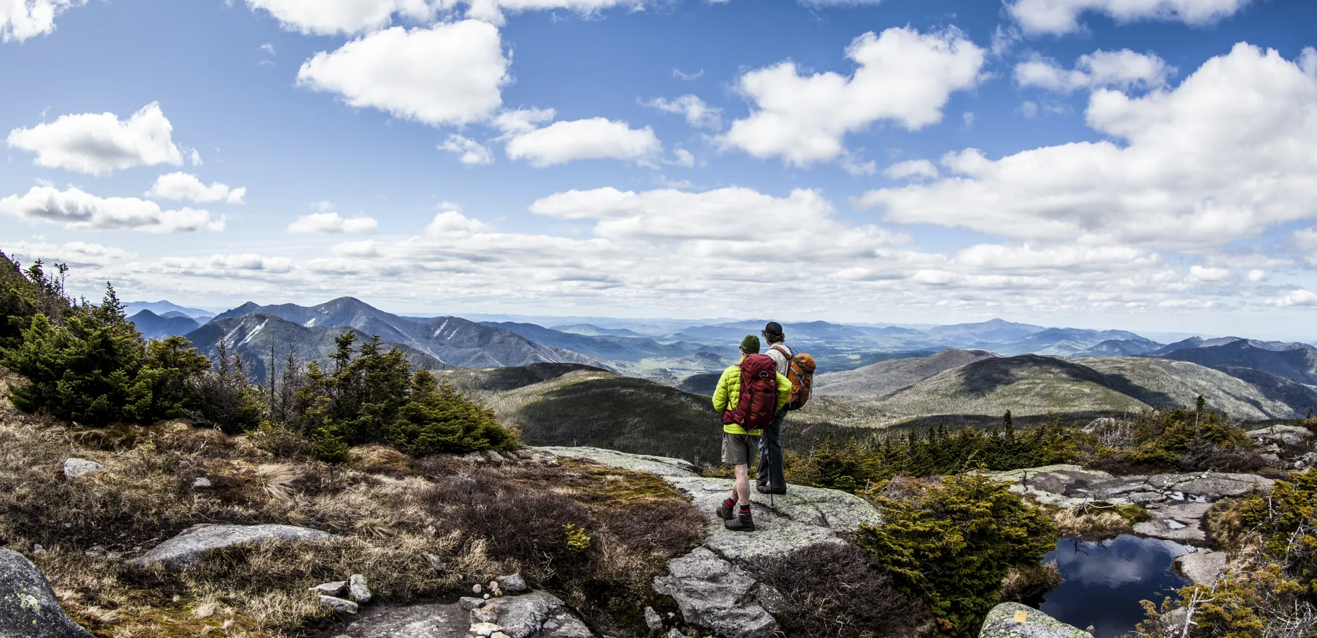
Mount Marcy is the tallest of the Adirondack High Peaks. It is a steep, serious hike that requires significant preparation. A successful hike of Mount Marcy involves research, physical fitness, the right gear, and knowledge of Leave No Trace principles.
Key takeaways
- Elevation: 5,344 feet
- Elevation gain to summit: 3,166 feet
- Distance: 7.4 miles, one way, to the summit (14.8 round trip)
- Hike includes water crossings, steep rock slab, and trail junctions
- Based on the Van Hoevenberg trail
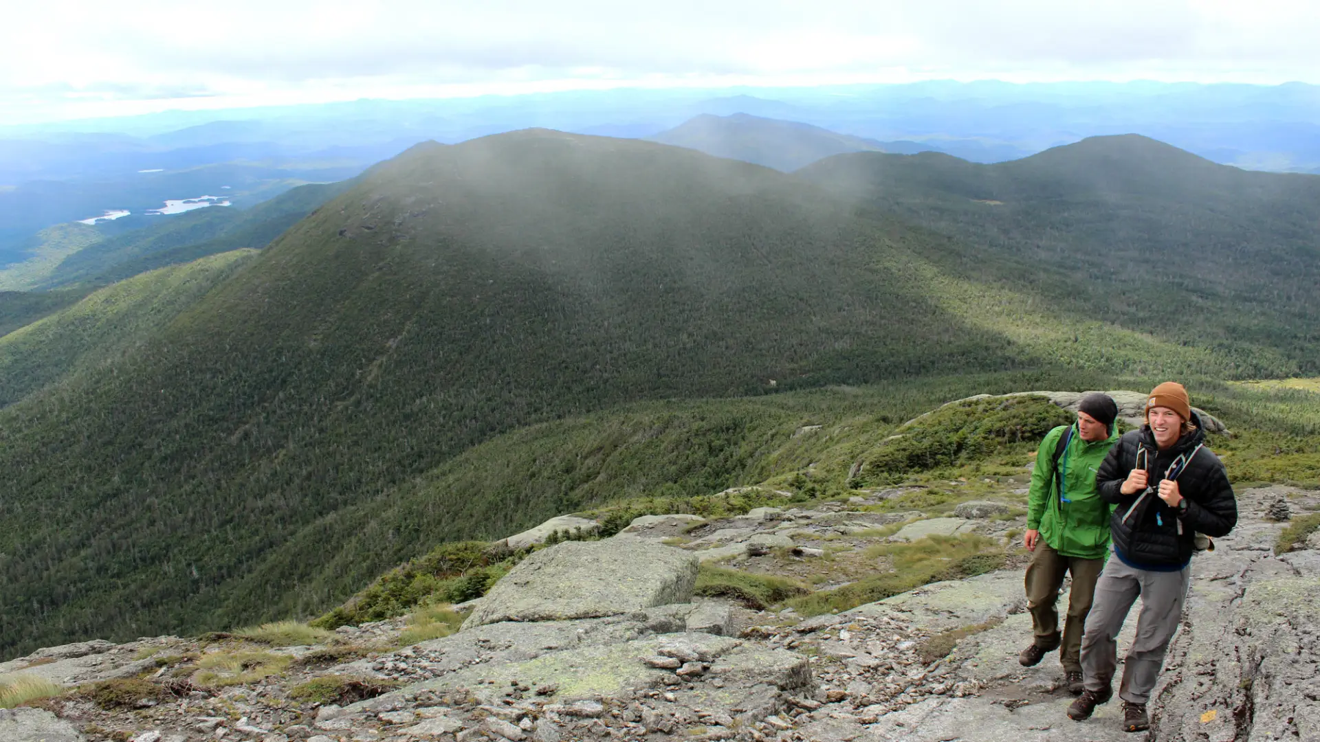
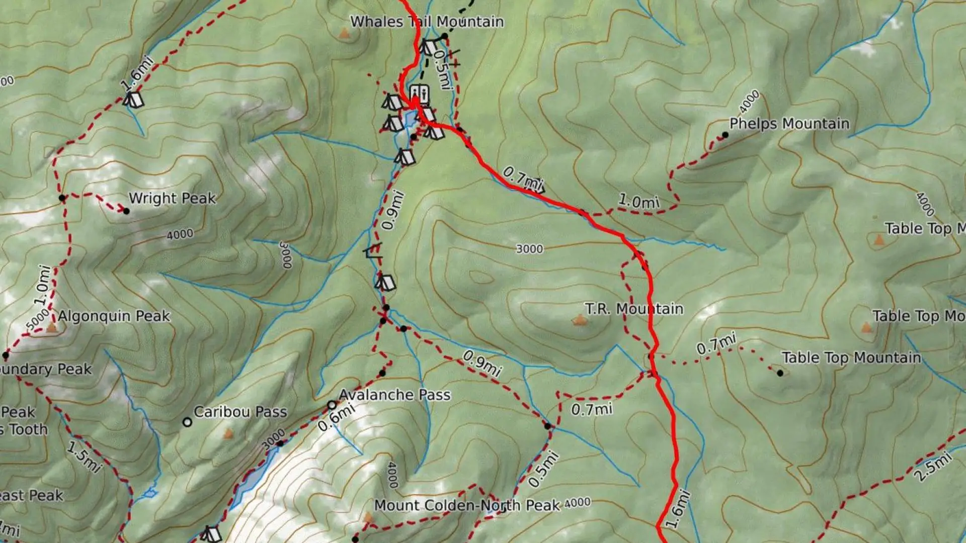
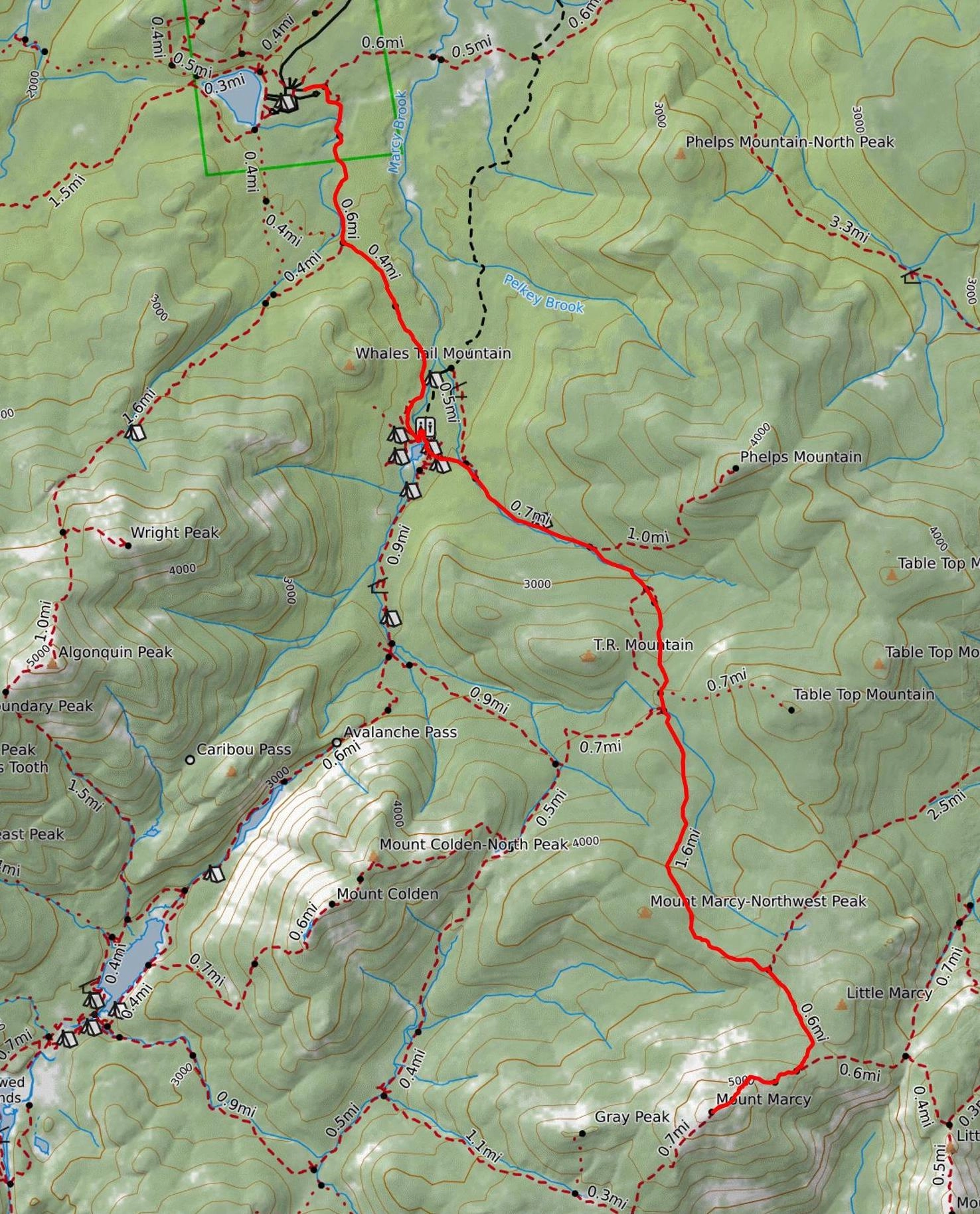
Hiking the Van Hoevenberg trail to Marcy
There are multiple trails to Mount Marcy's summit. The route from the High Peak Information Center, the Van Hoevenberg Trail, is the most popular. At 7.4 miles one way, it is the most direct route. Additional trails up Mount Marcy begin at The Garden in Keene Valley, Elk Lake in North Hudson, and Upper Works in Newcomb. We recommend you pick up a map and guidebook for more in-depth details on this and any other approaches to this peak.
This is a 14.8-mile round trip hike with moderate and steep trail sections. Starting at the High Peak Information Center, the first 2.3 miles of the Van Hoevenberg Trail traverse rolling hills as it approaches the former site of Marcy Dam.
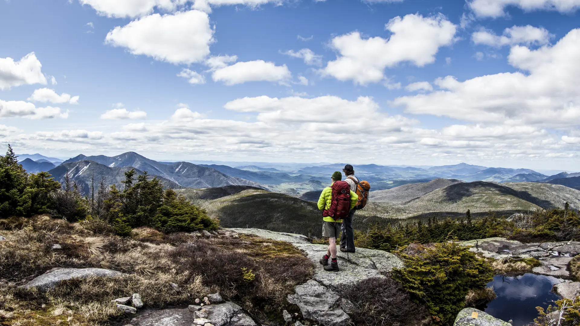
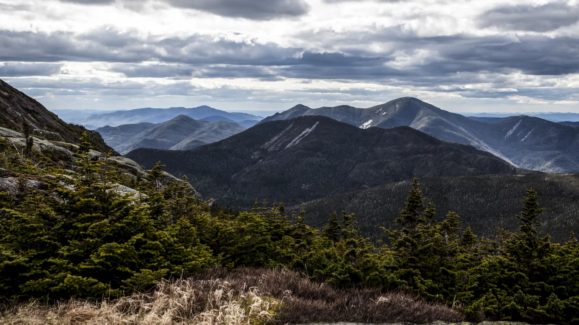
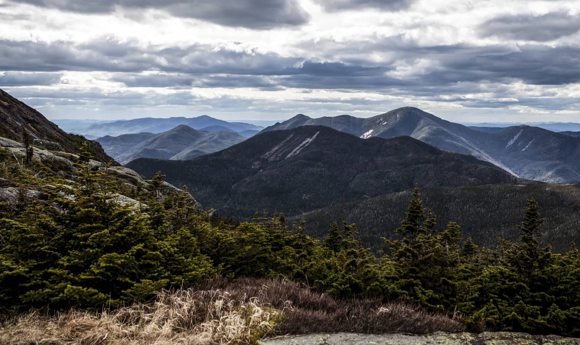
Turn left after the remnants of the dam to follow alongside Phelps Brook on a rocky section of trail that becomes steep at times, especially before it reaches Marcy Brook at 4.4 miles. An unmarked path to the right will detour hikers to the top of Indian Falls. The Van Hoevenberg Trail continues straight across Marcy Brook. There are amazing views to be had during the rest of the route, but be aware that temperature, wind, and visibility can change quickly and with little warning on the upper portions of any mountain.
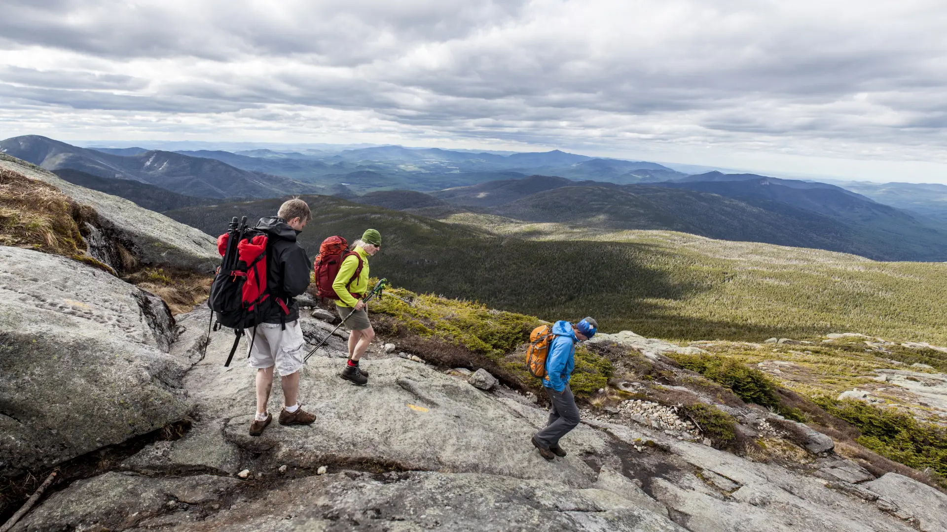
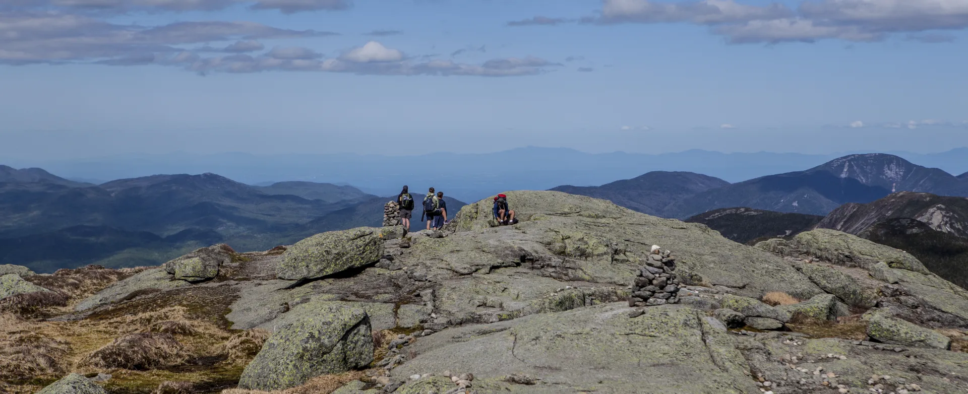
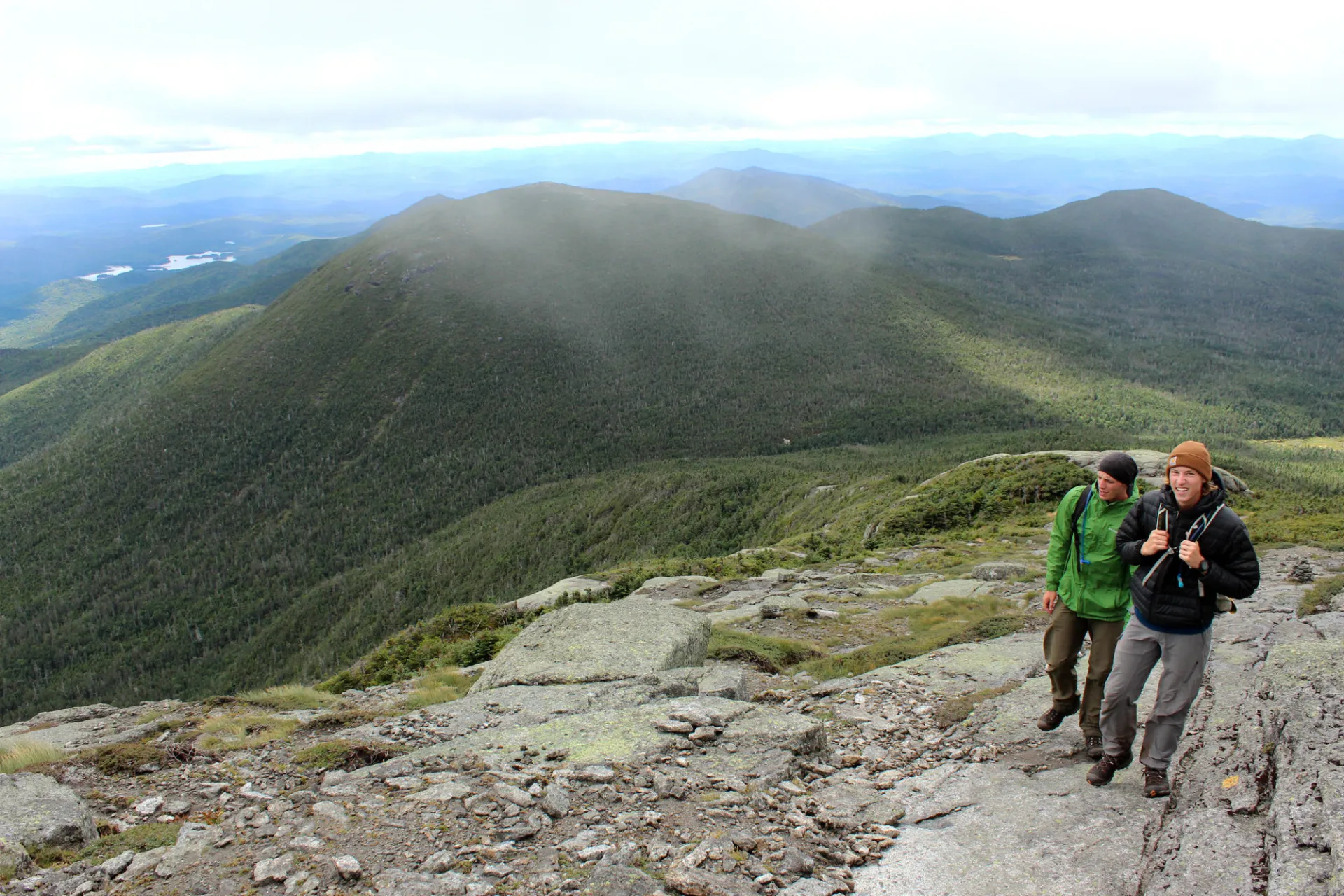
Things ease off for a bit, and several views of Marcy's summit cone reveal themselves before the timberline is reached at 6.8 miles. From here it's a steep climb over the open rock to the top, which is reached at 7.4 miles.
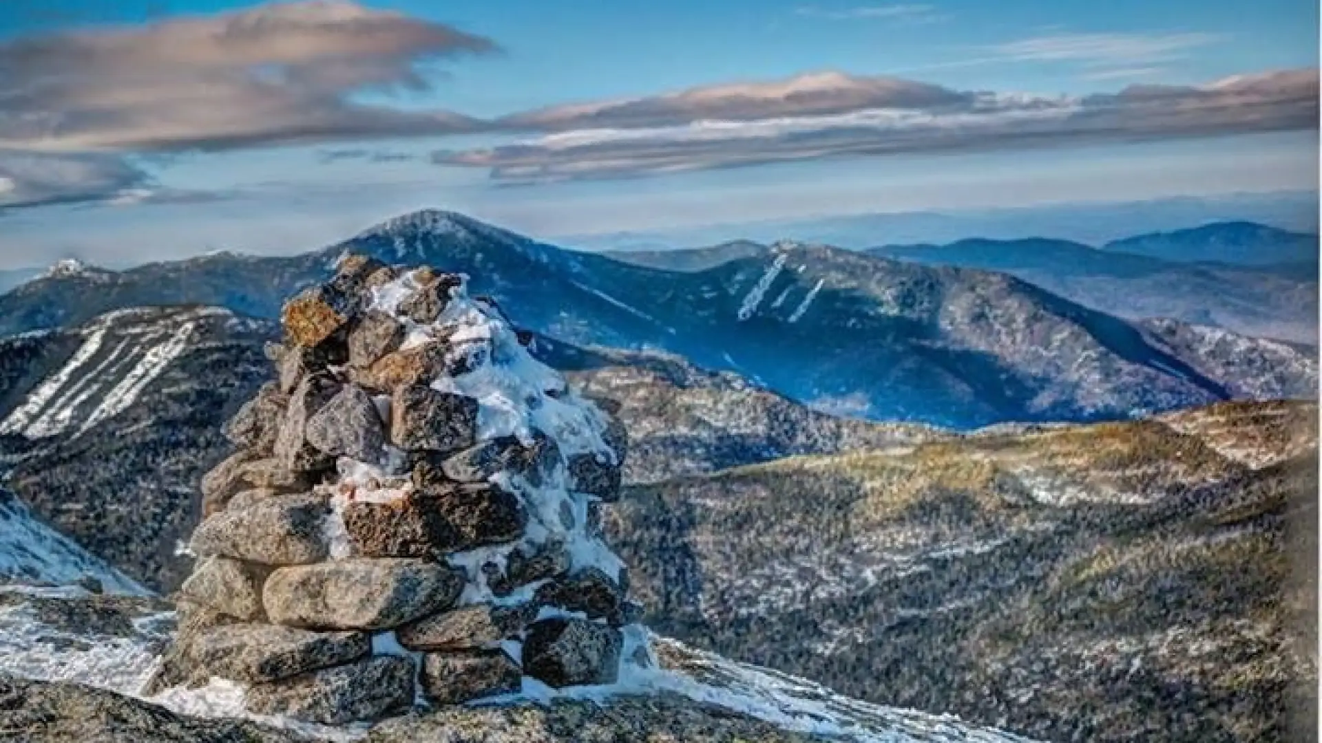
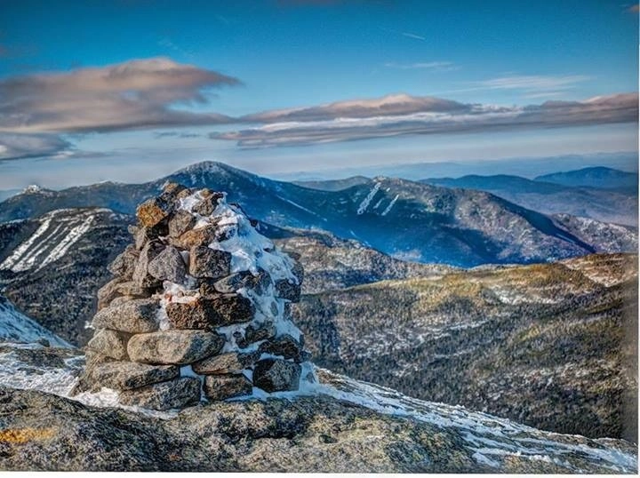
The summit of Mount Marcy is home to New York state’s rarest ecosystem, the alpine zone, and hikers should follow yellow blazes and cairns above treeline, and avoid trampling vegetation by doing the “rock walk”.
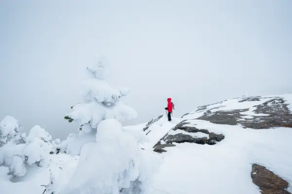
Mount Marcy in winter
Mount Marcy is a challenging mountain that should only be attempted by experienced hikers, especially in winter, so make sure you are prepared. Snowshoes are necessary, and snow spikes or crampons are needed to climb the exposed upper reaches of the peak. Plan on temperatures in the higher elevations being at least 20 degrees colder than at the trailhead, not including the windchill. Bring several extra non-cotton layers, a headlamp with spare batteries, extra food, a windbreaker, goggles, a face mask, and supplies for spending the night in case of an emergency. Marcy has two main water crossings at Phelps and Marcy Brooks. These crossings can be especially dangerous during the beginning and end of winter. Always use caution at water crossings. Turning around is always an option.
Find your perfect trail near Lake Placid
Does Mount Marcy sound amazing, but a little more than you want to tackle right now? No need to stress, with over 2000 miles of hiking trails in the Adirondacks we are sure we can find the perfect hike for you.
How to get there
The Van Hoevenberg Trail up Mount Marcy leaves from the Adirondack Mountain Club's High Peaks Information Center parking lot, near the Adirondack Loj. There is a parking fee to use this large lot. Leave Lake Placid on Route 73, turn right on Adirondack Loj Road, and follow it to its end. Pay the fee at the booth, even if no one is inside.
*NOTE: Though not the described route on this page, if you are choosing to hike Mt. Marcy as part of the Great Range Traverse from AMR (St Huberts), this hike will require a parking reservation from May 1 - October 31. Please plan accordingly. Visit www.HikeAMR.org for more information and to reserve your parking spot.*
Emergency Information
Related Content

Ready to hike in the High Peaks? There is no set way for how to become a 46er, but there is a R.I.G.H.T. way.

Lake Placid, NY is home to short hikes, moderate hikes, and longer hikes, making us the perfect hiking destination for any hiker! Read these hiking safety and etiquette tips that will keep you safe and happy on the trails this summer!
Written by the NYS Department of Environmental Conservation ---- Hiking in the winter can be fun and rewarding. Snow, ice, and cold temperatures can also make it more challenging. To ensure a safe and enjoyable hike, be prepared both for the...