Round Trip
2.4 miles
3.9 kilometers

Elevation
The height of the summit or destination, from sea level.
2460 feet
749.8 meters

Elevation Gain
The total amount of vertical ascent (uphill climbing) on a hike. This is cumulative gain, totalling the elevation change of the uphill segments from a round-trip hike.
280 feet
85.3 meters

Route Type
A hiking trail may be classified as a Loop, Out and Back, Point to Point, Bushwhack, or Multi-day Thru Hike, with some destinations having more than one of these ways as a hiking option.
  • Out and Back
Round Trip
2.4 miles
3.9 kilometers

Route Type
A hiking trail may be classified as a Loop, Out and Back, Point to Point, Bushwhack, or Multi-day Thru Hike, with some destinations having more than one of these ways as a hiking option
  • Out and Back
Elevation
The height of the summit or destination, from sea level.
2460 feet
749.8 meters

Elevation Gain
The total amount of vertical ascent (uphill climbing) on a hike. This is cumulative gain, totalling the elevation change of the uphill segments from a round-trip hike.
280 feet
85.3 meters

Round Trip
2.4 miles
3.9 kilometers

Route Type
A hiking trail may be classified as a Loop, Out and Back, Point to Point, Bushwhack, or Multi-day Thru Hike, with some destinations having more than one of these ways as a hiking option
  • Out and Back
Elevation
Lorem ipsum dolor sit amet consectetur. Phasellus cursus malesuada tincidunt placerat non maecenas. Viverra morbi aliquam neque id nibh lorem massa quam non.
2460 feet
749.8 meters

Elevation Gain
The total amount of vertical ascent (uphill climbing) on a hike. This is cumulative gain, totalling the elevation change of the uphill segments from a round-trip hike.
2460 feet
85.3 meters

The top of Cobble Lookout
View all photos
trail highlights
trail features
trail category

About

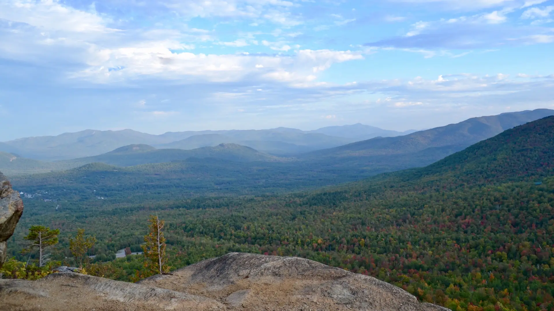
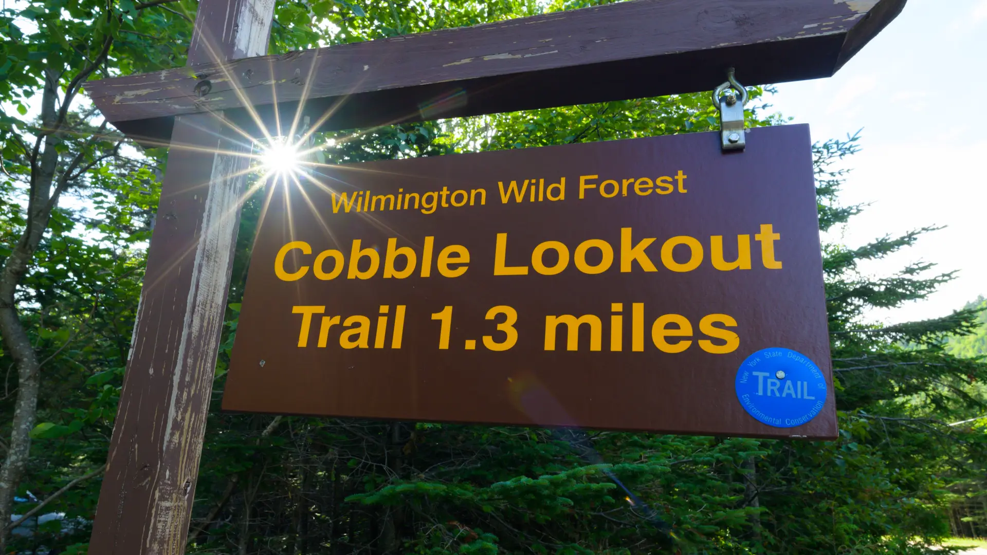
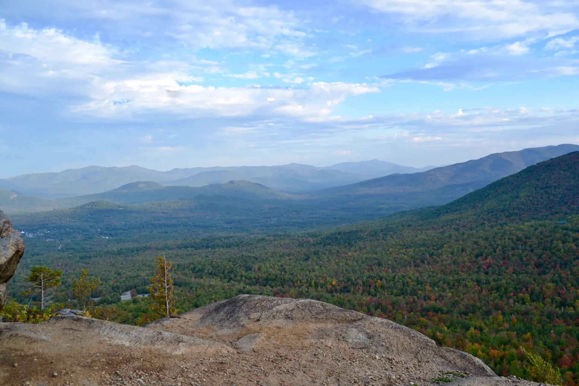
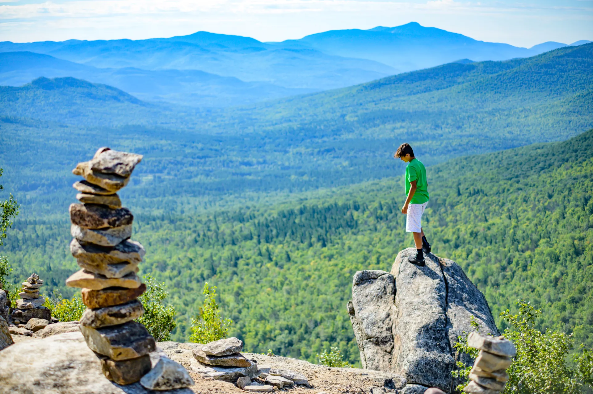
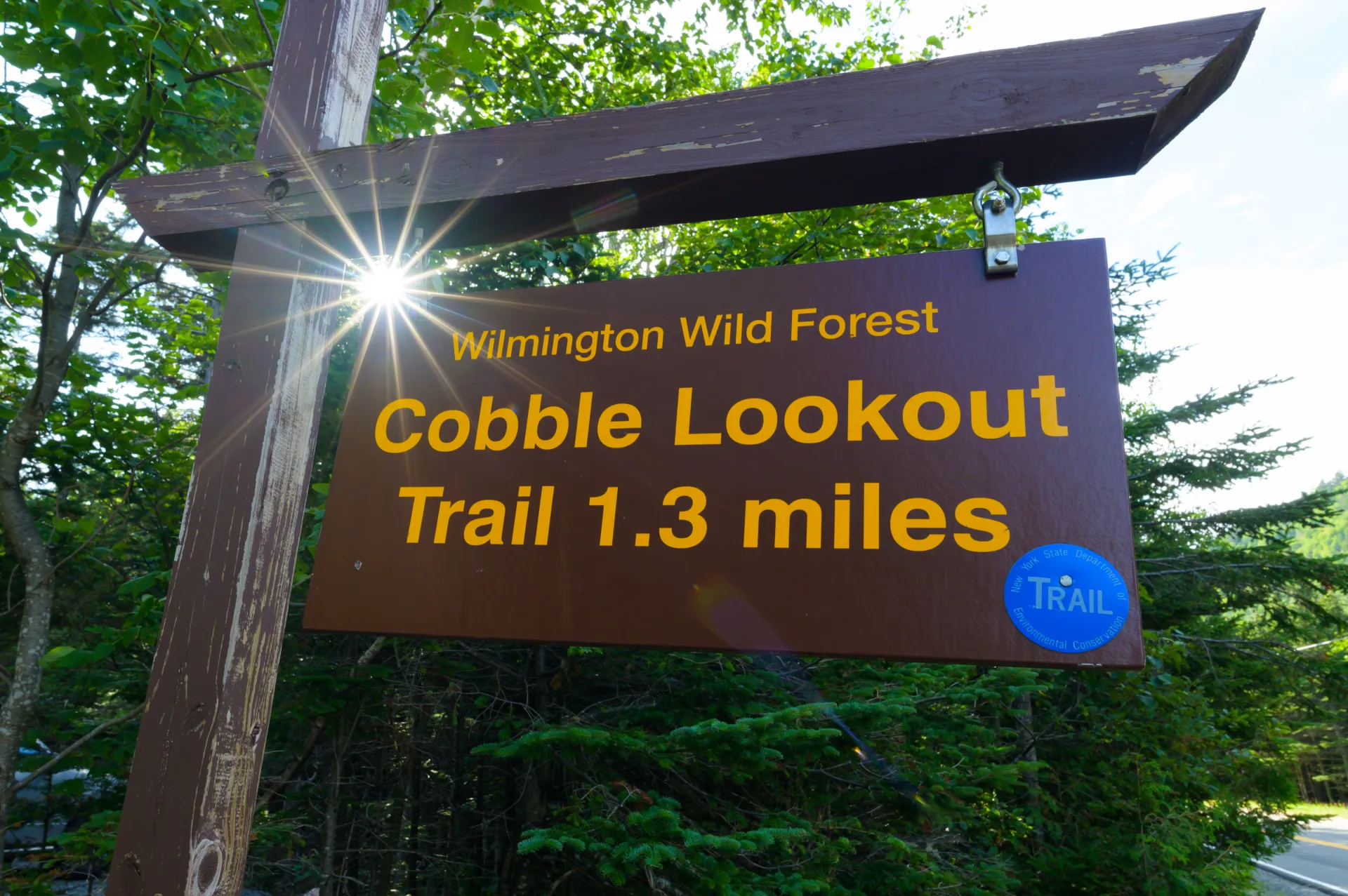
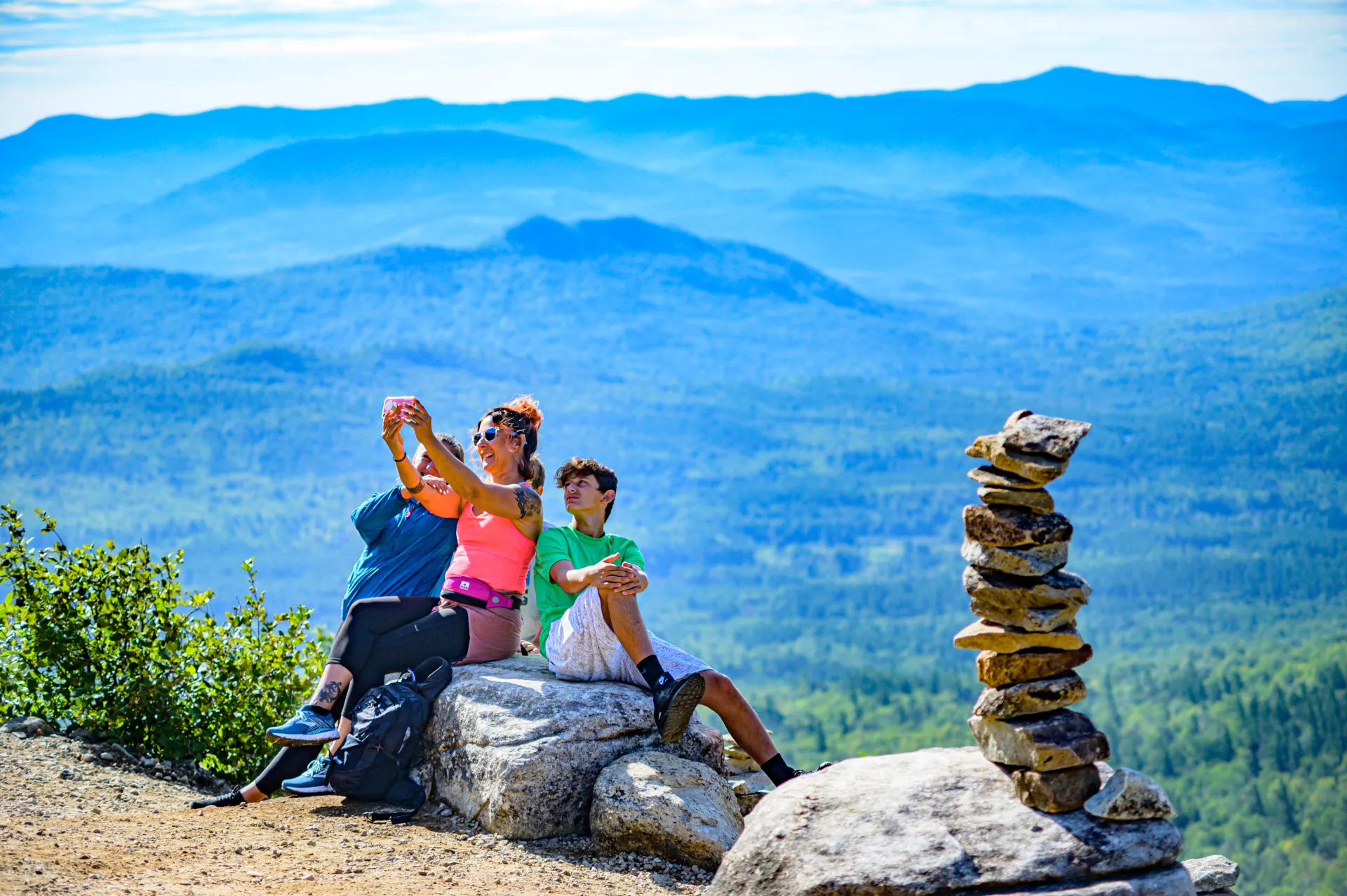
Constructed in the fall of 2014, this trail has become very popular because short hike to a spectacular view of the Ausable Valley and the surrounding mountains. The start is marked by a sign at the highway and with blue markers on the trail itself. Hikers should learn about Leave No Trace principles before hiking any trail in the Adirondacks.

Key takeaways

  • Distance: 2.4 miles round trip
  • Elevation gain: 280 feet

Hiking to Cobble Lookout

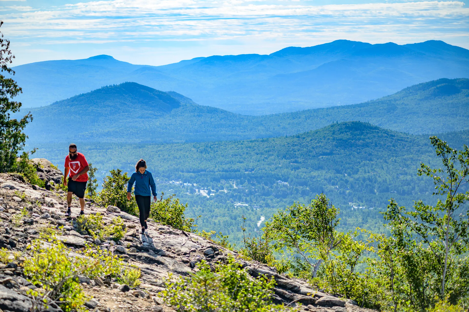
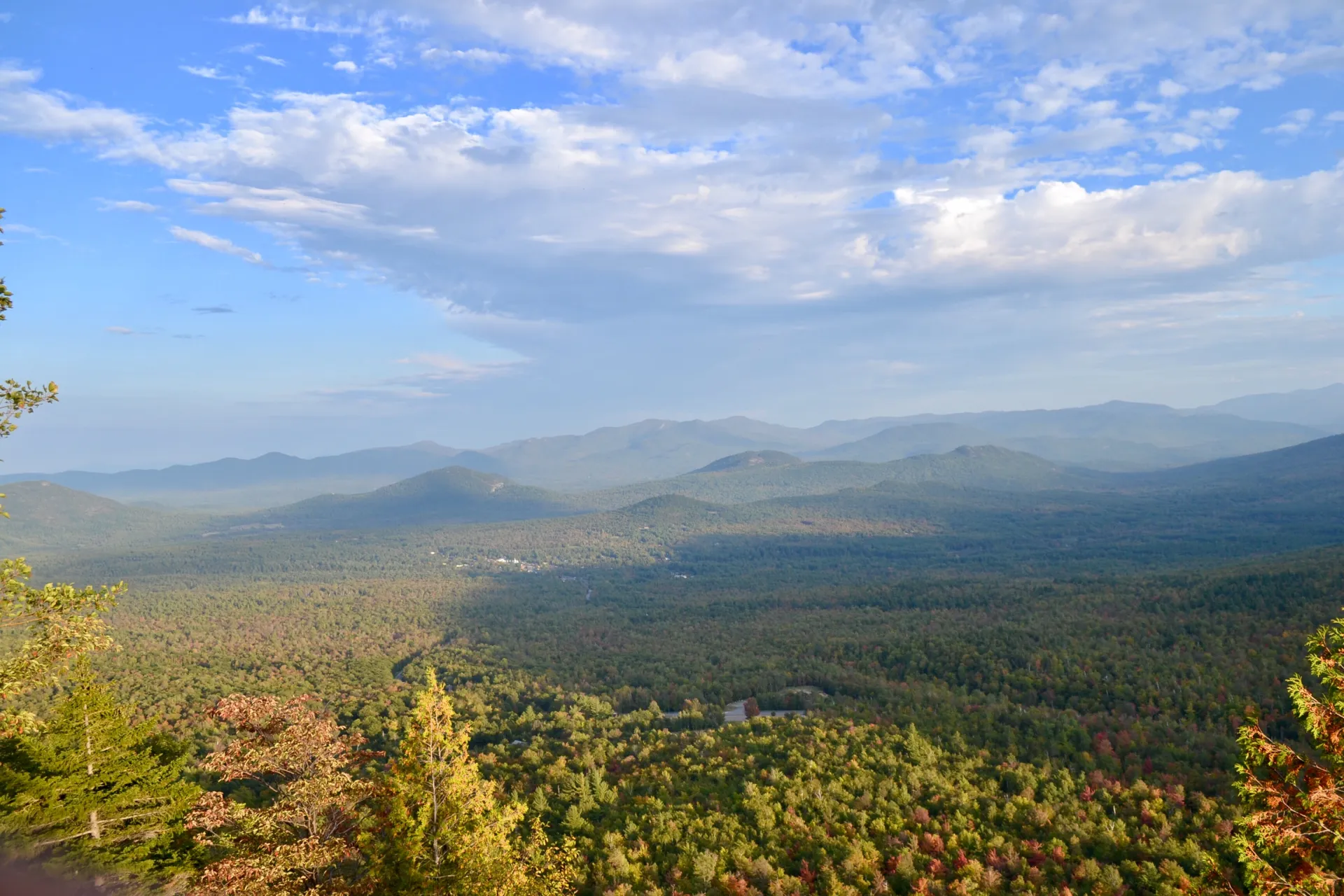
From the trailhead, an old road leads up gradually to an old quarry. Past the quarry, the trail is flat for a few yards before turning up and left and climbing in stages to a broad shelf at 0.4 mile from the trailhead. From here, the trail is mostly flat or gently rolling, with some muddy sections at times, to the ledge at 1.2 miles from the trailhead. Santa's Workshop is directly below the ledge with Wilmington further below. The great bulk of Whiteface and Esther mountains are to the right, with Giant Mountain and other High Peaks straight ahead.  

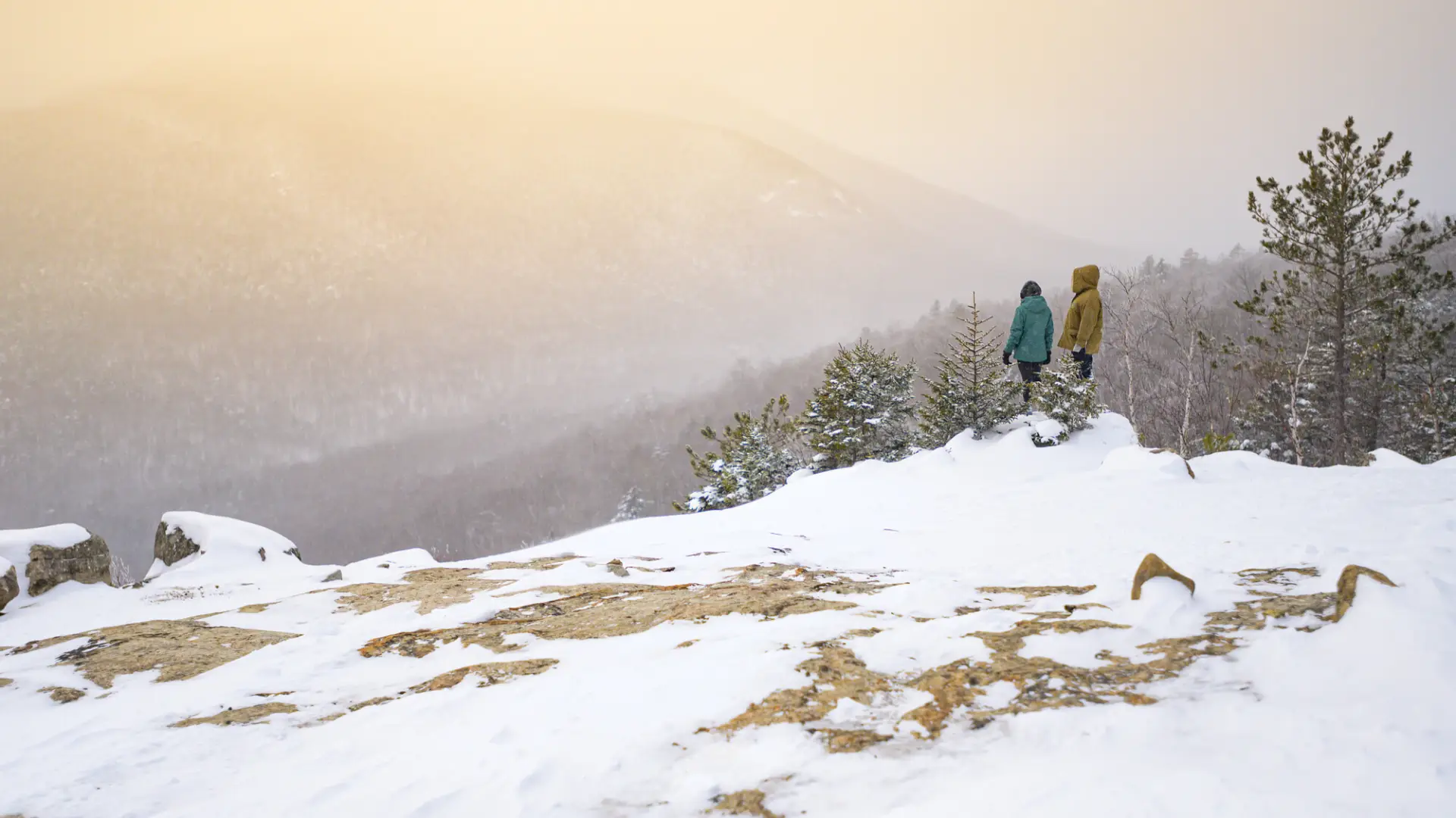
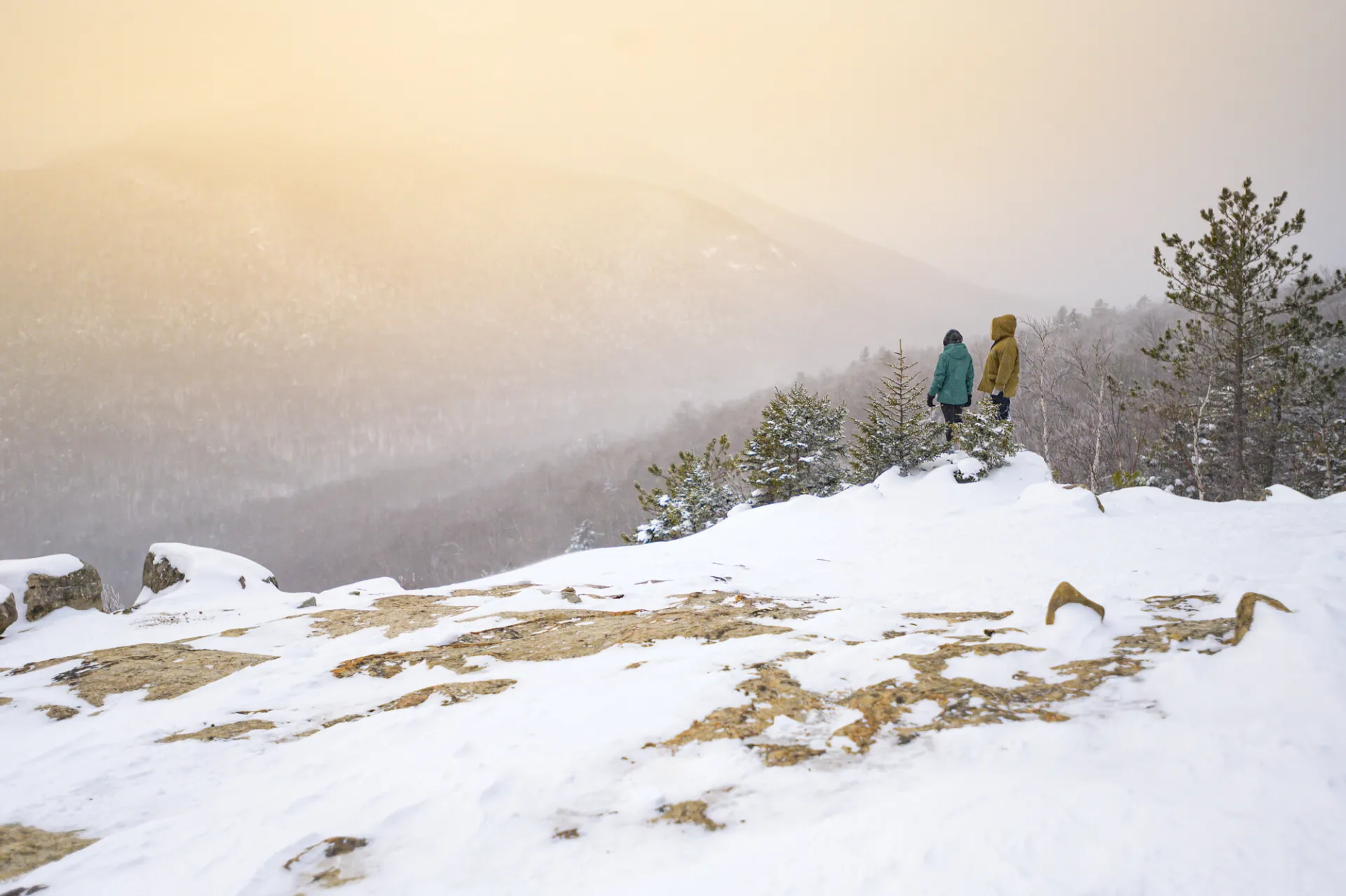
Cobble Lookout in the winter

This gentle snowshoe is perfect for the entire family and beginner snowshoes. Being prepared is necessary for any winter hike.

Get close to more trails in the Whiteface Region

Looking for another incredible trail in the Whiteface Region? With everything from High Peaks to backcountry ponds, there are more hikes waiting for you!

How to get there

From the four corners in Wilmington, take Route 431 for 3 miles. At the three-way intersection with the Whiteface Memorial Highway, bear right on Gillespie Drive (county Route 18A on some maps). Continue for 0.3 mile to the trailhead and parking area on the right, just past Lake Stevens.

Emergency Information
If you get lost or injured, remain calm and stay put. If you have cell service, call 911 or the DEC Forest Ranger Dispatch, 833-NYS-RANGERS (833-697-7264).
 
Plan ahead and hike smart. Bring a map, extra food, water, and warm clothing, and check the weather before you go. Stay aware of your surroundings and landmarks. If you get turned around, don’t panic—stop, think, and stay where you are. Let someone know your route and expected return time.
Additional Info
Cobble Lookout Trail map