- Loop
- Loop
- Loop


The Nun-Da-Ga-O Ridge (also called the Soda Range) is a classic hike over a ridge with continual overlooks, including Weston Mountain. While the trail is a bit obscure in areas, this offers some of the best primitive hiking in the region. The approach, which is not as obscure, also provides access to Lost Pond on the way to Weston Mountain. A successful hike of the Soda Range involves research, physical fitness, the right gear, navigational skills, and knowledge of Leave No Trace principles.
Key takeaways
- Distance: 7 miles round trip
- Elevation: Weston Mountain - 3,182 feet
- Elevation gain: 1,800 feet
- Hike includes trail junctions and unmarked trail
- Based on a counter-clockwise loop
Hiking the Nun-Da-Ga-O Ridge
The start crosses a small footbridge before hiking along a very soft and well developed trail. This trail is mostly flat to the Hurricane Mountain Trail on the right at 1.1 mile. A nice lean-to is located in this area, as well as a couple designated primitive tent sites.
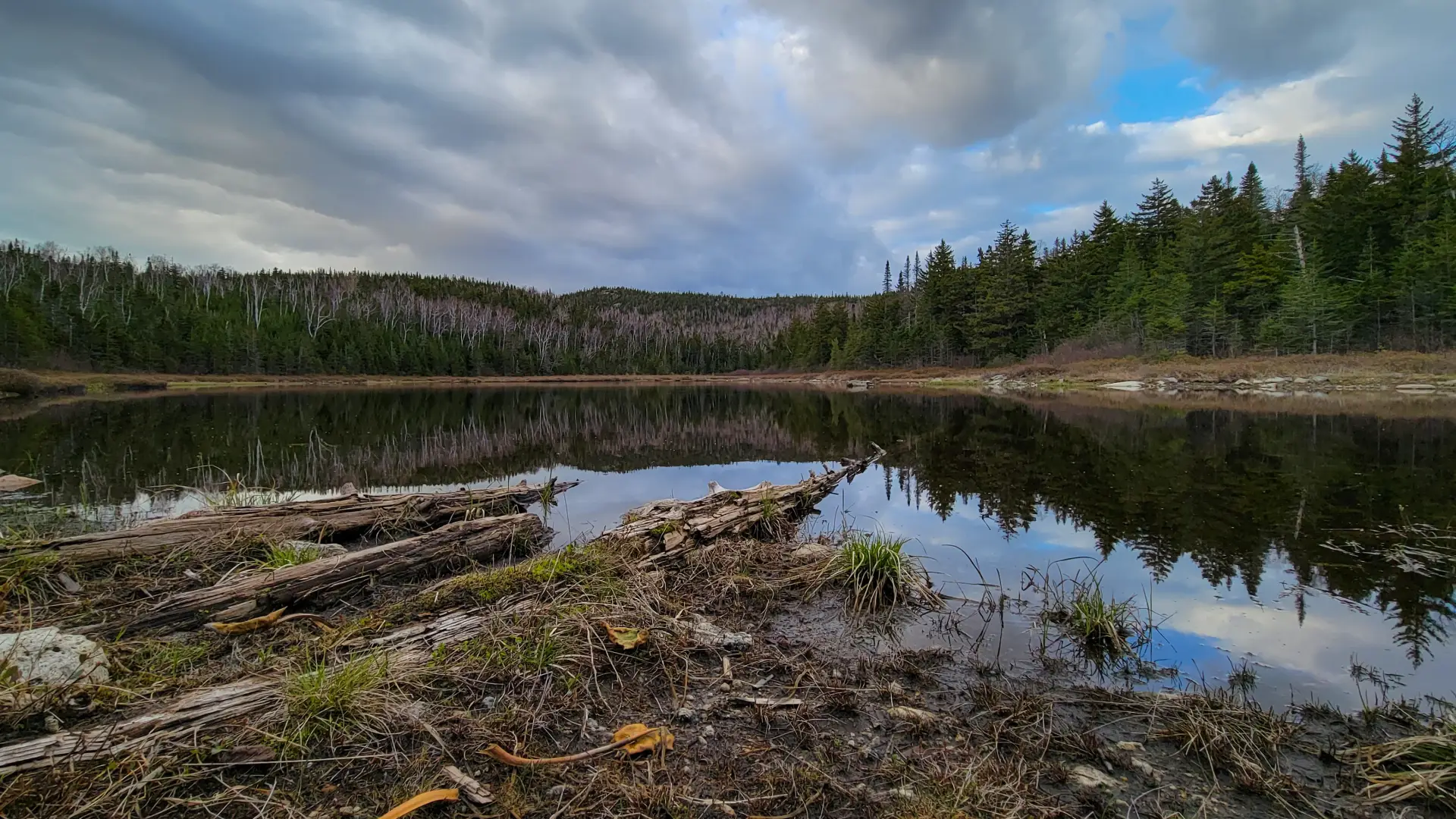
Past this point you will continue flat for a bit before starting a steady climb that passes through a mixed forest. Once the trail moderates again you will move through the area and drop slightly to the south side of Lost Pond at 1.8 mi. where there is an excellent viewing area, just off the trail to the right. The trail continues along the west side of the pond over slightly difficult terrain before reaching the north side at the Biesemeyer Memorial lean-to. The pond is a bit difficult to reach on this side, but paths are developing out through the vegetation. A well-developed path continues past the lean-to to Weston Mountain and Nun-Da-Ga-O Ridge.
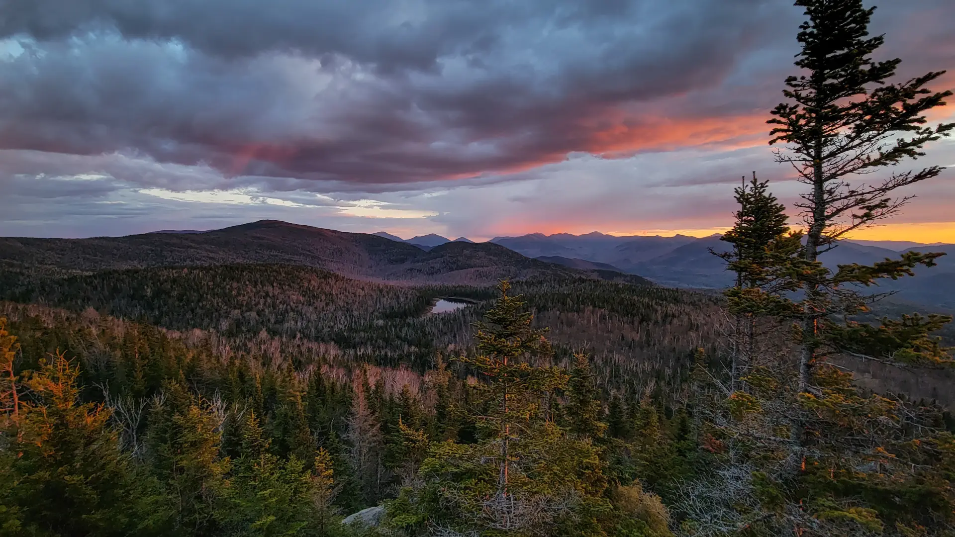
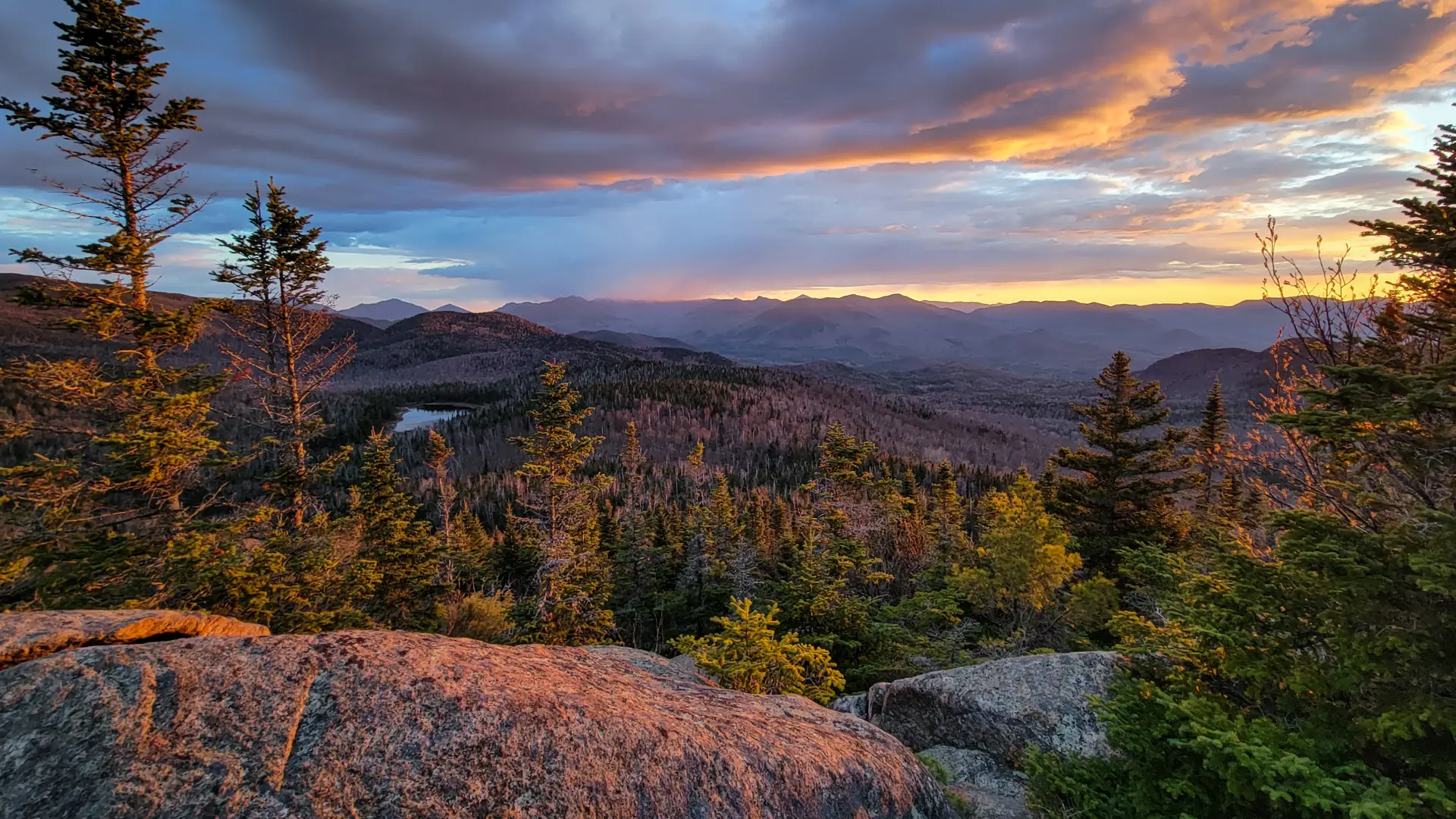
From here follow this path and hike moderately over a narrow trail to a very steep shoot to the upper ridge. Past the steep shoot you will continue to climb slightly as you top out on the summit of Weston Mountain at 2.5 miles, the high point of the ridge. This rocky summit sits looking out over Lost Pond with outstanding views of the entire area including Hurricane Mountain, the Giant Mountain Wilderness Area, and the High Peaks Region.
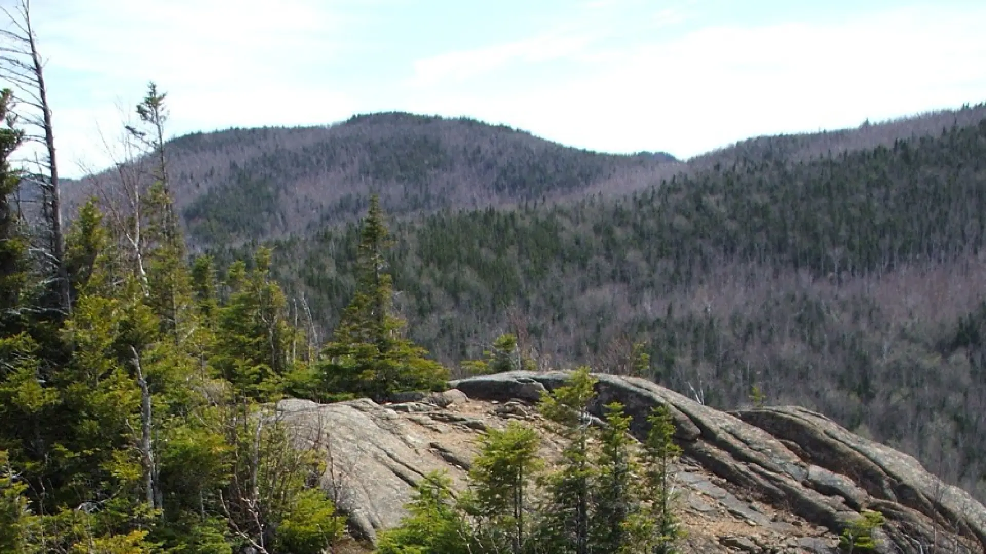
From here, the next few miles bring you over several viewing areas and numerous small bumps along the way. Some steep terrain is intermixed with loose stone and sand footing; other sections are open rock and forested trails. Care is sometimes needed to find the continuation of the trail after some of the many open areas.
After over 3 miles of up and down on the ridge, you will be at the Big Crow Trail. Big Crow Mountain is a few hundred yards to your right up a steep section of trail. Left will lead you back to the Crow Clearing Trailhead. From here you will descend steeply to the valley below. The descent can be slippery. The loop will exit you on the opposite side of the parking lot from which you started.
The Nun-Da-Ga-O Ridge in the winter
The Nun-Da-Ga-O Ridge (Soda Range) is a challenging trip that should only be attempted by experienced hikers, especially in winter, so make sure you are prepared. Snowshoes are necessary, and microspikes are needed to climb the exposed and steep sections. Plan on temperatures in the higher elevations being colder than at the trailhead, not including the windchill. Bring several extra non-cotton layers, a headlamp with spare batteries, extra food, a windbreaker, goggles, a face mask, and supplies for spending the night in case of an emergency. Expect the ridge to either not be broken out, or have large drifts in the open areas.
Find your perfect trail near Keene
Does the Ridge sound amazing, but a little more than you want to tackle right now? No need to stress, with over 2000 miles of hiking trails in the Adirondacks we are sure we can find the perfect hike for you.
How to get there
From the intersection of Route 73 and Route 86 in Lake Placid follow Route 73 toward Keene. Continue down the Keene hill into the Town of Keene. Look for Hurricane Road on the left as you come into town just after the intersection with Route 9N. Follow this road to O’Toole Road, which will be on the left at a very sharp left right. Follow this dirt road to the end at Crow Clearing. This is also the trailhead for The Crows and Hurricane Mountain.