- Out and Back
- Out and Back
- Out and Back


Hiking New York's 45th tallest mountain
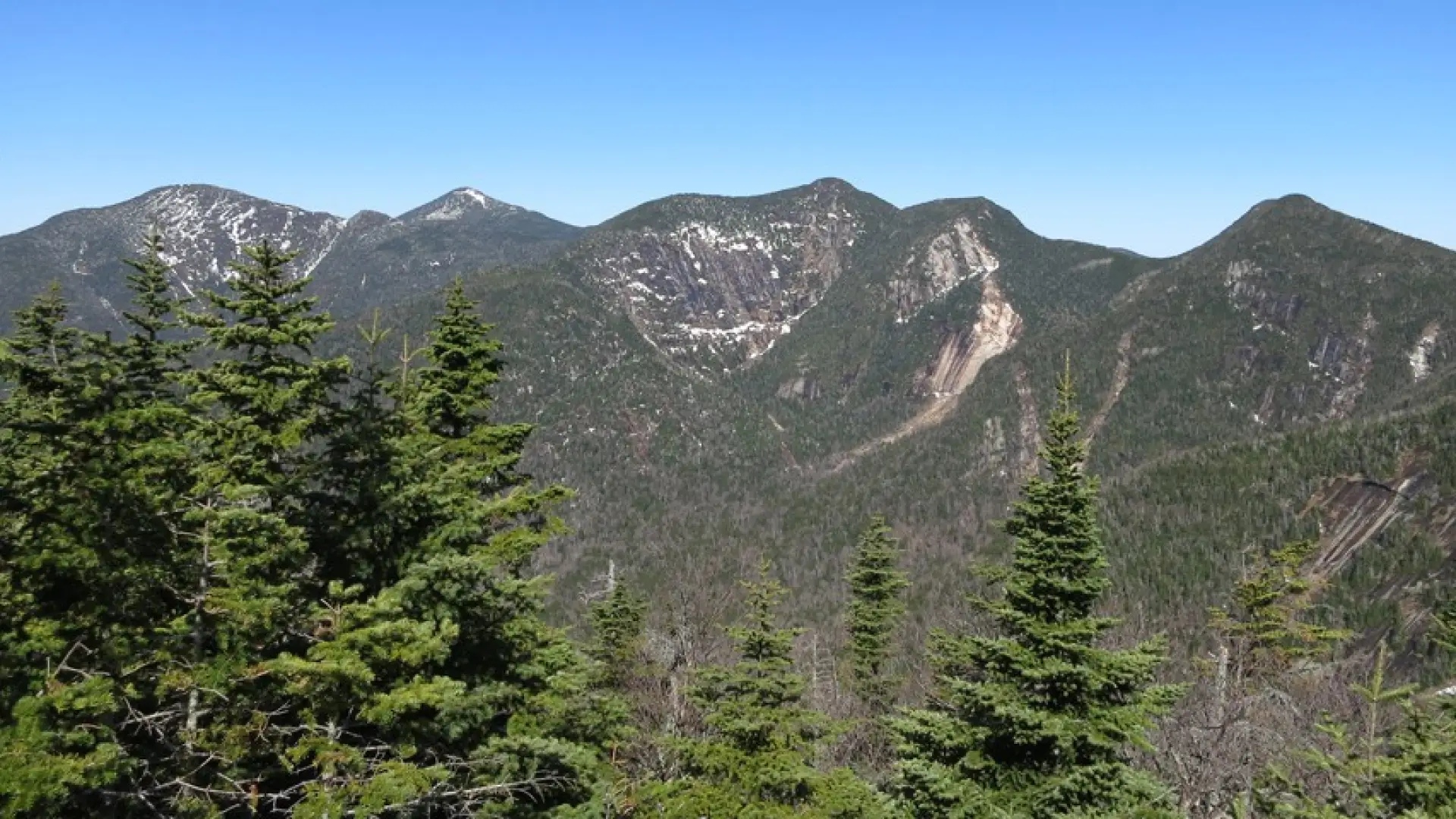
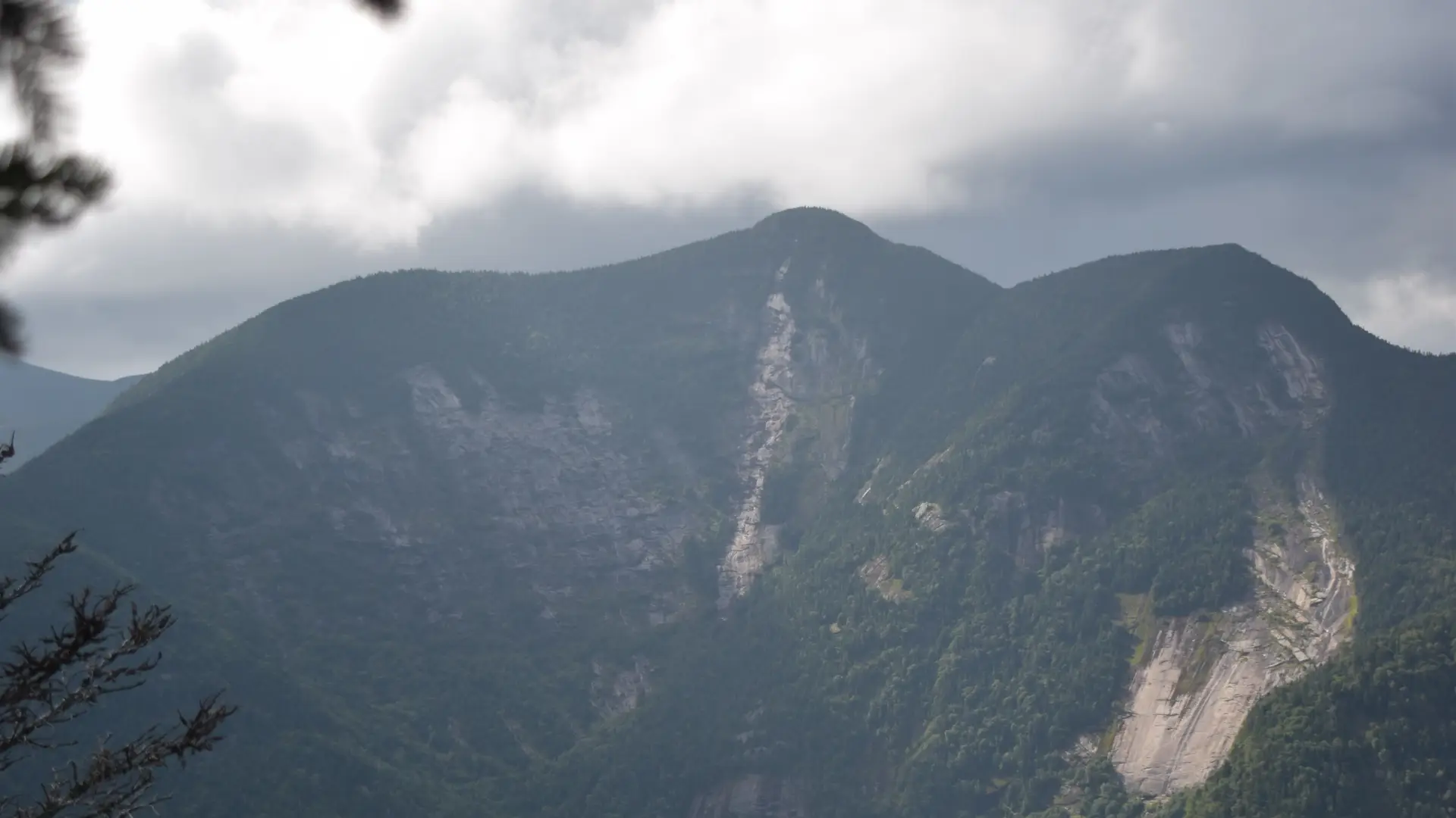
Sawteeth Mountain is the 35th tallest of the Adirondack 46 High Peaks. It is a steep, serious hike that requires significant preparation. A successful hike of Sawteeth involves research, physical fitness, the right gear, and knowledge of Leave No Trace principles. Be aware that there are no dogs allowed on AMR property.
SPECIAL INFORMATION
This hike is accessed through a conservation easement with the Adirondack Mountain Reserve (AMR). A parking reservation is needed from May 1 - October 31. Although it is called a “parking reservation,” everyone will need a reservation to access hikes leaving from AMR, whether you drove yourself, rode a bike, got dropped-off, or walked. These reservations can be made online via the AMR website. For more information, please read these FAQs or contact the New York State Department of Environmental Conservation.
Key takeaways
- Distance: 12 miles round trip
- Elevation: 4,100 feet
- Elevation gain: 3,100 feet
- Hike includes trail junctions, steep rock slab, bridges, and a road walk
- Based on an out-and-back hike via the Weld Trail
Hiking Sawteeth Mountain
Sawteeth can be ascended via multiple trails, such as from Gothics, Warden's Camp, or the Scenic Trail. The route described is an out-and-back hike up Sawteeth from the AMR via the Weld Trail. If you are interested in the other routes mentioned, consult with local information centers and guides, and do your research.
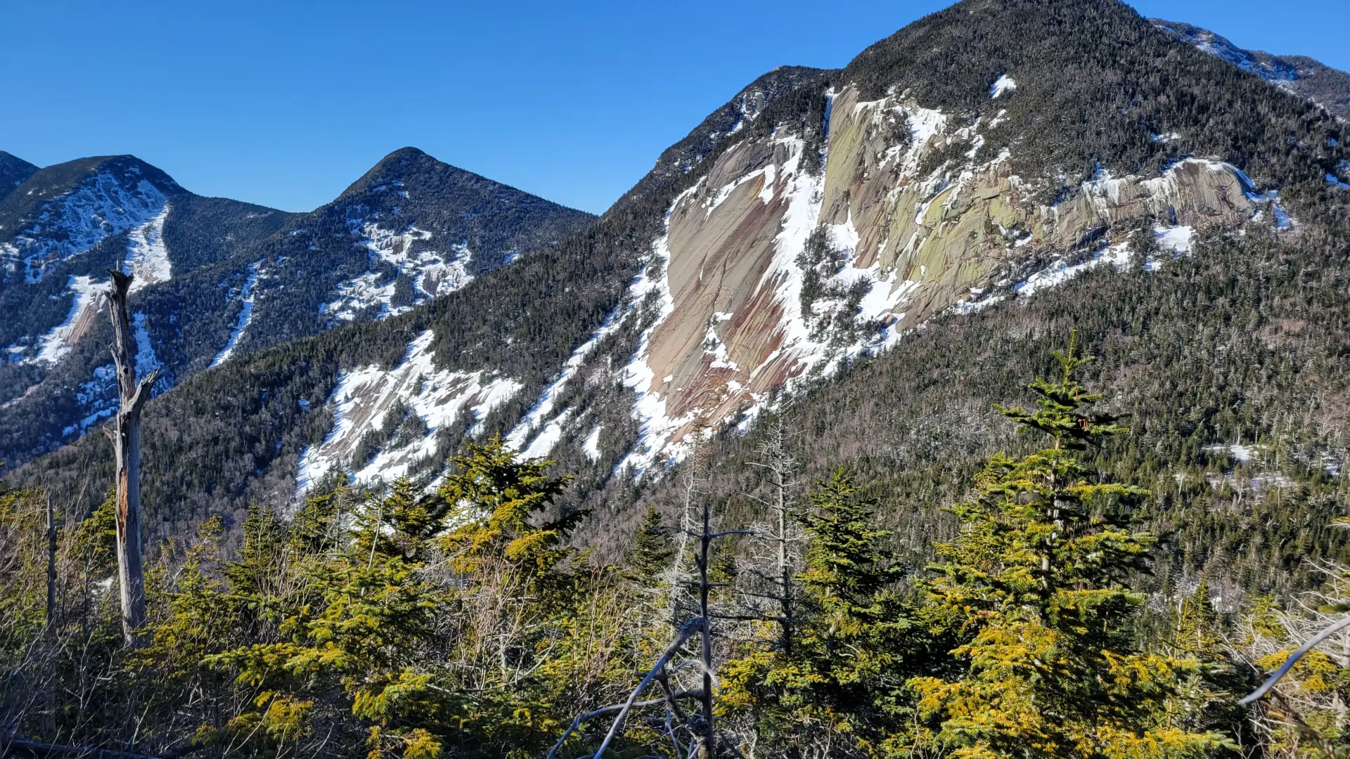
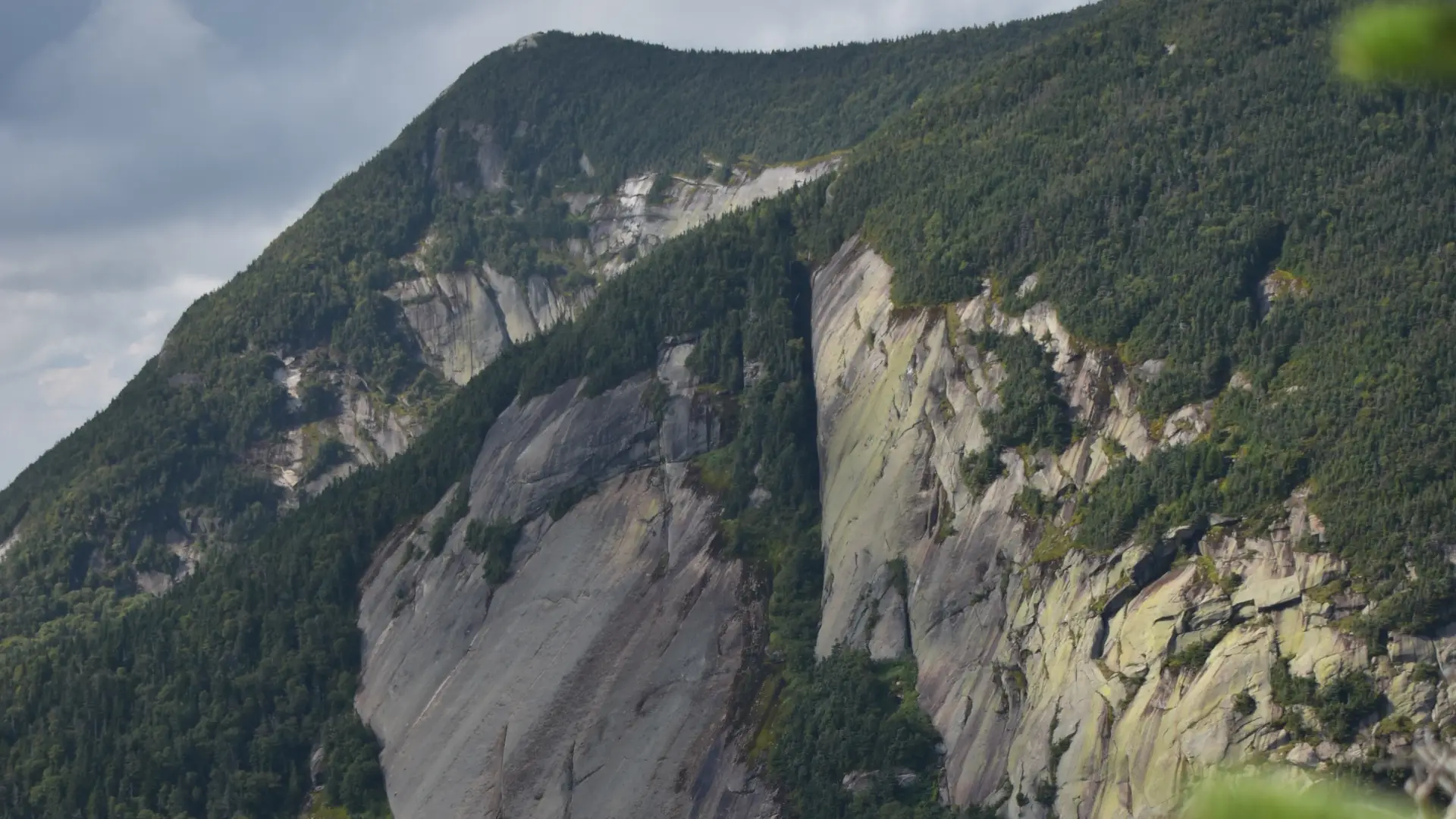
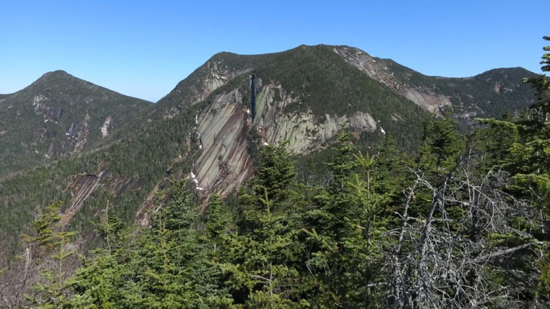
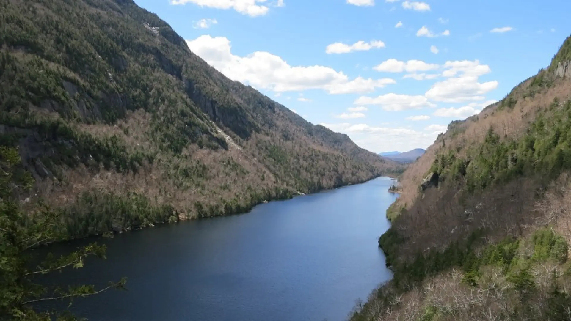
From the parking lot, you will initially have to follow a dirt road to a paved road next to a golf course. At 0.5 miles from the parking area, go left and down between two tennis courts on Lake Road Way to get to the gate into the AMR. The AMR is a private property area with recreational easements, special rules apply to use and those are posted at the gate. After the gate, you will need to hike the dirt access road for a bit over 3.0 miles to Lower Ausable Lake. This dirt road is referred to as Lake Road. The road climbs steadily to the dam. At the dam, cross the bridge below the dam and follow the signs for Gothics and Sawteeth. Just past the dam you will come to an intersection with the Scenic Trail going left. Most hikers making a loop choose to ascend via the shorter trail. Just beyond the Scenic Trail junction, a short side trail to Rainbow Falls goes to the right and is a worthwhile side trip. Continuing past this junction, start a steady moderate to steep climb. This hike will bring you past the top of Rainbow Falls and a green sign stating "Don't be a dropout". You will continue for 1.6 miles of moderate to steep climbing to the intersection with the trail right to Pyramid Peak and Gothics. Take a left here and continue for 0.5 miles up a steep grade on eroded footing to the summit of Sawteeth, where there is a viewpoint looking out towards the Great Range.
Sawteeth in the winter
Sawteeth is a challenging mountain that should only be attempted by experienced hikers, especially in winter, so make sure you are prepared. Snowshoes are necessary, and snow spikes or crampons are needed to climb the exposed upper reaches of the peak. Plan on temperatures in the higher elevations being at least 20 degrees colder than at the trailhead, not including the windchill. Bring several extra non-cotton layers, a headlamp with spare batteries, extra food, a windbreaker, goggles, a face mask, and supplies for spending the night in case of an emergency. Turning around is always an option.
Find your perfect trail near Keene Valley
Does Sawteeth sound amazing, but a little more than you want to tackle right now? No need to stress, with over 2000 miles of hiking trails in the Adirondacks we are sure we can find the perfect hike for you.
How to get there
This is part of the St Huberts parking area/trailhead. Leave Lake Placid on Route 73, follow Route 73 toward Keene. Continue through Keene and Keene Valley and into Saint Huberts. Continue to the trailhead for the AMR on the right, directly across the road for the Roaring Brook Falls Trail to Giant Mountain. This is approximately 3.0 miles from the outskirts of Keene Valley. This approach is on land owned by the Adirondack Mountain Reserve (AMR) over which there are foot trail easements.
Emergency Information
Additional Info
Map
Related Content

Ready to hike in the High Peaks? There is no set way for how to become a 46er, but there is a R.I.G.H.T. way.