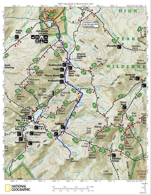
Mount Redfield is a very popular peak for me as a mountain guide and of course Cliff Mountain being its neighbor, its par for the course that it is also on the punch list for the day. Typically the issue at hand is, once many are done with Redfield, Cliff becomes much less important. Redfield alone from the Adirondack Loj is 16.4 miles, round trip. To include Cliff you add on over 2-miles of hiking making this an 18+ mile day.
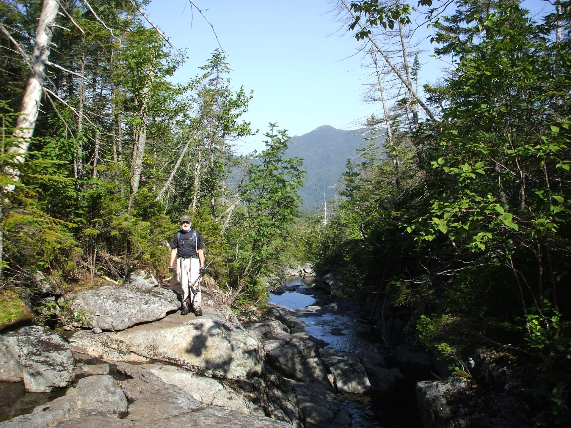
Setting off on a, not so bright, 5am start with Cliff and Redfield on the order form, we had high hopes of getting them both before the day was out. The sky was light enough that headlamps were not necessary so we started off with no delay and with a kick to our step as well. We managed to move along quite quickly to Marcy Dam in under 50-minutes and then over the rock jumbles to Avalanche Camps in another 20 or so. I must say for a man in his mid-sixties, he can move along pretty well, I hope I am that limber when I am in my 60’s.
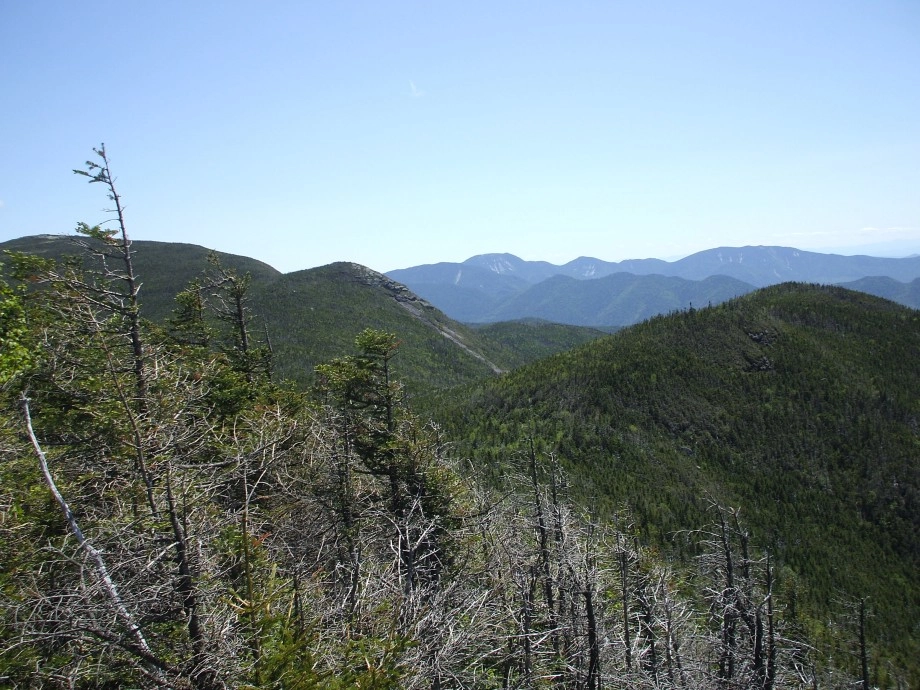
From this point on though I wanted him to know that the trail begins to climb considerably and the rock situation becomes more apparent and defined, over 1300’ in the next 1.75 miles – to be a bit more exact. We had made excellent time up to this point so we opted to drop the pace so as to not bun out in route to Lake Arnold, which can easily be done. We battled our way through the boulders that seem to be getting more jumbled by the year, but maybe that’s just my brain getting muddled. With no real issues we got to Lake Arnold, we took a bit of extra time here, looking over the map, eating some stale granola bars and sipping on some good ice cold water, like a fine wine.
It seems as though Lake Arnold, being such a major intersection would be the top of the pass, but it’s not, it never is, but looking on the map, it can be deceiving. There is another 100’ of elevation gain past the pond to the top of the pass. Then, oh then, you have to lose so much elevation to reach Feldspar – over 500’ to round down. The descent is not only dramatic in size by lengthy in distance. Once in the Feldspar we had to pick our way through the tall wet grass and then over the slippery boardwalks and log stringers to proceed through the wetland.
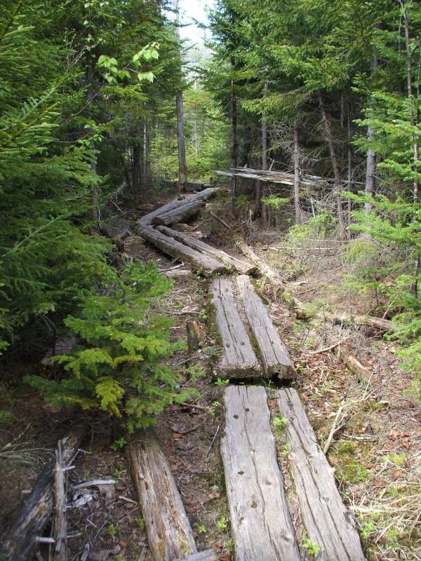
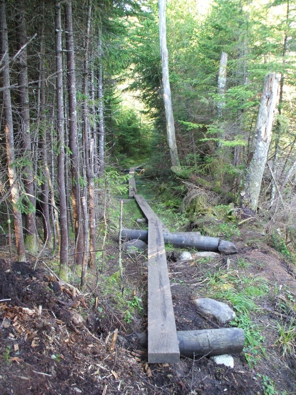
Most of the wetland isn’t too bad, but a couple of the log stringers are floating and when they get stepped on, they sink, just a bit, but enough to make you hesitate a bit. There is one crossing in particular that will make you clench up a bit and that’s the single log bridge over the main water flow. Yes a single log bridge of about 8-inches wide with no hand rail and a water depth of about 5-feet or so surrounding it, so I have been told by the unsuccessful. That’s not all. To get on this one log bridge you must walk across a submerged boardwalk, step over another log, back onto the submerged boardwalk and onto the one log bridge, which sinks as you put weight on it. Then if you make it across without falling in there is the exit. I had to reposition the exit log onto its flat side while balancing on this one so the exit wouldn’t roll under my feet. All while I was blindfolded, the spectacle of everything! Once we were both dry on the other side we could concentrate on the rest of the day.
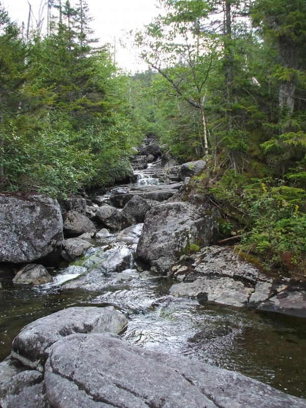
From here we made excellent time past Feldspar Lean-to and then over the continuous muck and mire to the Uphill Lean-to at the location of the herd-path for Cliff and Redfield. We moved along the initial portion of the herd-path with ease, passing by the spur to Cliff Mountain that we were hoping to use a little later. The pace was slowing a bit at this point, but we were only 4-hours deep into this adventure. The steep terrain brought us to a much slower advance than we had planned on and by the time we reached the summit it was time for an extended break. This was #43 for my client and the steep, rough terrain was starting to show on his face. While he still wanted the summit of Cliff, we still had to observe the time and the request to be back at the car by 7pm, at the latest, for the drive home to Albany. Doing the math, it would be close and that would be with optimal conditions and no impediments in our steps. In a perfect setting with no hiccups or delays we would be back at the car at 7pm after doing Cliff. We knew the chances of having the perfect climb on Cliff to be small and with sore legs the pace would be slowing down even more as we approached the cliffs along the herd-path. So, to make this story shorter we opted to bail on Cliff and save it for another day and maybe approach it from Upper Works.
Once we had decided this it was all about getting out to the car and taking off our cement hiking boots. The only thing that slowed us down was that single log bridge and the 500+ foot climb back to the pass toward Lake Arnold. After that the boulders didn’t seem to be much of an issue and we pushed out even faster than we went in. 45-minutes for the final 2.1 miles from Marcy Dam to the Adirondack Loj, not bad for the end of a 16+ mile day.
Interested in being guided up Redfield and Cliff or any of the other High Peaks, seek out information through a local guide service. Need a place to rest your head or get a well-deserved bite to eat, Lake Placid is the home of fine food and lodging.
Explore More

Lake Placid is one of the best places for a guys trip in the country. Lakeside golf courses, world-class breweries, and outdoor adventure combine here for the perfect trip.

Discover why Lake Placid is a rising astrotourism destination, with pristine dark skies, innovative lighting efforts, and unforgettable stargazing experiences. Explore the best spots to watch meteor showers, learn how locals are protecting the night sky, and get tips for your visit.
Johns Brook Lodge, New York state's only backcountry lodge open to the public, turns 100 this year! Celebrate by reading a bit about it, and booking a stay at this backcountry getaway.

Make the most of your upcoming trip to Lake Placid with "Slow Travel," a relaxed, immersive way to explore your destination.